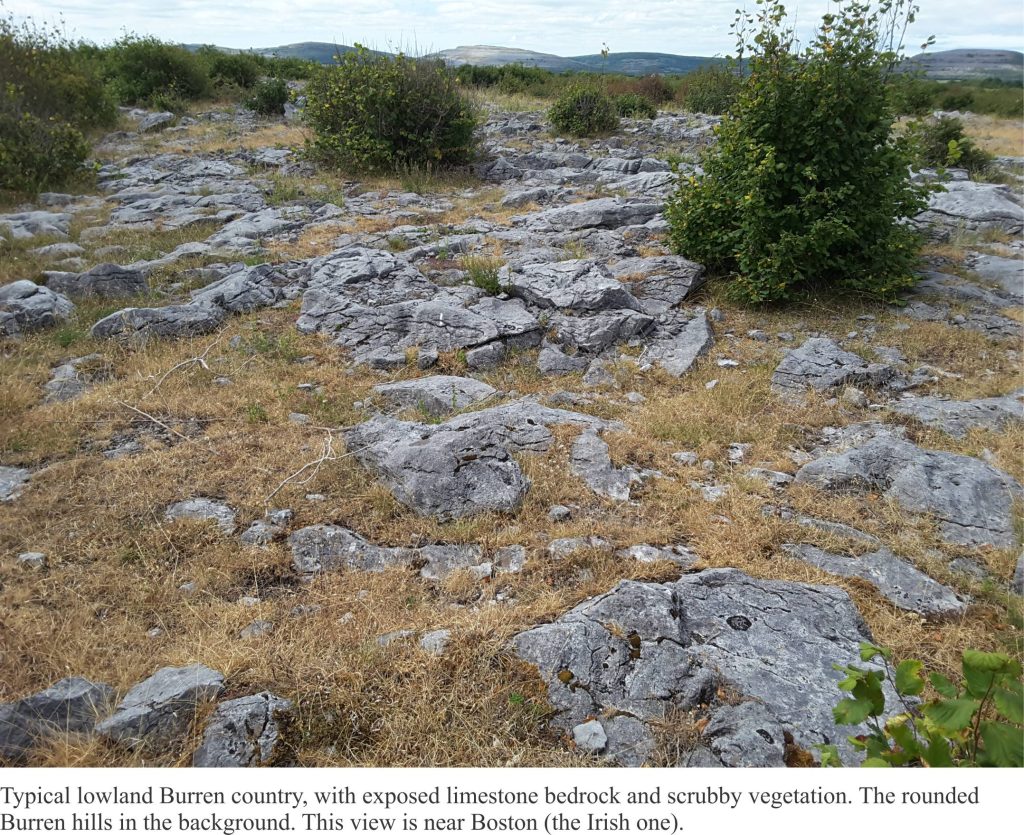
The Celts must have known a thing or two about rocks. They certainly recognized the bare hillslopes of western County Clare (Ireland) for what they were – Burren, an anglicized version of the Irish Boíreann (a stony or rocky place). Even the grasses and wild flowers in a myriad nooks and crannies, have trouble eking out a living. The lower hillslopes and valleys between these stony, limestone hills seem verdant (although the soils there must be alkaline), but the hills themselves…! Patchwork dry-stone walls ascend and encircle the hills, evidence of the optimism of farmers, the odd cow or horse searching for an elusive blade of grass. Whoever worked these stones are distant memories.
The Burren and the Cliffs of Moher are a UNESCO Geopark (established in 2011). From a geological perspective, the two sites are diametrically opposed – one a cluster of bare limestone hills and the other, vertiginous coastal cliffs that are in a constant state of renewal from pounding Atlantic waves.
The limestones formed about 350 million years ago, part of the geological period known as the Carboniferous. Ireland back then was closer to the tropics; seas were warm and teeming with life. This was a time of relative stability, following on the heels of momentous events caused by continental collisions and mountain building – the Caledonian event. The present landscape was moulded more recently by a couple of glaciations, the last one ending about 10,000 years ago. During the Last Glacial Maximum, about 22,000 years ago (i.e the time of maximum ice accumulation), Ireland was covered by the Celtic Ice sheet (more or less a continuation of the Scandinavian Ice Sheet). Glacial ice plucked and scoured the hard limestone, leaving rounded hills and in places a veneer of ice-carried debris. It is a glacio-karst landscape, and it is the latter to which most visitors are drawn.
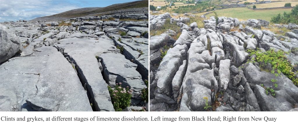
Limestone is naturally prone to dissolution, a process where calcium carbonate (CaCO3) dissolves slowly in rain and percolating groundwater. Over time (many 1000s of years), unique ‘karst’ landscapes evolve including rugged surface structures, sinkholes (also called dolines), and subterranean caves and streams. Karst landscapes are common in limestones exposed to humid tropical and warm temperate climates. The Burren is unique because its karst followed the retreat of glacial ice.
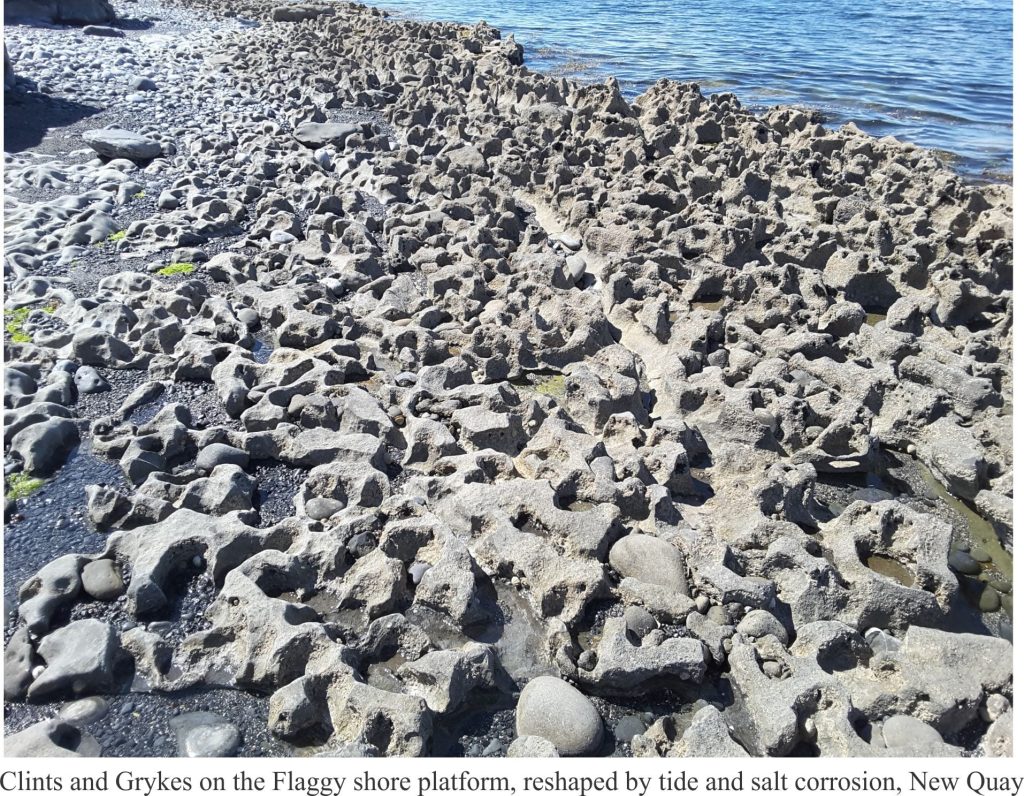
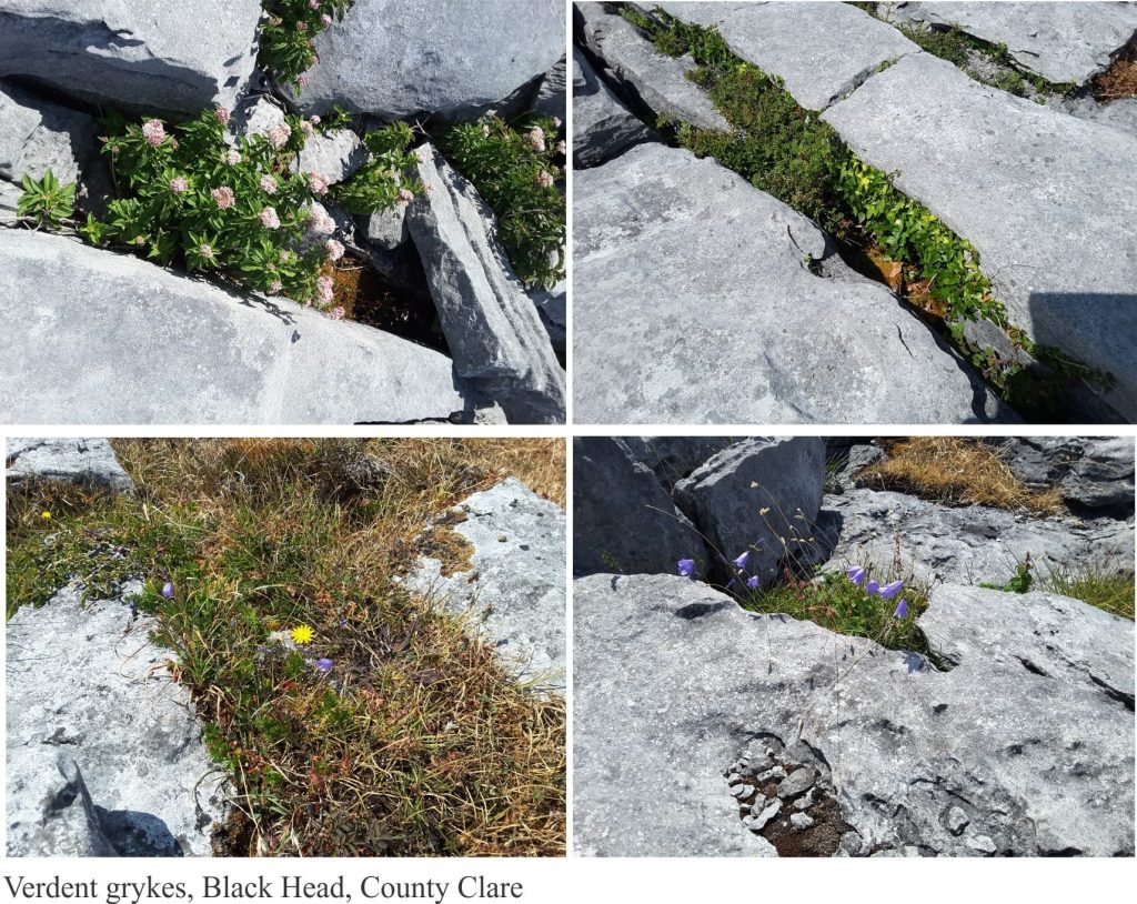
Scramble over any part of the Burren and the first thing you’ll comprehend is the need to watch your step. The limestone slopes and pavements are cut by myriad fractures, enlarged and deepened by the slowly dissolving limestone – these are the grykes, that separate the intervening limestone blocks, or clints. Clints and Grykes; the word clint is old Scandinavian (Viking) meaning summit or cliff; gryke (a variant of grike) – not much is known about this word other than it is from 18th century northern English. Grykes focus surface water and hence are home to a wonderful array of flowers (including many orchids), grasses, small scrubby bushes and creepers (like ivy). Surface waters from rain and snow melt rapidly descend the gryke-riven limestone to become part of an extensive network of small, underground fracture flows and seepage, groundwater that emerges lower down the slopes, in valleys and along the shoreline.
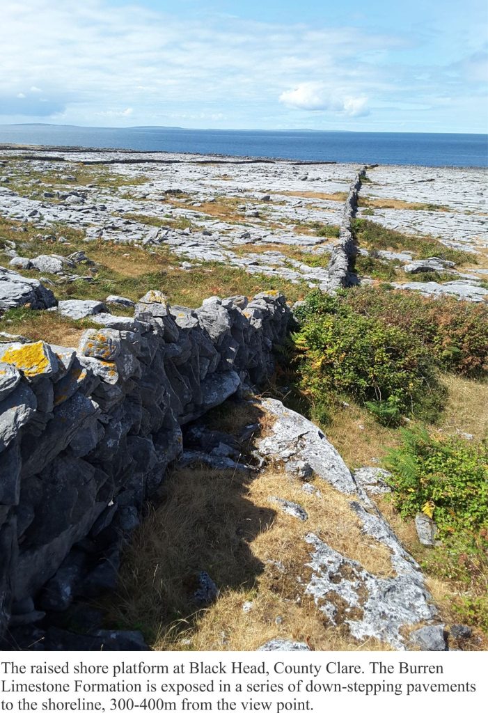
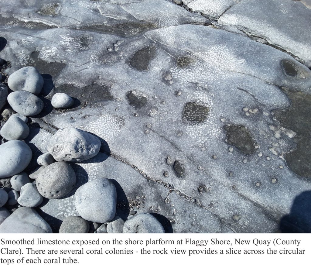
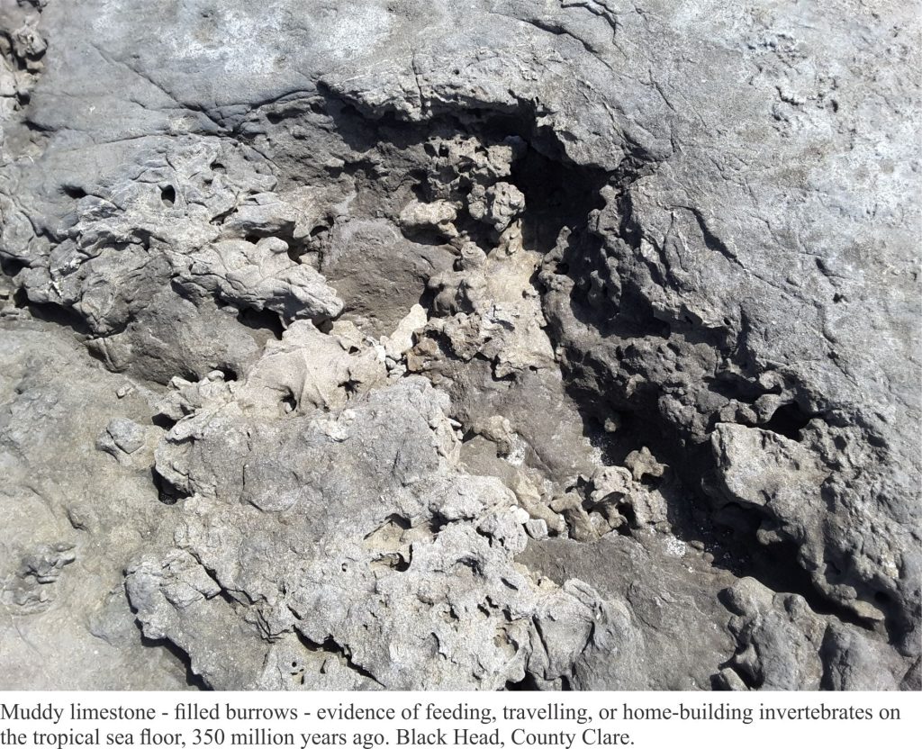
Burren limestones contain many fossils, and the best place to see these is along the shore, where waves have smoothed the rock surface. Two stretches of coastline we walked during our sojourn there, were Flaggy Shore near New Quay (and close to a Linnane’s, a delightful pub on the estuary), and Black Head, a promontory that is fully exposed to the Atlantic. Limestones at Flaggy Shore belong to the Tubber Limestone Formation; those at Black Head are the Burren Limestone Formation and are a bit younger. The limestone formation at Black Head appears step-like along shore and hillslope; the steps reflect the well-developed laying, or bedding. Some of these beds are separated by thin layers of muddy or shaly rock. Back-stepping of layers at Black Head may have been accentuated by post-glacial uplift of the coast, a product of isostatic rebound following retreat of the ice sheet.
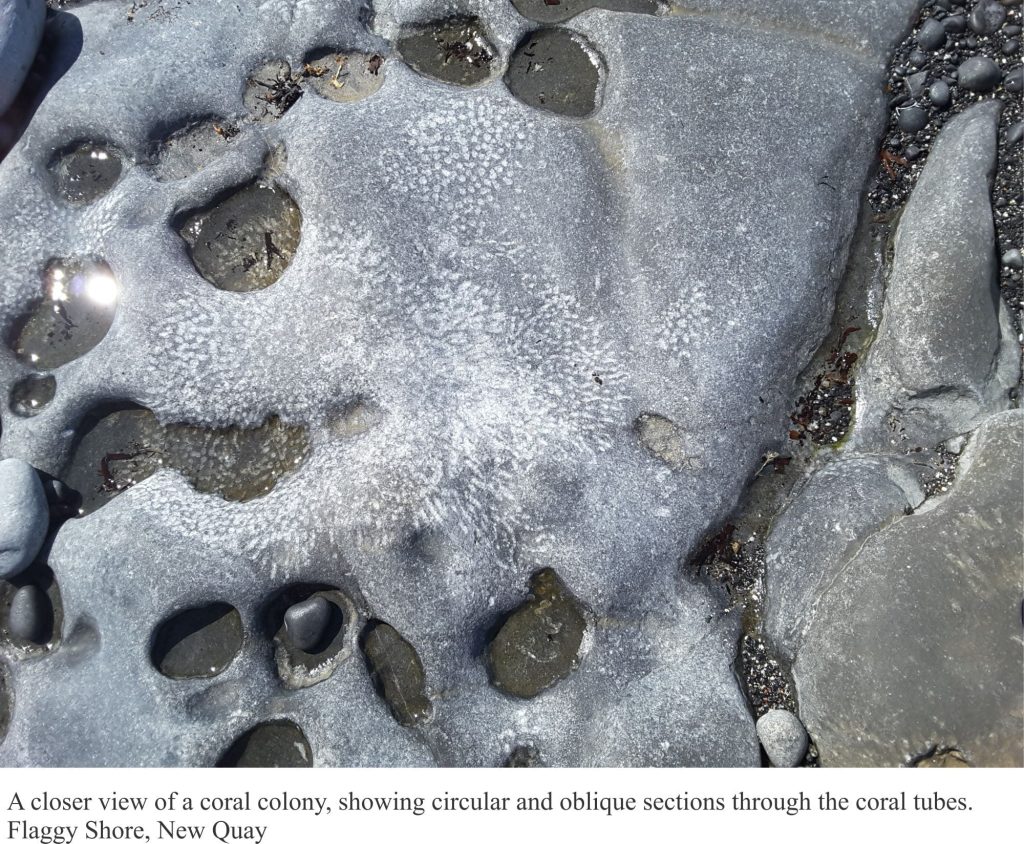
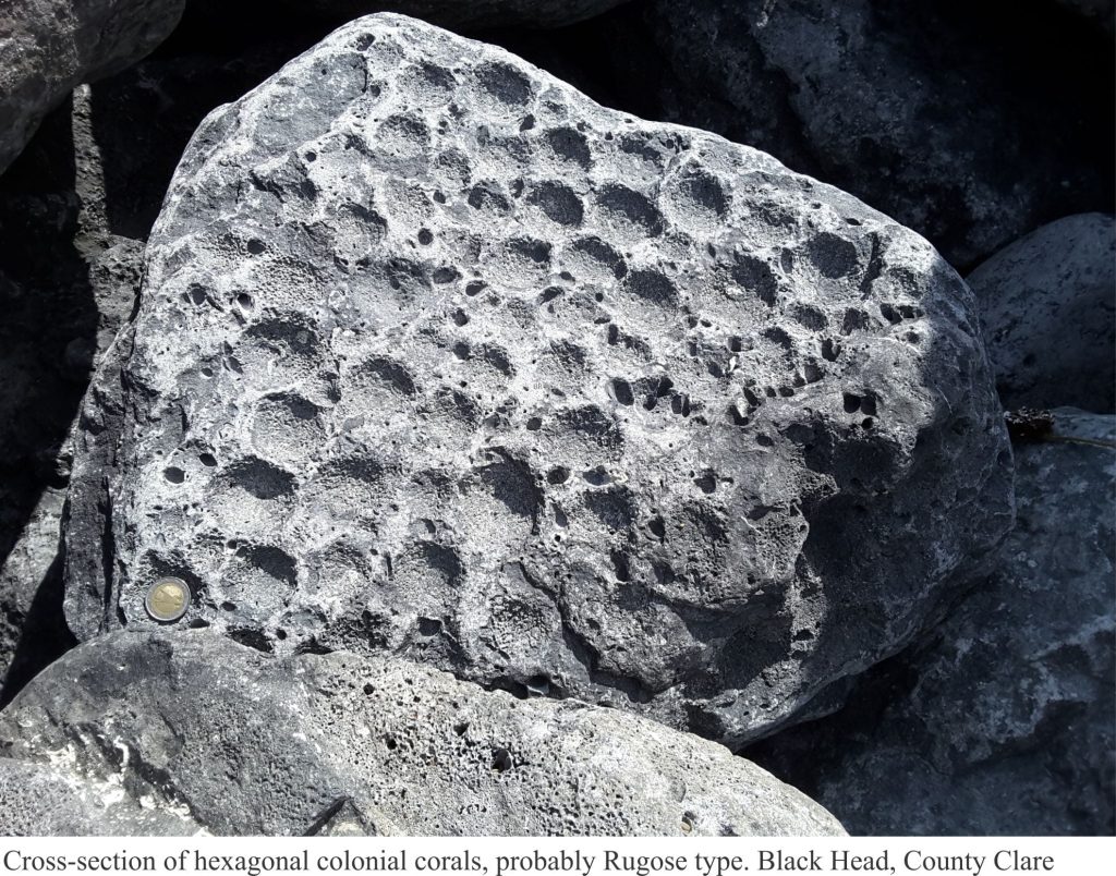
The most common fossils include brachiopods (sometimes called ‘lamp shells’, are invertebrates with two shells, superficially like clams, but having a completely different animal inside), corals, and gastropods (sea snails). There are also crinoids (distant relatives of star fish) but I did not see any of these. Corals are common along the coastal exposures, mostly in clusters of skinny branched colonies. Most have circular cross-sections, but we did find one example of a colony where individual columns had hexagonal cross-sections – a now extinct group known as Rugose corals. The exposures seen along the coast are like a slice through these colonies; this also applies to the brachiopods – rarely do we see the complete shells.
The Burrens are unlike anywhere else in Ireland. The expression ‘Emerald Isle’ doesn’t really apply here. Green fields and woodlands, the idyllic Irish scenes in tourist brochures and poetic verse, are replaced by grey hues that merge with cloud and sea. Even the dry-stone walls disappear in the tide. As far as landscapes go, the Burrens are a bit understated; there’s none of the vertigo sensed at the Moher Cliff edge, no brooding mountains, just the quietude of a landscape that has withstood Atlantic battering. The Burrens are unique.
