A brief look at the key stratigraphic surfaces that help us construct sequence stratigraphic models.
Look at any pile of sedimentary or volcanic rock and you will see a multitude of stratigraphic surfaces: bedding planes, lava and ash-flow tops, unconformities, and erosional discordances. Each is important in its own way and has a story to tell.
Genetic stratigraphic models, like sequence stratigraphy, use specific surfaces to define (and in some respects be defined by) abrupt changes in baselevel (regression, transgression) and sediment accommodation, changes in the direction of shoreline migration, the boundaries of stratigraphic trends (e.g. coarsening or fining upwards trends), and the stacking of parasequences and other high-order cycles. The main stratigraphic surfaces are (Catuneanu et al. 2011):
- Subaerial unconformity
- Correlative conformity
- Regressive surface of marine erosion (RSME)
- Maximum flooding surface (MSF)
- Maximum regressive surface (MRS)
- Two kinds of ravinement surface (tide- and wave-formed)
All have been referred to by different names and synonyms over the decades since sequence stratigraphy was first formalized (Payton, 1977). Details on this terminological jungle are documented by Catuneanu (2006).
There are four conditions under which these surfaces form – conditions that are related to the different stages of baselevel rise and fall, shoreline trajectory, sediment accommodation, and depositional environments. For each stage, refer to the relative sea level curve below:
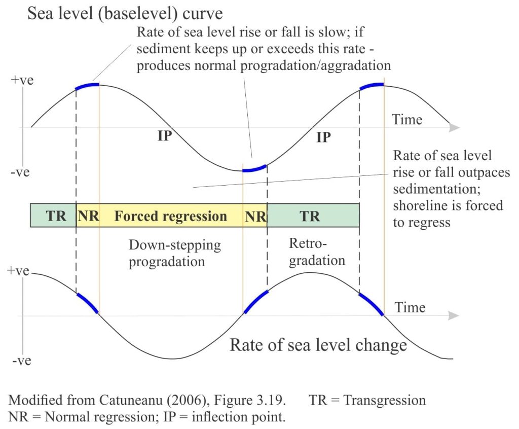
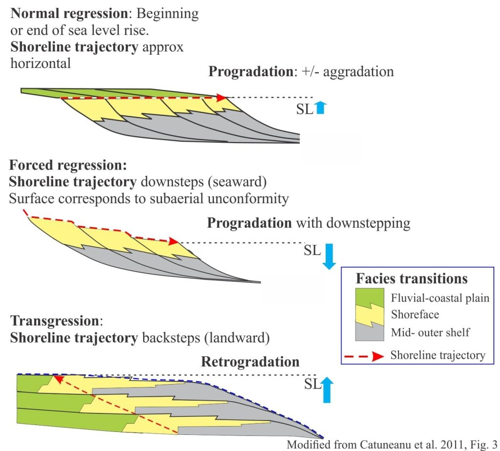
- Beginning of baselevel fall and forced regression: Forced regression takes place when relative sea level fall outpaces sediment supply, forcing the shoreline and associated shelf facies seaward. Deposition associated with forced regression produces a succession of seaward-stacked shoreface wedges, where each wedge in succession is stranded as the shoreline moves seaward. In profile, the shoreline trajectory defining these wedges, downsteps in concert with falling sea level. Landward, a correlative surface will develop via fluvial incision.
- The end of forced regression and the beginning of normal regression: In this case normal regression produces a typical prograding (the shoreline trajectory is approximately horizontal) and aggrading profile (the shoreline trajectory has a vertical component) and usually signifies that the supply of sediment is keeping pace with or exceeding the changes to baselevel and accommodation. Landward, fluvial incision will slow or cease as drainage adjusts to the lowstand baselevel.
- End of regression and the beginning of transgression: Transgression occurs when baselevel rises and accommodation increases, such that the shoreline and associated shelf facies move landward. The back-stepping sediment packages are referred to as retrogradational. Landward, rivers will begin to aggrade, or change their sinuosity to accommodate the rising baselevel.
- End of transgression and the beginning of the next phase of normal regression: Here, the shoreline trajectory reverses such that deposition changes from retrogradational to progradational – aggradational.
Subaerial unconformity
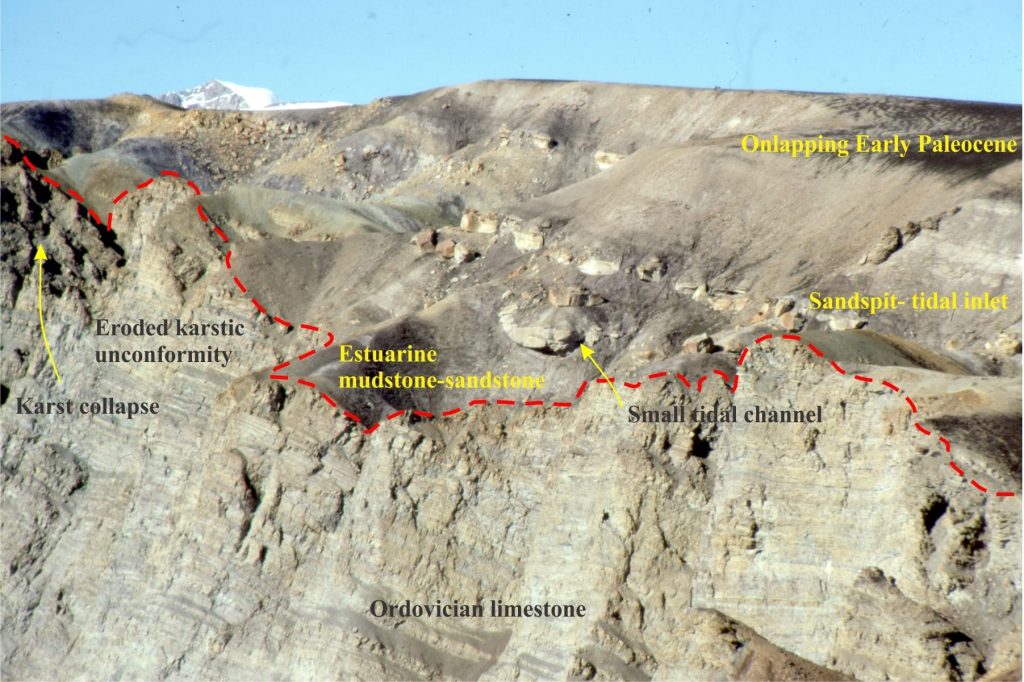
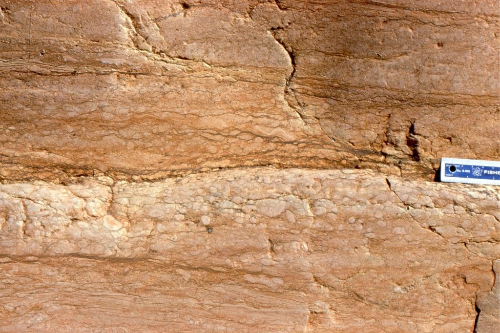
As relative sea level falls, the shoreline migrates seawards and the siliciclastic shelf or carbonate platform is progressively exposed. Exposure of sediment and bedrock results in various kinds of weathering – wind and water erosion, soil development, and diagenesis. Exposed marine carbonates are particularly prone to meteoric diagenesis because a fresh watertable will move seaward in concert with the shoreline. Rivers draining across the shelf will erode to depths controlled primarily by local baselevel (during sea level fall this baselevel will also fall); much of the sediment produced by these lowstand rivers will be delivered to the slope and deep basin.
Subaerial unconformities are sequence boundaries. The hiatus at a subaerial unconformity is commonly variable because the depth and breadth of erosion changes across the exposed shelf. They are generally considered to represent chronostratigraphic surfaces; in reality, it takes time for shorelines to move seaward or retreat landward, but the hiatus is considered to be short relative to the duration of an entire sequence – hence its chronostratigraphic rank.
Subaerial unconformities develop during regression and sea level lowstand, and for at least some of the subsequent transgression until the shelf is completely flooded.

Correlative conformity
A subaerial unconformity encroaches upon the shelf or platform in concert with the shoreline, until the end of regression. As sea level falls, sediment is delivered to the slope and basin floor, accumulating as a relatively conformable, deep-water, succession – commonly submarine fan and related deposits. Although the subaerial unconformity (the sequence boundary) ends at the lowest shoreline, there will be an equivalent surface, marking the end of sea level fall (regression) at the top of the lowstand deposits. This surface is referred to as a correlative conformity. It is the surface corresponding to the end of relative sea level fall and, according to Hunt and Tucker (1992) the end of forced regression. As such, it is the marine extension of a sequence boundary. The Hunt and Tucker systematics also indicate a period of normal regression at the beginning of sea level (baselevel) rise, when the rate of rise is relatively low compared with the rate of sediment supply (they call this the Lowstand Prograding Wedge). Thus, the correlative conformity, and therefore the sequence boundary, lie between the deposits of forced regression and normal regression.

Regressive surface of marine erosion
This surface is manifested as an abrupt contact beneath the regressive shoreface wedges (commonly resistant sandstone), that form during forced regression and are subsequently abandoned as baselevel falls. The RSME commonly develops where wave orbitals impact the sea floor, at and above fairweather wave-base. It forms in concert with the basinward down-stepping shoreline trajectory as sea level falls (Plint, 1988). The RSME will erode mudrocks deposited on the mid to outer shelf. Sandstones deposited above the RSME are commonly crossbedded, reflecting the high-energy shoreface conditions. The RSME overlies highstand deposits that accumulated during the previous stage of normal regression.
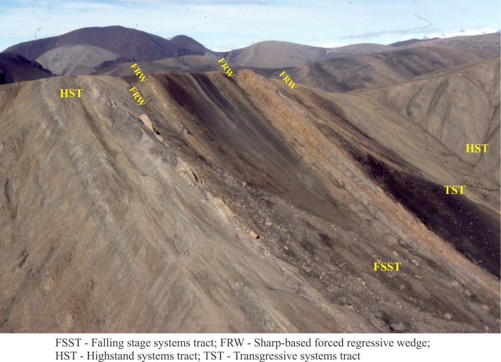
Maximum regressive surface (transgressive surface)
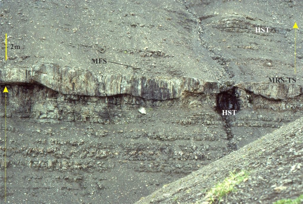
This surface represents the sea floor at the time when regression ends and transgression begins, and the shoreline trajectory reverses from seaward to landward. Its preservation potential is relatively high because erosion by continued regression has ceased, and burial by deeper water sediment begins as shoreline migration reverses (landward). However, in some circumstances shoreface ravinement during transgression may erode the MRS (and the subaerial unconformity).
Maximum flooding surface
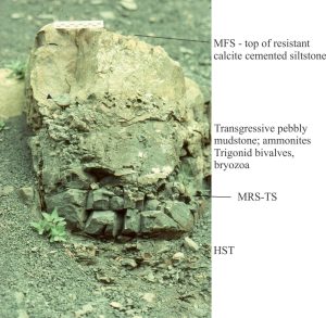
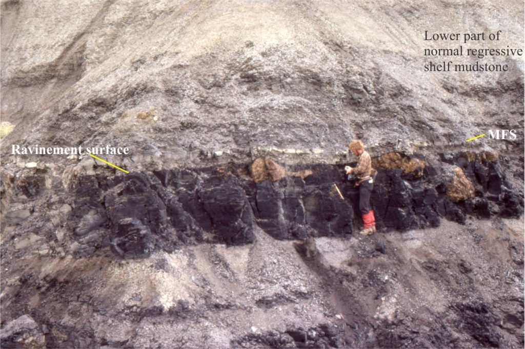
During the late stages of transgression, the rate of sediment supply is usually very low, resulting in thin, condensed stratigraphy that commonly includes organic mudstone (black shale), calcareous mudstone or limestone, glauconite, or phosphatized fossils and nodules. Gamma tool signatures frequently record high levels of natural radioactivity through this condensed interval. The MFS is usually located at the top of this condensed section.
The MFS is the paleo sea floor at the end of transgression, marking the change to normal regression where the shoreline trajectory reverses from landward to seaward. The initiation of progradation during the subsequent normal regression means that the MFS will be a downlap surface for prograding clinoforms.
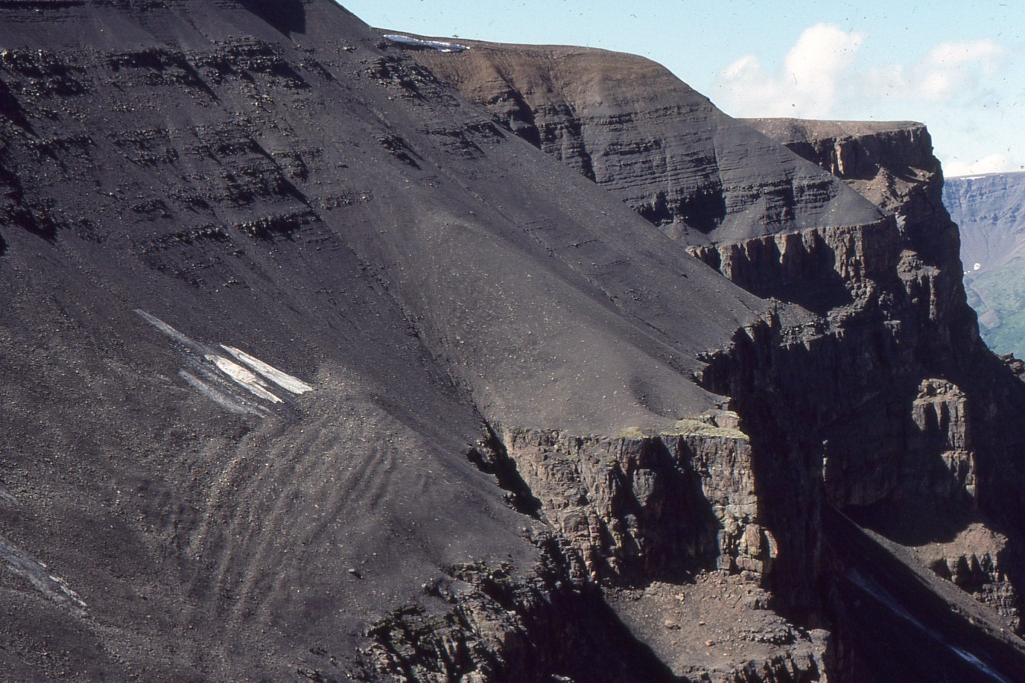
The (transgressive) condensed section overlies coarsening-upward, highstand deposits from the previous regression. The MFS is in turn overlain by muddy lithologies of the succeeding normal regression. The contrast between the condensed strata and the overlying muddy facies is expressed in outcrops as an abrupt change from resistant to recessive exposure. In outcrop, this produces a stair-like appearance in successive cycles (a good example is shown below).
Ravinement surface
During transgression the shoreline, beach, and shoreface migrate landward, the attendant waves and tidal currents scouring as they go. The distinction between wave- and tide-dominated ravinement is often made, although depending on coastal dynamics, both can occur along the same stretch of coast. The depth of erosion of the underlying regressive deposits and their stratigraphic surfaces, such as the subaerial unconformity, RSME and MRS, depends on the wave climate and the efficiency of tidal currents to redistribute the eroded sediment. Thus, it is possible for the ravinement surface to overlie highstand deposits directly, where beach and other associated shoreline deposits have been removed. In other situations, scouring may be quite shallow, such that lagoon and estuarine deposits are preserved below the ravinement surface.
As the shoreline moves landward, the ravinement surface is overlain by deeper shoreface deposits. The contrast in facies through a ravinement surface is one of the more recognisable characteristics in outcrop and core. For example, deeper shoreface deposits containing interbedded mudstone and sandstone, or typical storm wave-base structures like hummocky crossbeds, will onlap the ravinement surface that, in turn, overlies lagoonal muds. Trace fossils, benthic faunas, and sedimentary structures will help your identification of the erosional surface separating these disparate facies. Facies transitions across a ravinement surface will vary depending on whether delta lobes, sand barriers, tidal channels, lagoons or estuaries are transgressed.
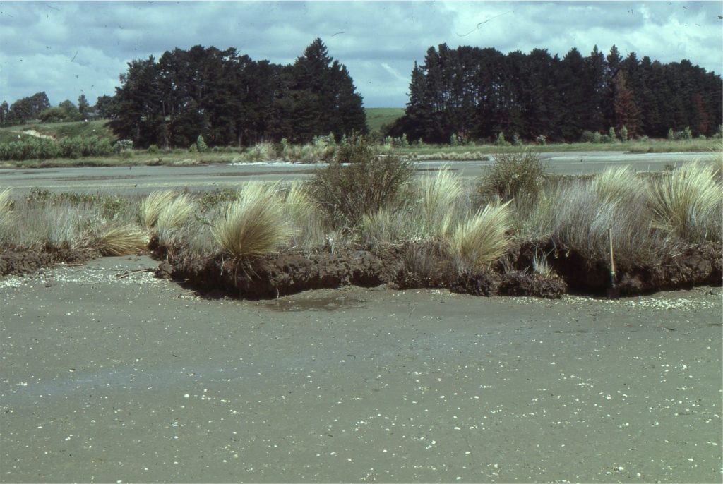
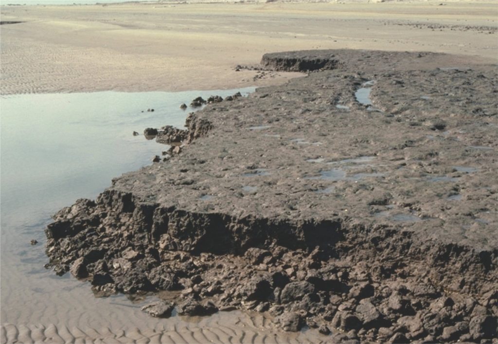
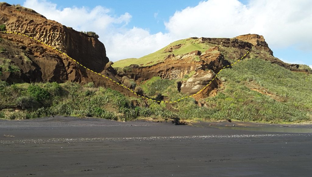
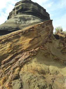
Wave erosion of Late Quaternary tidal flat and salt marsh – mangrove deposits at two locations: above – an estuary in Auckland Harbour (New Zealand), and the Galveston coast (below). The ravinement surface in both examples is at the level of the modern beach-tidal flat. The resulting stratigraphy will present in ascending order as tidal flat or beach sands, overlain by a thin remnant of salt marsh mud, the scoured (wave) ravinement surface, overlain by lower intertidal or subtidal deposits.
This is part of the How To…series on Stratigraphy and Sequence Stratigraphy
Other posts in this series on Stratigraphy and Sequence Stratigraphy
Stratigraphic surfaces in outcrop – baselevel fall
Stratigraphic surfaces in outcrop – baselevel rise
A timeline of stratigraphic principles; 15th to 18th C
A timeline of stratigraphic principles; 19th C to 1950
A timeline of stratigraphic principles; 1950-1977
Baselevel, Base-level, and Base level
Sediment accommodation and supply
Autogenic or allogenic dynamics in stratigraphy?
Stratigraphic cycles: What are they?
Shorelines and shoreline trajectories
Stratigraphic trends and stacking patterns
Stratigraphic condensation – condensed sections
