Geological-logo
Geological-logo

Sedimentary structures: Shallow marine

Tidal channel crossbeds

A look at intertidal through subtidal deposits in outcrop

This is part of the How To…series  on describing sedimentary rocks – outcrops of shallow marine deposits and their sedimentary structures.
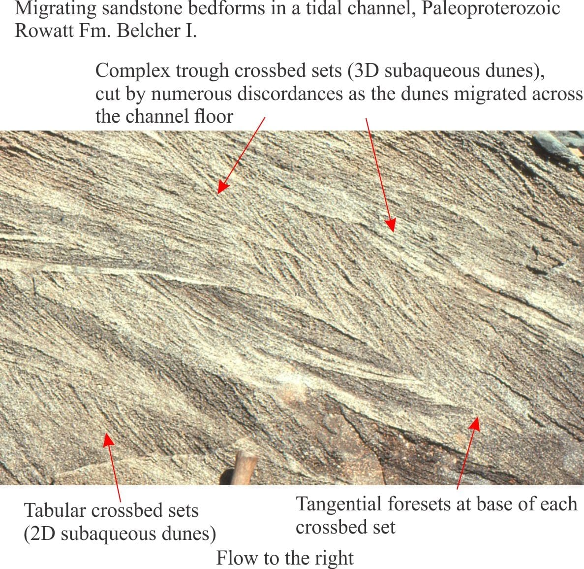
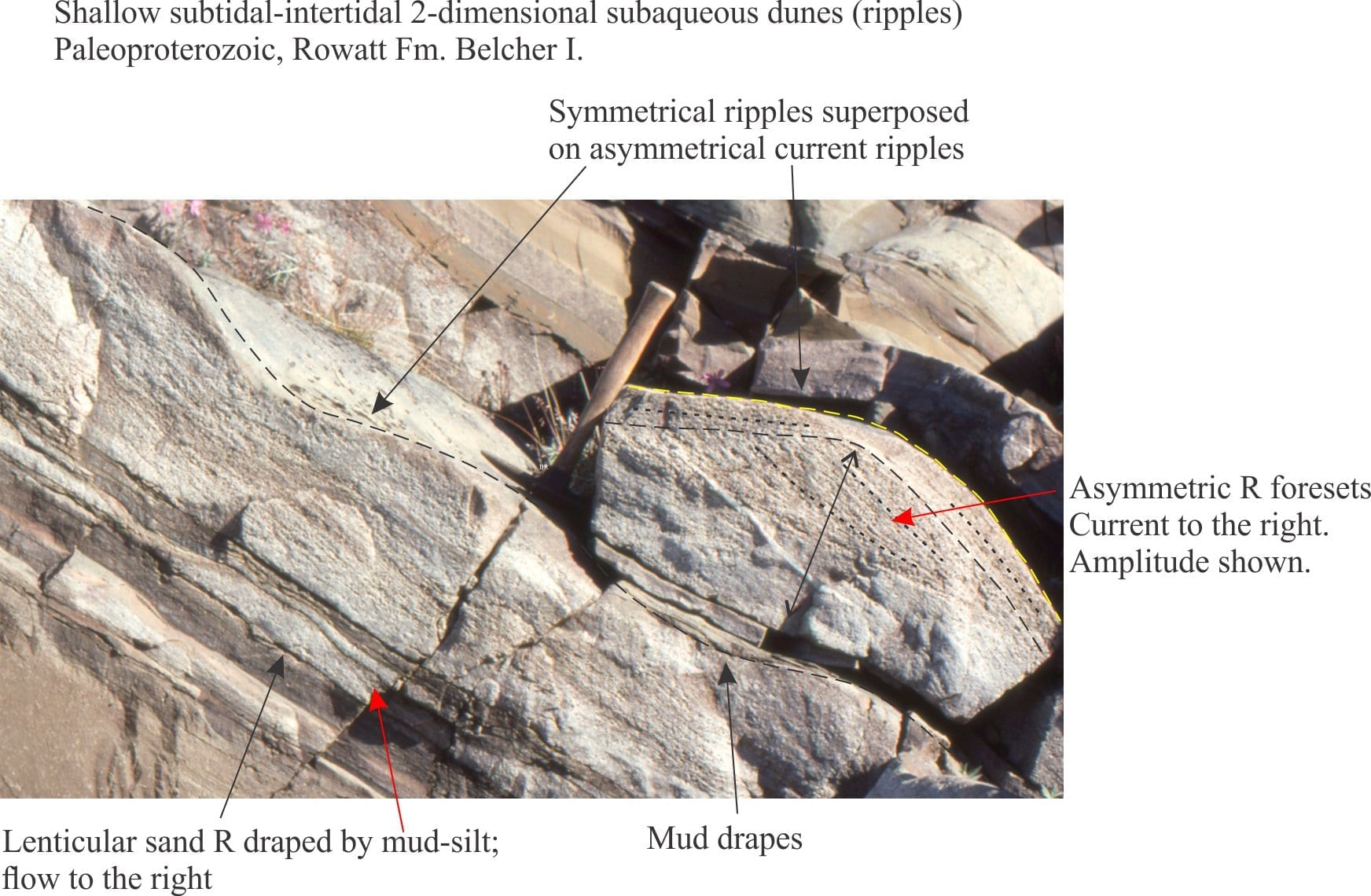
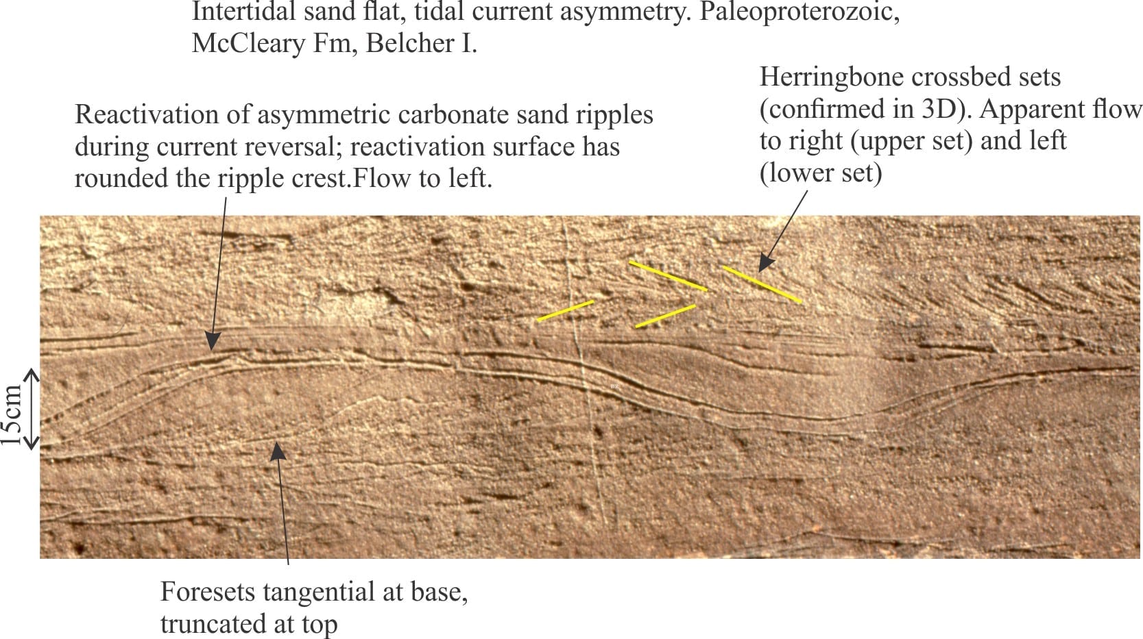
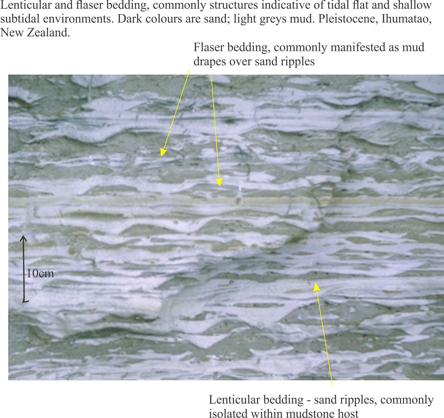
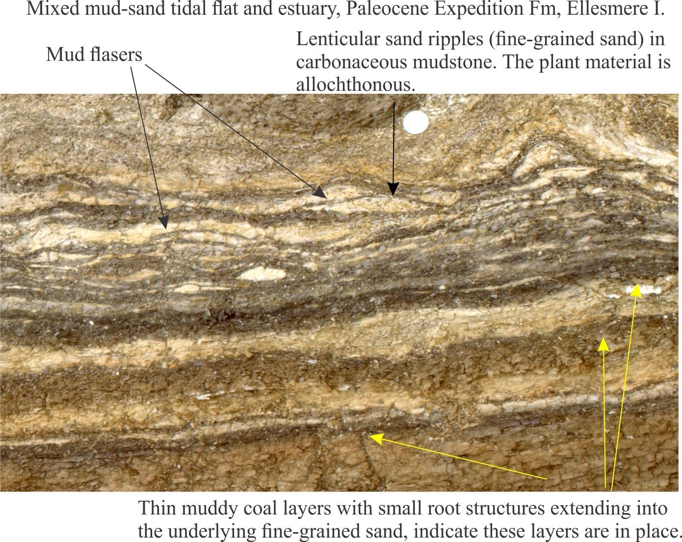
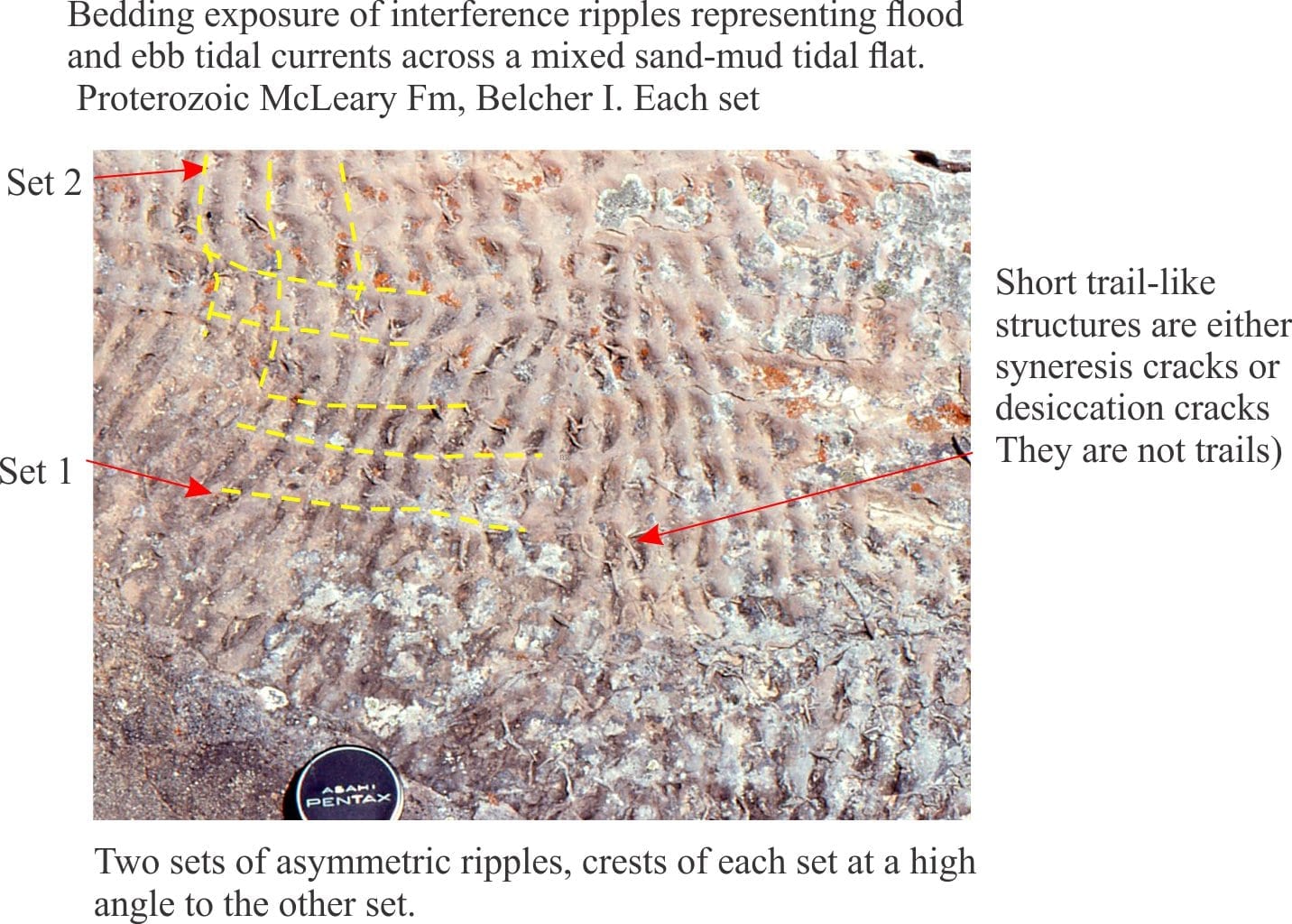
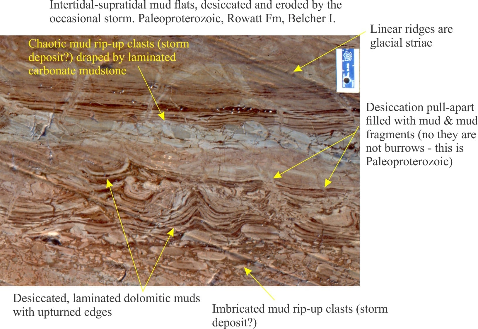
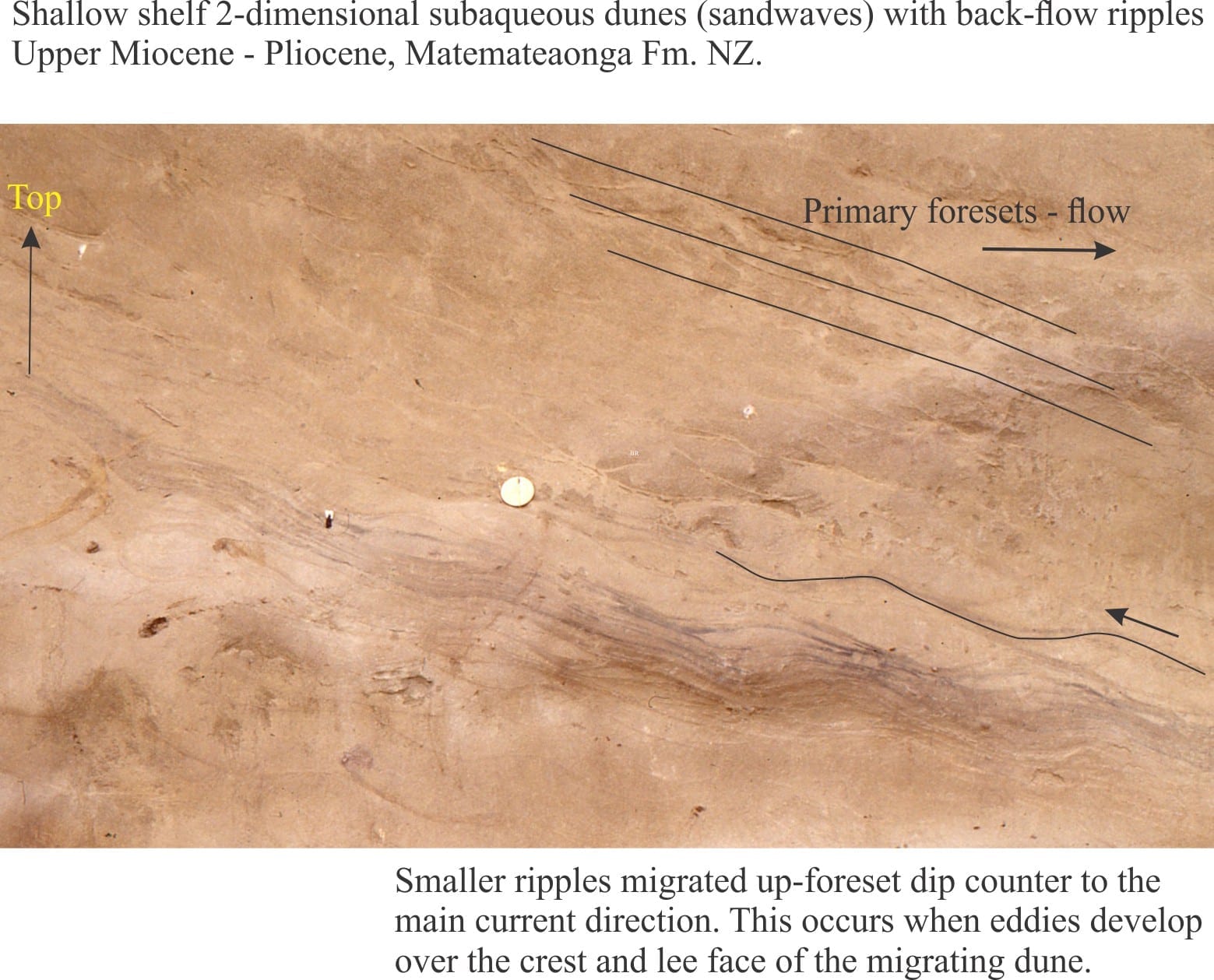
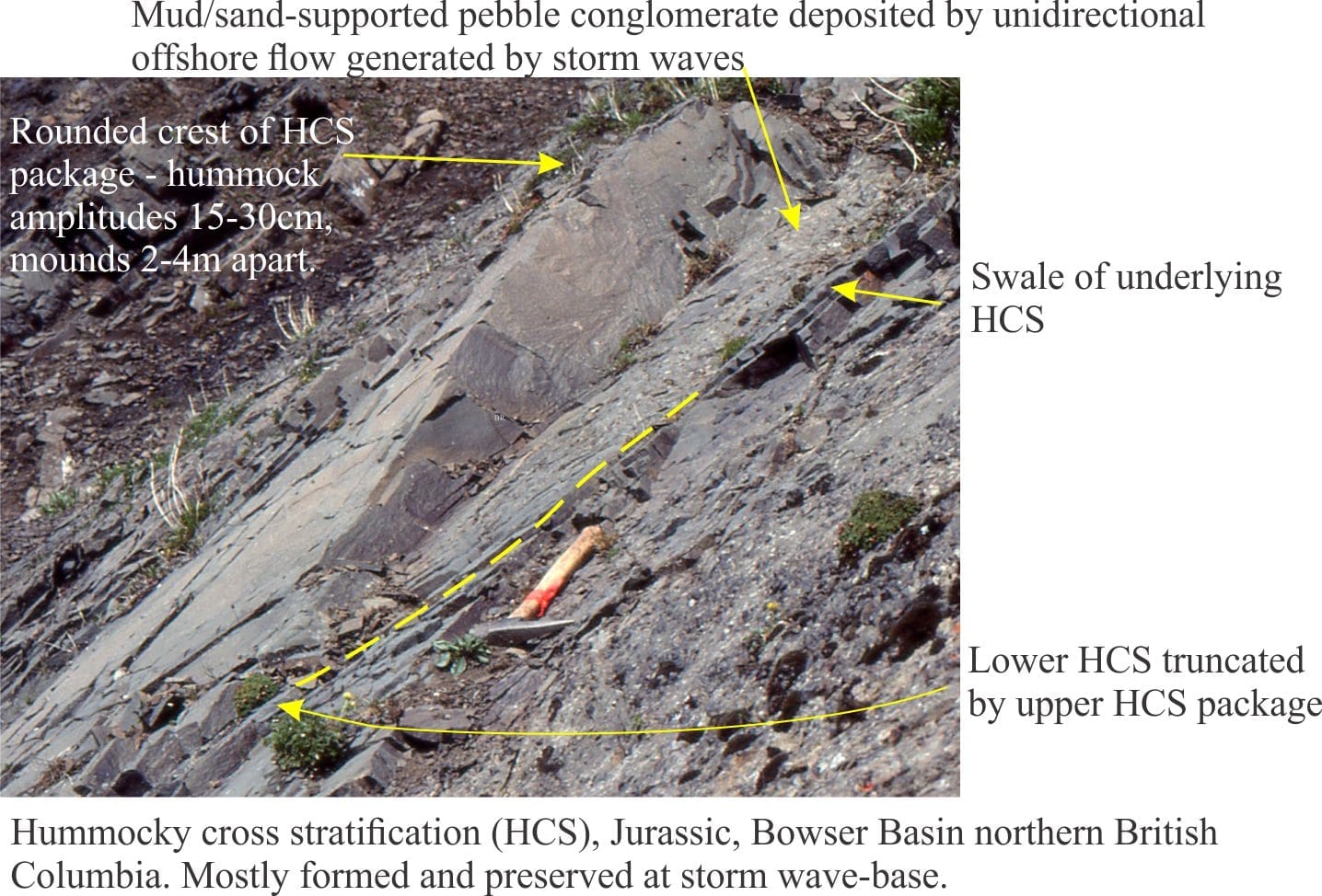
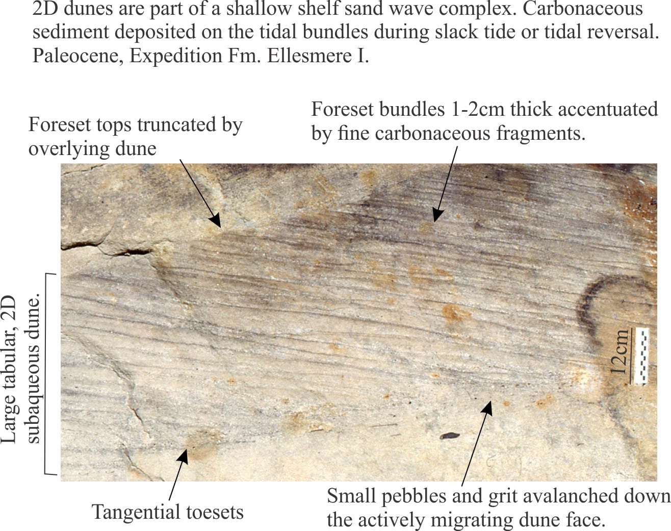
Here are some annotated, close-up outcrop images showing details of sedimentary structures – mostly bedforms from ancient shoreface, tidal flat and channel, and shallow shelf environments. The two guides to crossbed nomenclature have been borrowed from a previous post on crossbed terminology (link below). Most of these images have been cropped from originals featured in the Atlas of shelf deposits, and Atlas of beach-lagoon-bar-estuary-tidal flat deposits. The Atlases also show examples of modern analogues to these structures.


Related links in this series on outcrop descriptions

Sedimentary structures: Alluvial fans

Sedimentary structures: coarse-grained fluvial

Sedimentary structures: Fine-grained fluvial

Sedimentary structures: Mass Transport Deposits

Sedimentary structures: Turbidites

Sedimentary structures: Stromatolites

Volcanics in outcrop: Lava flows

Volcanics in outcrop: Secondary volcaniclastics

Volcanics in outcrop: Pyroclastic fall deposits


Other useful links

Sediment transport: Bedload and suspension load

The hydraulics of sedimentation: Flow regime

Fluid flow: Froude and Reynolds numbers

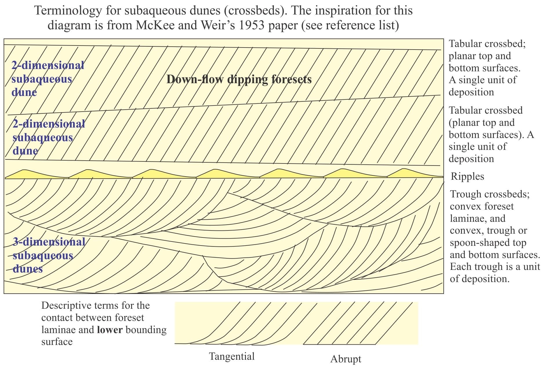
Crossbedding – some common terminology

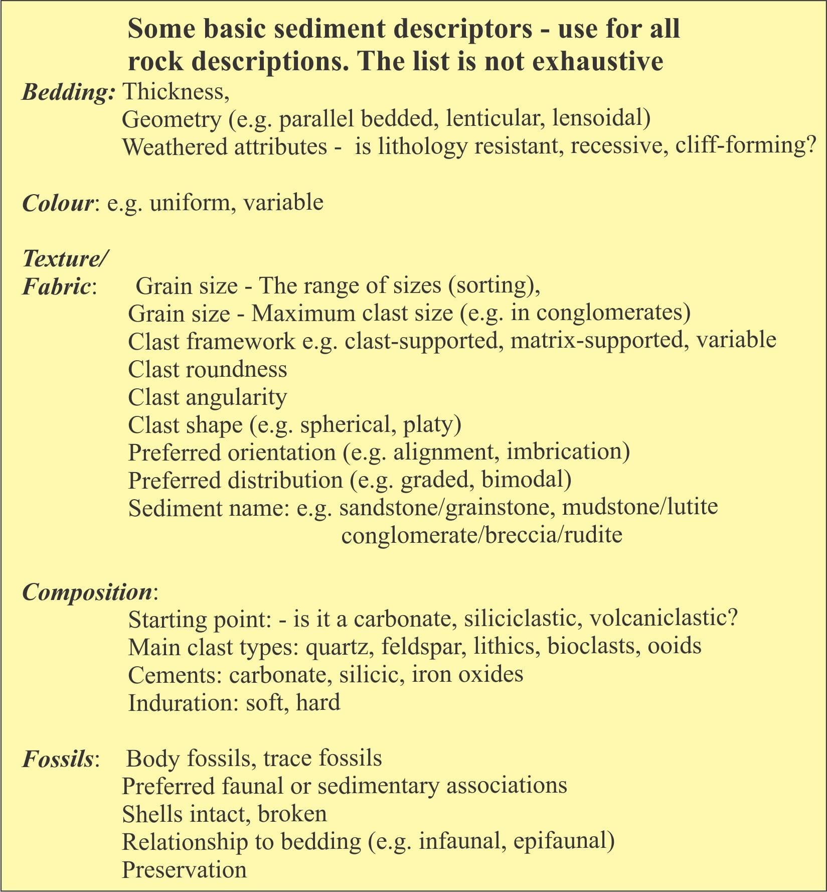
Describing sedimentary rocks; some basics

Analysis of sediment grain size distributions

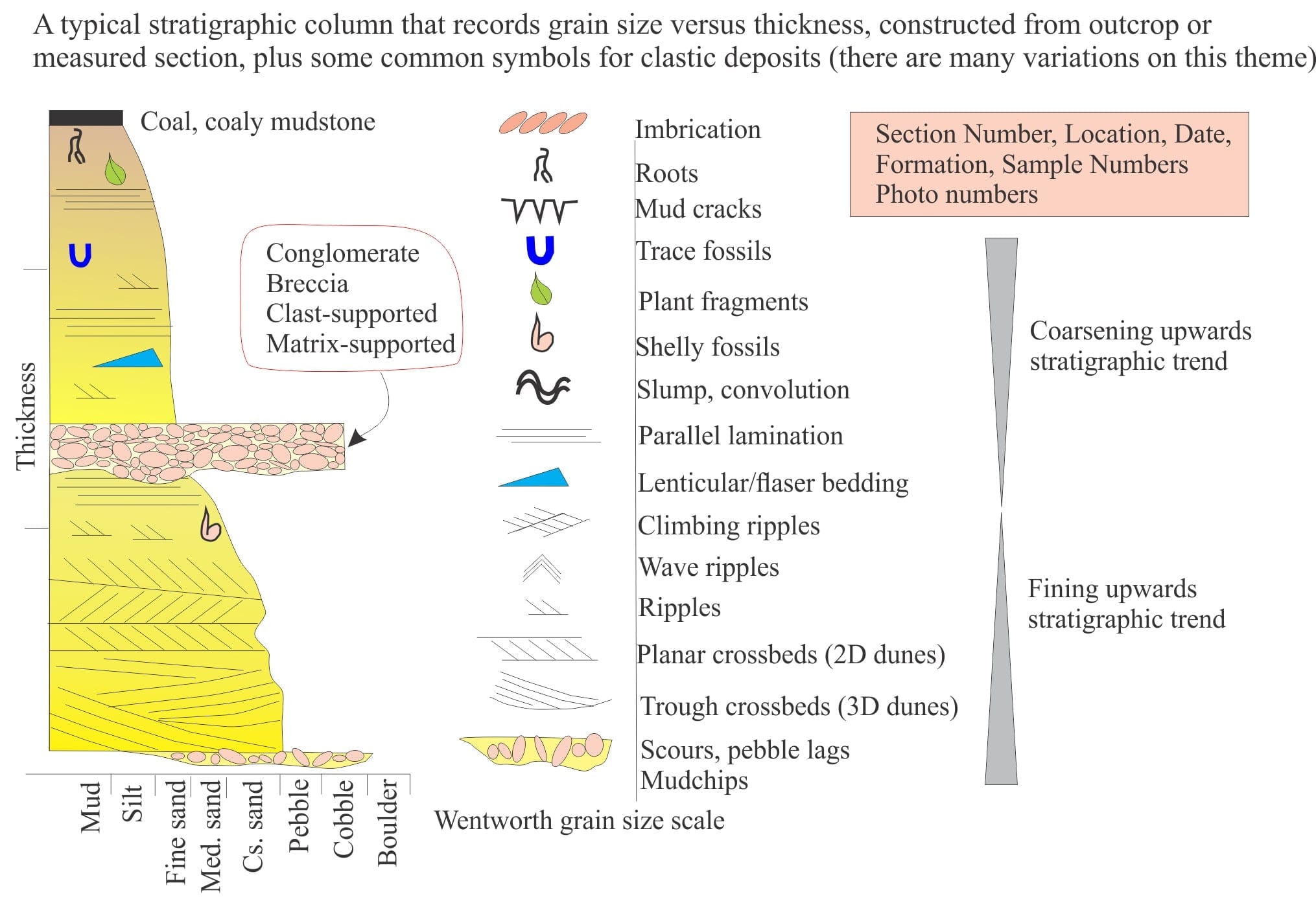
Measuring a stratigraphic section


Click on an image to zoom in, then back arrow to return to this page

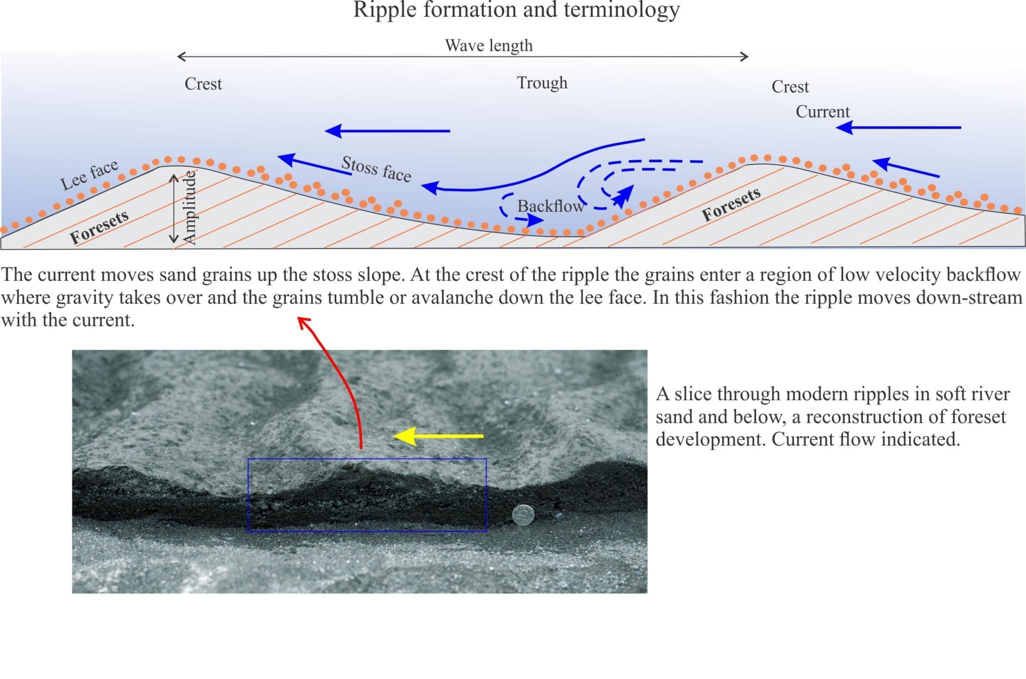
The first four diagrams show some basic sediment descriptors and terminology, and a typical stratigraphic column drawn from outcrop data. These are your starting points for describing and interpreting sedimentary rocks and sedimentary structures in outcrop, hand specimen, and core.


crossbed terminology


Ripple formation and terminology


Cross-section view of symmetric and asymmetric ripples


Reactivation surfaces, preserved lee and stoss slope, and herringbone crossbed in tidal deposit


Lenticular and flaser bedding in Pleistocene tidal flat deposit


Estuarine lenticular bedding and mud flasers, Eocene


Interference ripples and incipient mud cracks, Paleoproterozoic tidal flat deposit


Desiccation cracks, up-turned mudcrack polygons, and (event bed) storm rip up clasts


Back flow ripples on shallow shelf sandy bedform, Pliocene, NZ


HCS Hummocky cross stratification, Jurassic Bowser Basin


Tidal bundles in crossbed foresets, Paleocene shelf sandwaves


A few references on published sedimentary structure atlases and glossaries

J.C. Harms, 2003. Primary Sedimentary Structures. Annual Review of Earth and Planetary Sciences v. 7(1):227-248

A.W. Martinius and J.H. Van den Berg. 2011. Atlas Of Sedimentary Structures In Estuarine and Tidally-Influenced River Deposits of the Rhine-Meuse-Scheldt System. Their Application to the Interpretation of Analogous Outcrop and Subsurface Depositional Systems EAGE Publications. Available for download

F.J. Pettijohn and P.E. Potter. 1964. Atlas and Glossary of Primary Sedimentary Structures. Springer.A classic.

H.-E. Reineck and I.B. Singh.1980.  Depositional Sedimentary Environments. Springer.

Leave a Comment

Your email address will not be published. Required fields are marked *

Archives
Categories
dip and strike compass
Measuring dip and strike
sandstone classification header
Classification of sandstones
Calcite cemented subarkose, Proterozoic Altyn Fm. southern Alberta
Sandstones in thin section
poles to bedding great circles
Stereographic projection – poles to planes
froude-reynolds-antidunes-header-768x439-1
Fluid flow: Froude and Reynolds numbers
Stokes Law for particle settling in a schematic context of other fluid flow functions
Fluid flow: Stokes Law and particle settling
sedimentary-basins-distribution-1-768x711
Classification of sedimentary basins
Model are representational descriptions are written in different languages - diagrammatic, descriptive, mathematical, and conceptual. They commonly contain variables and dimensionless quantities that permit quantitative analysis of the physical systems the models represent.
Geological models
Recent Posts
Alta Dev-Miss east of Lewis Th
Atlas of Syntectonic sediments
oversteepend xb Fairweather
Atlas of syn-sedimentary deformation
Waitemata Army iconic Bay fold
Atlas of submarine fans and channels
Bowser todagin canyon 2
Marine slope, shelfbreak gullies, slope channels, submarine canyons
fold south bay
Atlas of shelf deposits
flah pillow interstices
Atlas of volcanoes and volcanic rocks
The window into Portsoy's coast and Dalradian underpinnings
The Dalradian from Scotland and Ireland
Braided gravel river draining into Canon Fiord, Ellesmere Island; autogenic storage and release from channel bars and the river mouth fan delta
Atlas of fluvial deposits
ironsands raglan overview
Atlas of beach, lagoon, bar, estuary, tidal flats
unconformity Lochranza atlas
Atlas of Unconformities
Scroll to Top