A look at fine-grained, high sinuosity rivers in outcrop
This is part of the How To…series on describing sedimentary rocks – describing and interpreting fine-grained fluvial (meandering river) deposits in outcrop.
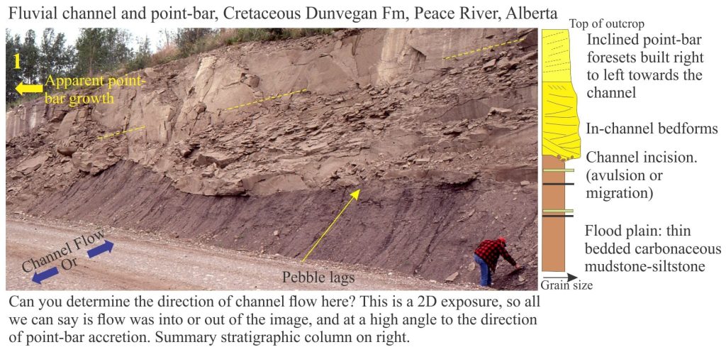
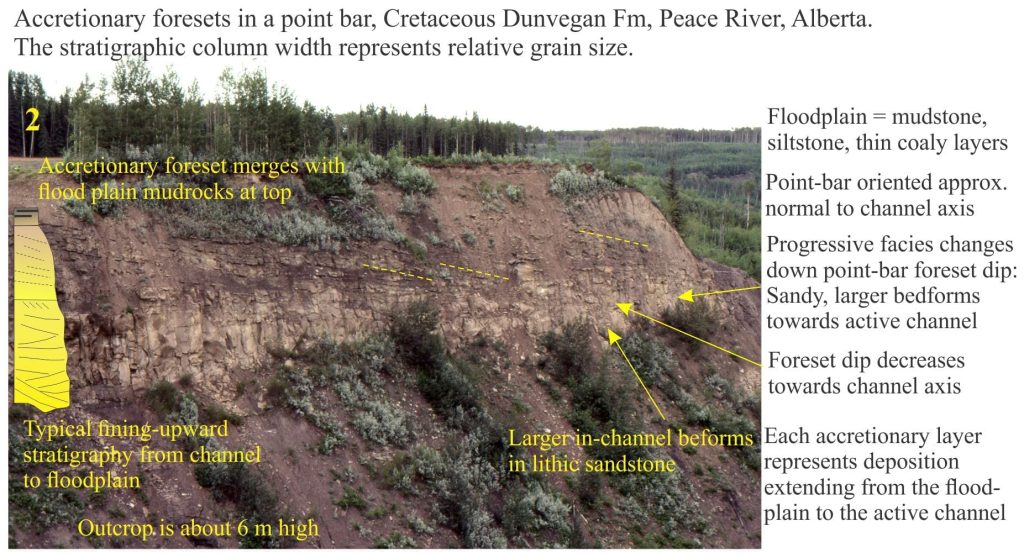
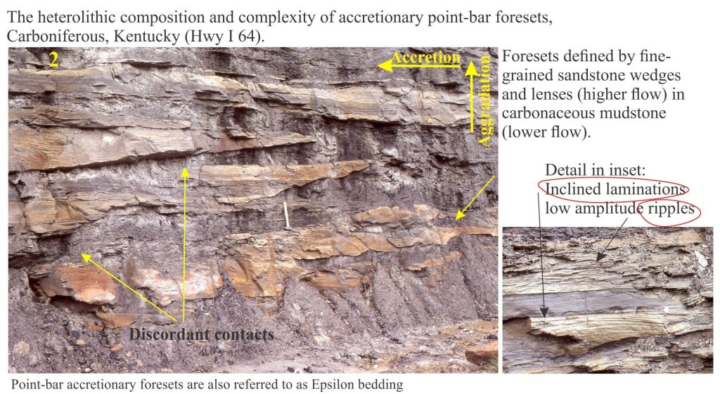
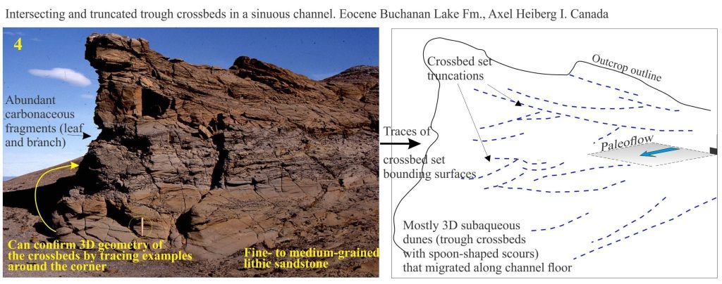
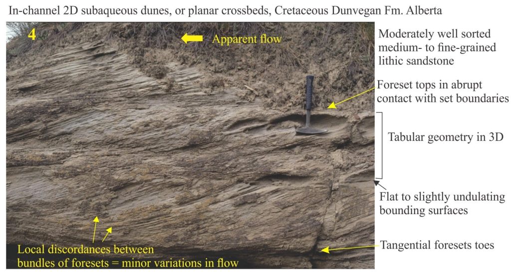
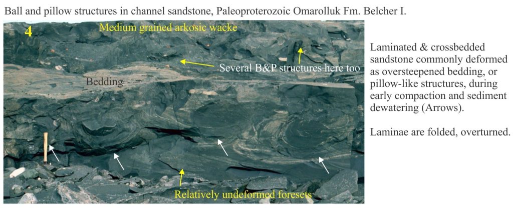
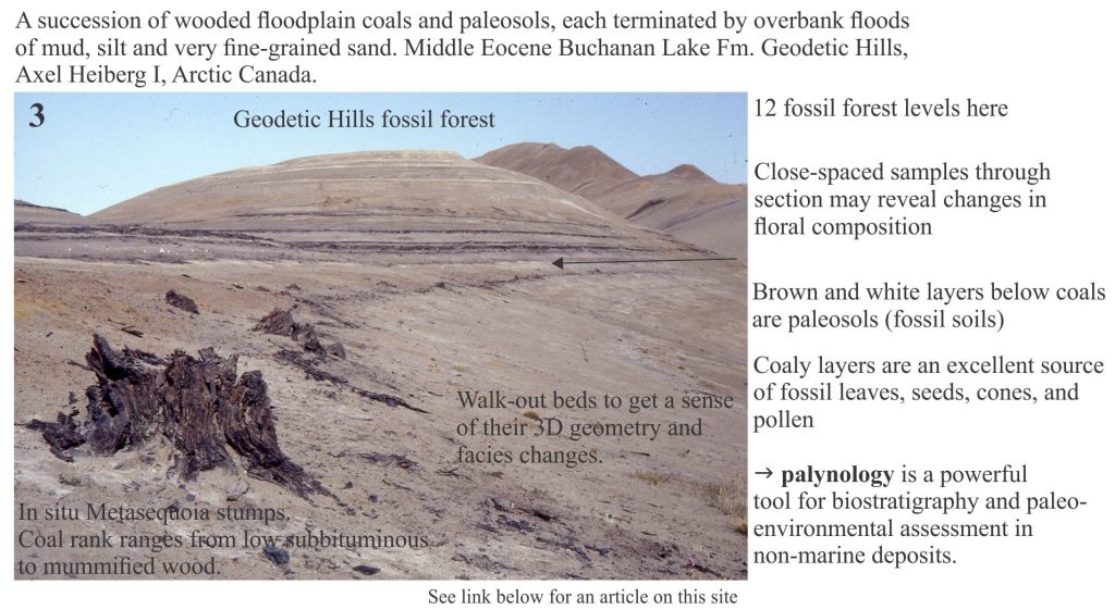
The images shown here illustrate some of the outcrop features associated with fine-grained fluvial deposits; In most cases they relate to ancient high sinuosity (meandering) channel systems and floodplains.
The identification and analysis of fluvial deposits from the rock record has a long and distinguished history in Earth sciences, focusing on:
- the ancient river systems themselves, their facies, channel dynamics, and development of depositional models,
- sequence stratigraphic frameworks,
- studies that place riverine sediment transport in the context of sedimentary basin evolution
- the dynamics of source area uplift and erosion, and
- analysis of source-to-sink, in other words, the journey that river-derived sediment travels.
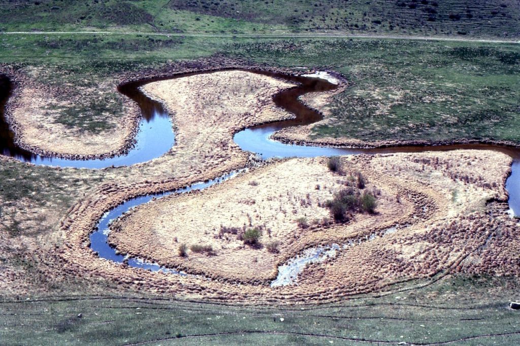
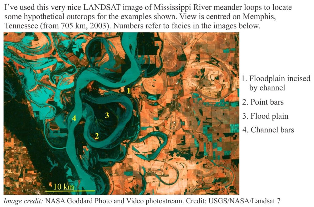
The Landsat 7 image provides useful context for meandering river systems. The images are keyed to four environmental components of sinuous channels and floodplains.
Two of the images show deposits from the Geodetic Hills fossil forest, an exquisitely preserved forest that thrived on Middle Eocene floodplains in what is now the Canadian Arctic.
Related links in this series on outcrops
Sedimentary structures: Alluvial fans
Sedimentary structures: coarse-grained fluvial
Sedimentary structures: Mass Transport Deposits
Sedimentary structures: Turbidites
Sedimentary structures: Shallow marine
Sedimentary structures: Stromatolites
Volcanics in outcrop: Lava flows
Volcanics in outcrop: Secondary volcaniclastics
Volcanics in outcrop: Pyroclastic fall deposits
Other useful links
Sediment transport: Bedload and suspension load
The hydraulics of sedimentation: Flow regime
Fluid flow: Froude and Reynolds numbers
Describing sedimentary rocks; some basics
Measuring a stratigraphic section
Grain size of clastic rocks and sediments
Some controls on grain size distributions
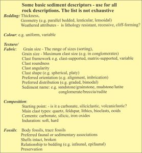
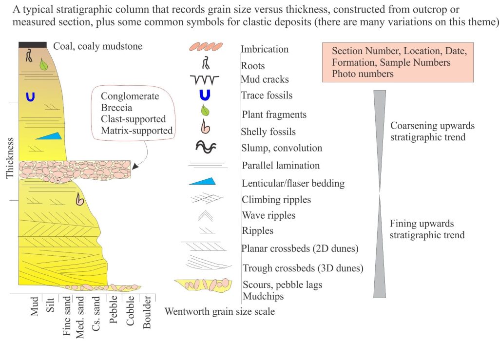
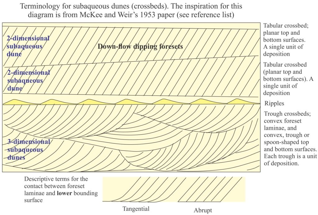
The first three diagrams show some basic sediment descriptors and terminology, and a typical stratigraphic column drawn from outcrop data. These are your starting points for describing and interpreting sedimentary rocks and sedimentary structures in outcrop, hand specimen, and core.
Meandering rivers usually flow through a single channel
References
The literature on fluvial systems and their deposits is vast (actually, this also applies to most other sedimentological domains); the accumulation of two centuries of knowledge and excellent science. The few cited here provide a taste of this talent.
J.S. Bridge, 2006. Fluvial facies models: Recent developments. In: Posamentier H W, Walker R G. (Eds.), Facies models revised. SEPM Special Publication 84, 2006: 85–170. This is a revision of the iconic volume Facies Models, originally published by the Geological Association of Canada (Geoscience Canada) (1976-79). Currently Open Access
S.K. Davidson, S.Leleu, and C.P. North (Eds.). 2011. From River to Rock Record: The preservation of fluvial sediments and their subsequent interpretation. SEPM Special Publication 97. 21 papers on many aspects of fluvial sedimentology.
A.D. Miall, 2006. The Geology of Fluvial Deposits: Sedimentary Facies, Basin Analysis, and Petroleum Geology. Springer.
G.S. Weissmann et al. 2015. Fluvial geomorphic elements in modern sedimentary basins and their potential preservation in the rock record: A review. Geomorphology, v.250, p. 187-219
