Colombia is a tapestry of snow-capped mountain ranges, peaks soaring to 5700m, volcanoes (15 of them active), tropical jungle with the myriad life-forms it supports, cascading rivers, and lazy rivers that in the east meander across the broad Orinoco and the northern edge of Amazonia. The tapestry has a few rents and many tears wrought by insurgence and drug wars, but Colombians it seems are a pretty resilient bunch and the prospect of peace is edging nearer.
 Colombia’s Andean rivers are becoming a drawcard for whitewater kayakers. In March 2013, Sam and his friend Jules Domine checked out over 5 days a trio of rivers not far south of Medellin, the ‘City of Eternal Spring’ (Antioquia Province); boulder-strewn and jungle-clad Rio Calderas, Rio Verde and Rio Samana. All three drain the eastern slopes of Cordillera Central, the Calderas upstream, and Samana eventually joining the north-flowing Rio Magdalena; a river highway. All are fed by melting snow and rain. Sam has written about this adventure in Cumec 2013.
Visitors at Rio Calderas
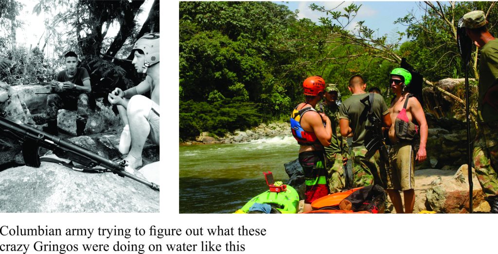 The put-in at an upstream reach of Rio Calderas would normally be uneventful but the visit by a small group of Colombian army soldiers put an interesting edge on proceedings. They were guarding an important bridge crossing. Their keen interest in the boys kayaking adventure plus regular banter (it pays to know some Spanish under such circumstances) soothed edgy nerves. Sam and Domine were soon underway, comforted a little by the watchful eye of their new friends.
Ancient rivers through older rocks
The Andean mountains in Colombia are a continuation of the chain that extends from Patagonia. A broad view of their formation, in a plate tectonic context is included in an earlier post.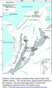 The Colombian story is complicated by the fact that the South American plate (on which all of South America rides), interacts with both the Nazca and Caribbean plates, plus the much smaller Panama Plate which is jammed between these two. One consequence of this plate arrangement is that north of the Ecuador border the Andean chain splits into three mountain belts: the western Cordillera Occidental, Cordillera Central, and the eastern Cordillera Oriental. Each is separated by a very large valley system. The rivers in this story drain the eastern flanks of the Cordillera Central. Rio Magdalena, into which the Samana flows, separates the Cordillera Central from the Cordillera Oriental.
These large drainage systems are very old. Geological studies indicate that the ancestral Magdalena Valley may be as old as 26 million years, corresponding to the period when the Cordillera Oriental began to rise (this is also about the time that the Amazon drainage system, as we know it now, began to form). Geologists don’t know the age of our three rivers, but their ancestral drainage could also date back several million years. Testaments to this are the deep and steep-sided valleys through which they flow. The drainage basins, ancient as they are, can be related back to the plate tectonic events and processes that gave rise to the oceans and South American continent
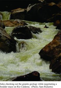
Boulder cascades
The geological backbone of Cordillera Central consists of very old metamorphic rocks (200 million years and more) and younger granite-like rocks. The three rivers on this journey run mostly over and through granite, a rock commonly consisting of large quartz and feldspar crystals; hence its white to pinkish colour. Quartz crystals are usually clear and glassy whereas feldspar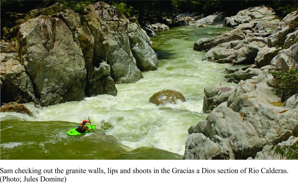 s tend to be milky white and block-shaped. Granite originates as magma deep in the earth’s crust and mantle (10s of kilometres deep) and rises, because of buoyancy to shallower levels where it cools, very slowly. Crystals begin to grow during the cooling phase; feldspar crystals in granite commonly form as the magma cools below about 1000oC and quartz crystals a bit later between 800-650oC.
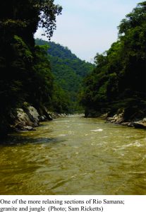 Rio Calderas, with its steep gradient has some great Class 5, bouldery rapids in narrow granite slab-lined gorges. Sam and Domine camped the first night at the confluence with Rio Verde after a pretty long and exhausting day. Rio Verde is less challenging but no less beautiful, with lazy, glassy reaches interrupted by stretches of rolling standing waves. The Rio Verde leg took 2 days.
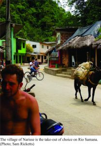
The final two days were dedicated to Rio Samana that by now has gathered water from Calderas, Verde, and many smaller tributaries. It has Class 4/4+ (depending on water levels) that take you through cascades and standing waves. The take-out, after a 40km run from Rio Verde, is near the small village of Narisse, that as the image below suggests is definitely worth the visit.
Postscript
Colombia, from all accounts is a beautiful country – people, scenery, culture. At the time this item was posted, the peace process was thankfully still alive.
Jules now runs a raft-guiding and kayaking company out of Medellin. Check it out if you are heading in that direction.
Also, check out Sam’s SeaToSkyWhitewater image gallery.


4 thoughts on “Paddling Colombia; ancient rivers over granite”
Pingback: pokemon onesie
Facebook might be your best bet, for the kayaking community
Pingback: COLOMBIA RIVERS CONSERVATION | Expedition Colombia
Pingback: Class 5; The falls and cataracts of Li Phi, southern Laos | Geological Digressions