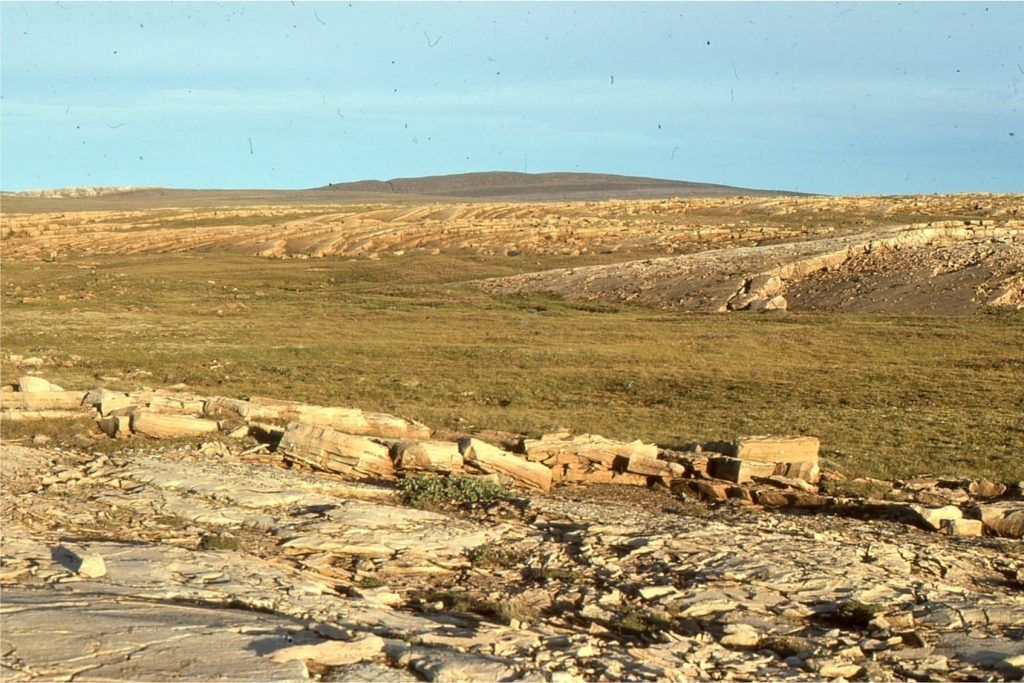
An example of a Paleoproterozoic stromatolite reef
This is part of the How To…series on carbonate rocks
Reefs are the largest biological constructions on Earth. They are ecological powerhouses, domicile to a multitude of invertebrates and vertebrates, algae and phytoplankton, all playing their part in acts of communion, competition, and symbiosis.
Reefs are also geological constructions:
- Modern coral reefs, and most reefs since the beginning of the Cambrian (541 million years ago) have rigid frameworks of corals, stromatoporids or rudists.
- Reefs fringe islands, platforms and continents.
- They range in size from small, isolated pinnacles and oceanic atolls, to extraordinarily large barrier systems; Great Barrier Reef extends about 2300km along the eastern coast of Australia.
- Reefs act as baffles to ocean waves. Waves support reef life by constantly refreshing oxygen and nutrients, but they can interrupt progress during damaging storms.
- Reefs have a partnership with lagoons.
These are the reefs we are most familiar with. They even evoke romantic notions, the splendours of nature; diving amongst brilliantly coloured corals and fish, home to apex predators, ships dashed upon… etc.
Earth’s earliest reefs looked quite different. For almost 3 billion years, Precambrian reefs consisted of stromatolites, constructed by micro-organisms; primarily cyanobacteria. They lacked rigid frameworks – most were susceptible to erosion, although sea floor cementation might have rendered them crusty. There were no grazing invertebrates – the ecological web must have been much simpler. Despite these fundamental differences, Precambrian reefs occupied and responded to similar oceanographic conditions as their Phanerozoic cousins:
- Cyanobacteria are photosynthetic prokaryotes which means the buildups accumulated within the photic zone, responding to changes in filtered light and seawater temperature.
- Stromatolite reefs defined platform margins, sometimes extending across entire platforms and shelves.
- Lagoons, tidal flats and sabkhas were partnered with the offshore buildups.
- Reefs that developed on platforms or shelves were usually associated with deeper water slopes that deposited hemipelagic material plus any coarse-grained shallow water sediment that bypassed the reefs. Slope facies may include mass transport deposits (slumps and slides, turbidites and debris flows).
- Stromatolite reefs and associated platform facies responded to fluctuating sea levels.
- Extensive buildups acted as baffles to waves and currents, and in turn were moulded by these forces.
- They were occasionally battered by storms.
- They were long-lived constructions. Large reefs probably represent hundreds of thousands and even millions of years accumulation.
Stromatolite reefs of the Mavor Formation
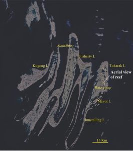
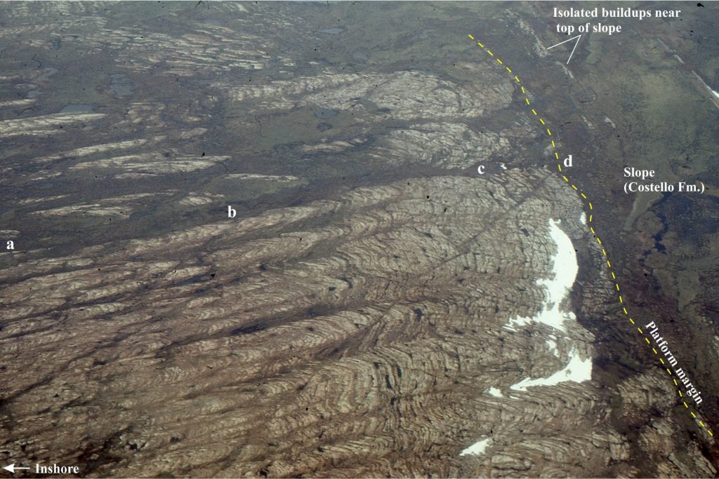
The Paleoproterozoic succession on Belcher Islands (Hudson Bay, Canada) contains carbonate platforms replete with stromatolites and cryptalgal laminates. One stratigraphic unit, the Mavor Formation, contains spectacular mounded buildups. One of the best exposures is shown below; here one can walk through a continuous succession, from beach to platform margin. The margin itself is delineated by an abrupt change in sedimentology, from large, high synoptic-relief stromatolitic buildups, to thin bedded, carbonate-rich rhythmites and shale deposited on the seaward slope. Slump packages and turbidites do occur but are not common. A few small, isolated stromatolites domes grew on the upper slope (i.e. outboard of the platform margin) – this probably reflects the maximum limit of the photic zone. The platform margin is a mappable boundary; slope deposits belong to the Costello Formation. The stratigraphic thickness of the reef package in the aerial view is 244m.
Shallow water facies
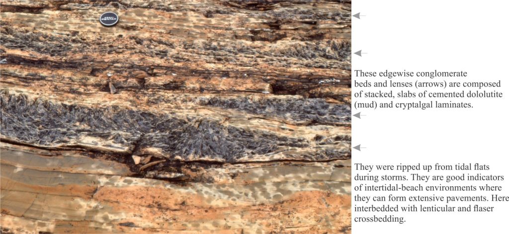
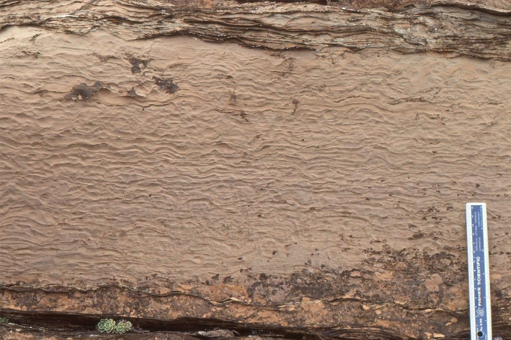
Depending on location, the landward part of the platform changes from sandy beach to intertidal-shallow subtidal flats. Facies indicative of beach settings include crossbedded grainstone, edgewise conglomerate pavements, and beachrock. Typical tidal flat structures are lenticular and flaser cross bedding, plus indications of prolonged exposure with mud cracks and gypsum crystals (replaced by dolomite). Local clusters of branched stromatolites and laminates show frequent scouring and reworking by storms.
Reef transitions across the platform
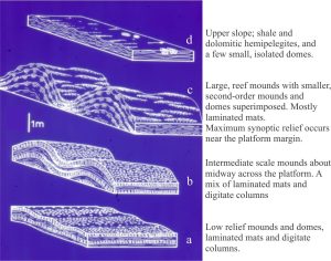
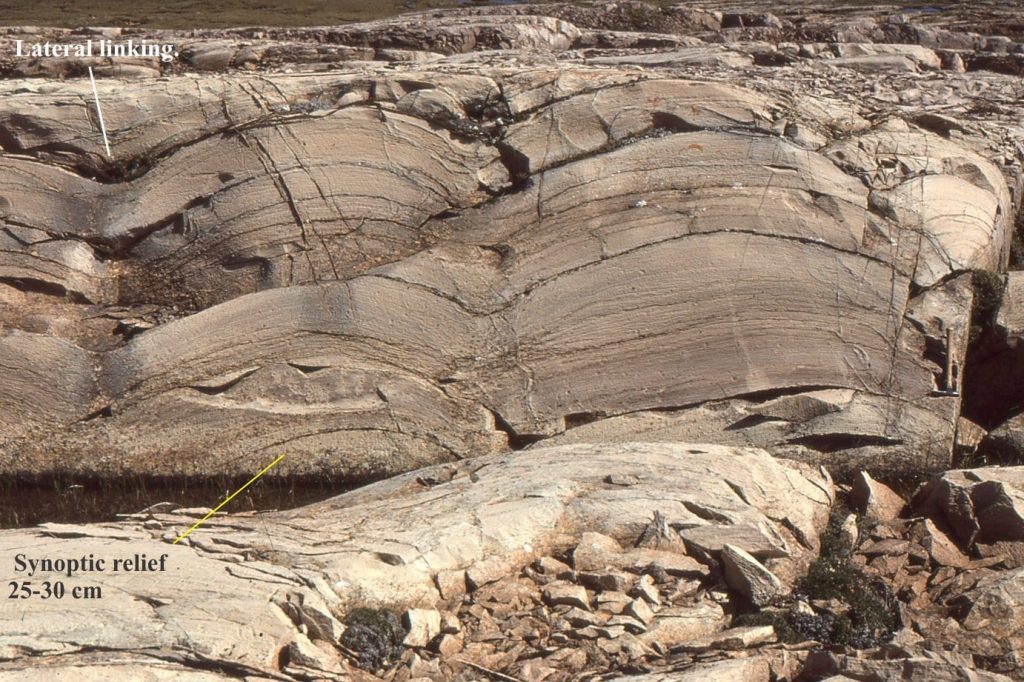
In the image above, the four panels reconstructed from field sketches and photos, show the stratigraphic changes in buildup organization. Beyond the beach, shallow subtidal mounds are relatively small, have synoptic reliefs of a few centimetres, and consist of laterally linked hemispheroidal domes and columns. Mounds are elongate, parallel to the overall trend seen in the aerial view; elongation direction is normal to the paleoshoreline, the strike of which was established from bedform azimuths.
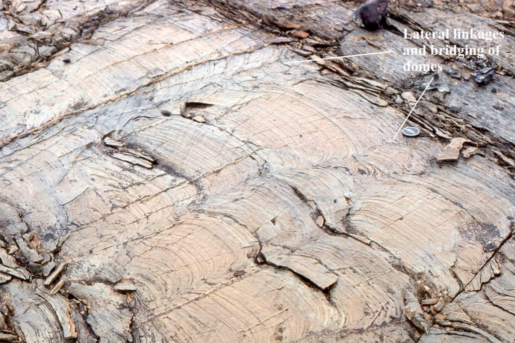
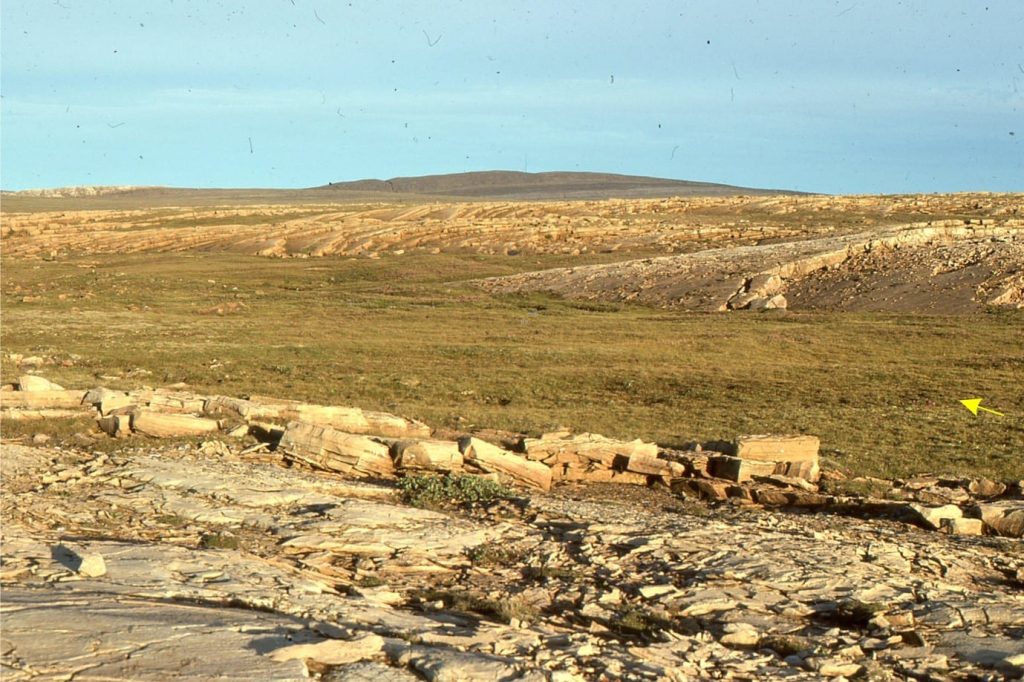
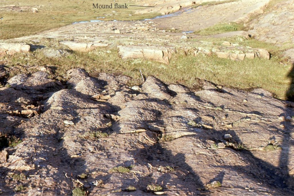
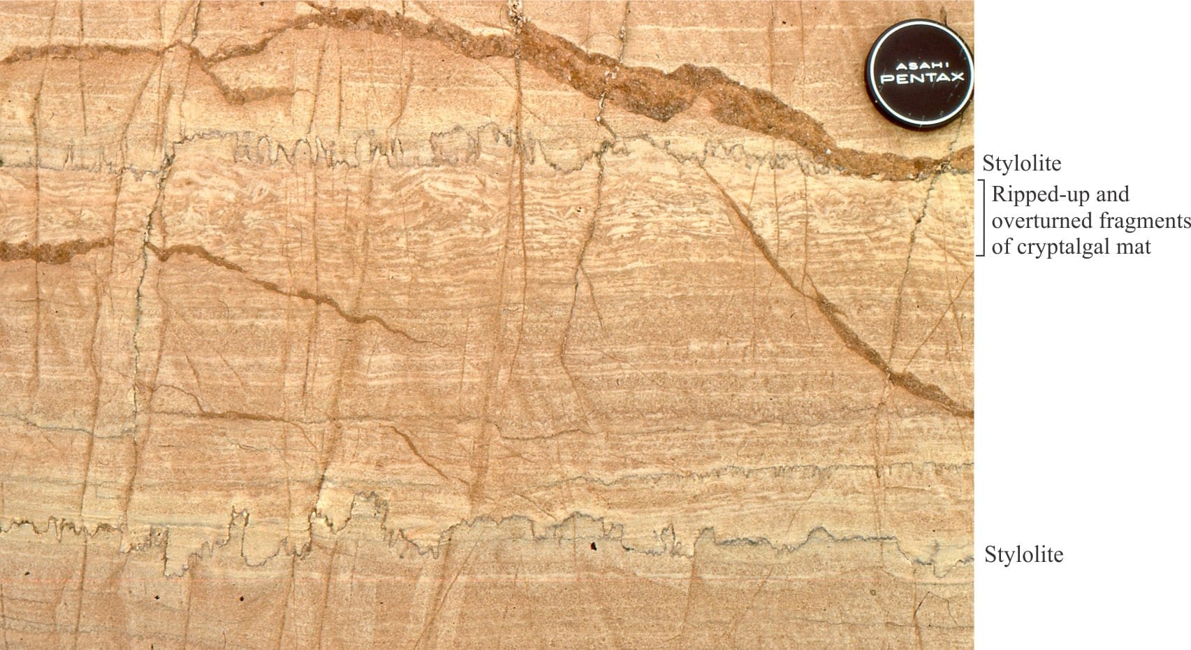
Moving across the platform, corresponding to higher stratigraphic levels, mounds coalesce into fewer but larger buildups, with concomitant increases in synoptic relief. Synoptic relief is a maximum 2m to 3m at the platform margin. Here, buildups consist almost entirely of wavy, undulating and crinkly laminates; digitate branching is far less common. In addition, smaller scale elongate mounds are superposed on the larger structures. Thin beds of mud and laminate rip-ups, floored by shallow scours, indicate the passage of storms. Disruption by storms is seen in all the buildups including those near the platform margin. This implies that the depth of the margin itself was close to storm wave-base.
The exposure in places allows one to walk out individual beds from mound crest through the adjacent trough to the opposite mound; the only thing that’s missing is the water over your head.
The slope
The transition from reef buildups to slope shale and carbonate rhythmites is abrupt, although a few small, isolated stromatolite domes occur immediately outboard of the platform margin, within slope mudrocks; these occurrences are inferred to represent the photic zone depth limit of stromatolite growth . The rhythmites are particularly striking, with alternating intervals of red and white dolomitized carbonate mudstones and calcilutites. There are a few graded beds containing more sandy sediment (mudstone fragments, ooids) and climbing ripples, deposited by turbidity currents. Clearly, some coarse-grained, shallow water sediment was moved onto the platform, perhaps through troughs between the mounds, eventually bypassing the margin. Slump structures also occur but like the turbidites, are not common.
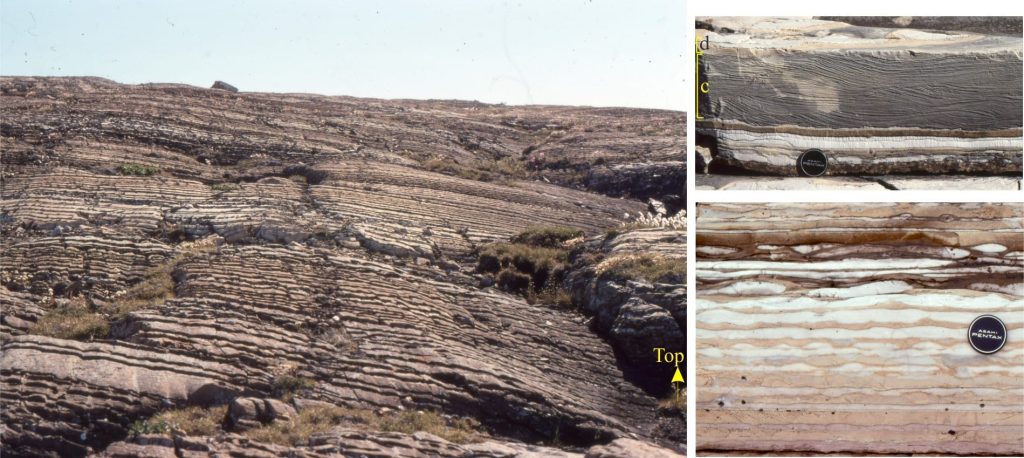
The Mavor platform was dominated by muddy carbonate sediment. It was a large carbonate factory where the production line consisted entirely of cyanobacteria. Reef and slope stratigraphy indicate long-term transgression, conditions conducive to the viability of factory production. There are no chronostratigraphic controls on this part of the succession, but I speculate the cycle duration is roughly equivalent to a 3rd-order Sequence.
Links to other posts in this series:
Mineralogy of carbonates; skeletal grains
Mineralogy of carbonates; non-skeletal grains
Mineralogy of carbonates; lime mud
Mineralogy of carbonates; classification
Mineralogy of carbonates; carbonate factories
Mineralogy of carbonates; basic geochemistry
Mineralogy of carbonates; cements
Mineralogy of carbonates; sea floor diagenesis
Mineralogy of carbonates; Beachrock
Mineralogy of carbonates; deep sea diagenesis
Mineralogy of carbonates; meteoric hydrogeology
Mineralogy of carbonates; Karst
Mineralogy of carbonates; Burial diagenesis
Mineralogy of carbonates; Neomorphism
Mineralogy of carbonates; Pressure solution
References
Bosak, A.H. Knoll, and A.P. Petroff, 2013. The Meaning of Stromatolites. Annual Reviews of Earth & Planetary Science, v. 41, p. 21-44. Free Access. Lots of great references.
T.E. Playton, X. Janson and C. Kerans. 2010. Carbonate slopes and margins. In N.P.James and R Dalrmple (Editors), Geological Association of Canada, Facies Models 4, Chapter 18. P. 449-476. Available for download
E.P. Suosaari, R.P. Reid, and M.S. Andres, 2019. Stromatolites, so what?! A tribute to Robert N Ginsberg. Depositional Record, v. 5, p. 486-497. Open Access. Evaluates some of the main controversies with stromatolites and microbialites. Lots of great references.
B.D. Ricketts and J.A. Donaldson, 1989. Stromatolite reef development on a mud-dominated platform in the Middle Precambrian Belcher Group of Hudson Bay. In, H. Geldsetzer, N.P. James and G. Tebbutt (Eds.), Reefs, Canada and adjacent areas. Canadian Society of Petroleum Geologists, Memoir 13.
H.D. Williams and others, 2011. Investigating carbonate platform types: Multiple controls and a continuum of geometries. Journal of Sedimentary Research, v. 81, p.18-37. Good account of factors influencing platform and ramp geometries using 2D modelling. Available for download


