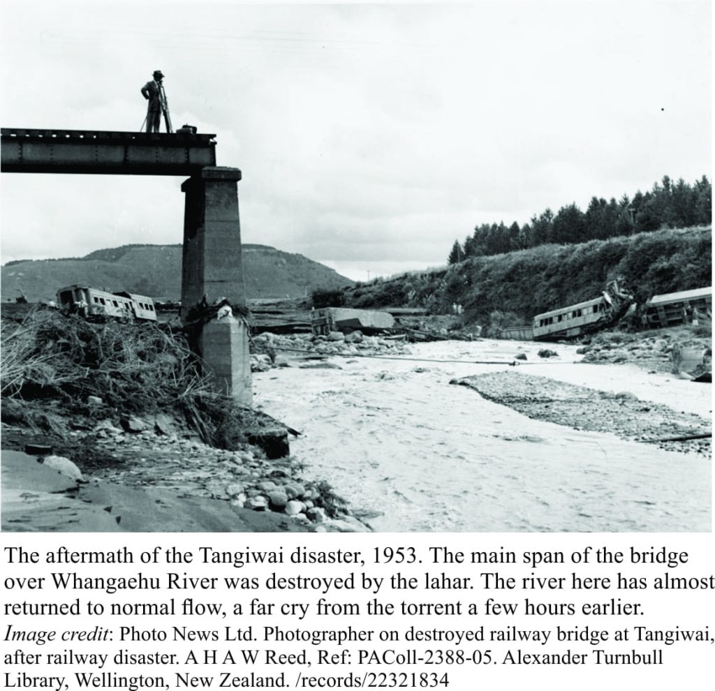
Christmas morning in New Zealand is synonymous with mid-summer barbecues at the beach, deservedly lazy times, perhaps a bit of over-indulgence. That morning, in 1953, Kiwis were expecting to awaken to news of the Royal tour; the newly crowned Queen was doing the rounds of towns and countryside, perfecting that royal wave to flag-waving folk lining the streets. Instead, they awoke to the news of a train disaster near Mt. Ruapehu, one of three active volcanoes in central North Island; a railway bridge on Whangaehu River, near Tangiwai, had been washed out on Christmas Eve. Train carriages were strewn along the river banks, 151 people were killed. The culprit was a geological phenomenon known as a lahar.
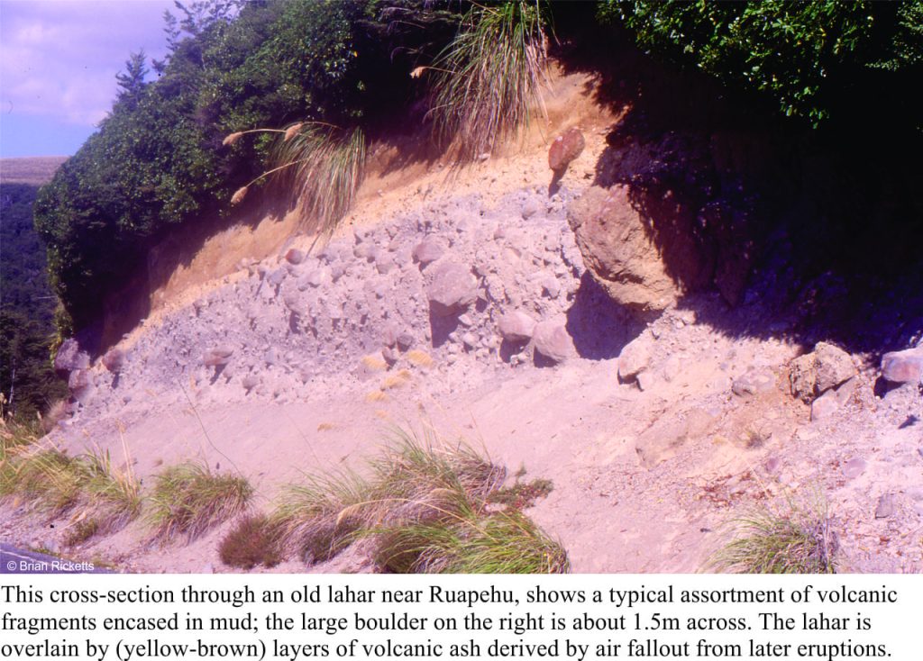
The slopes of most volcanoes are strewn with an assortment of volcanic debris (volcanic ash, chunks of lava flow, lava bombs, fragments from hot ash clouds). If there is a sudden addition of water to this mix of loose rock, then, under the constant influence of gravity, the entire conglomeration will begin to move. Volcano slopes tend to be steep, and the watery mixture quickly gains speed and momentum, guided by gullies and existing river channels. These highly mobile mud-rock-water slurries commonly attain speeds of 50km/hour, but have been clocked at more than 140km/hour. They are lahars, a kind of debris flow that contains mostly volcanic fragments and is initiated on the slopes of volcanoes. Their mobility and speed make them highly destructive.
Lahars can develop at any stage of a volcano’s life; during eruptions when hot materials melt snow and ice, and long after eruptions during major precipitation events. They can also arise from the breaching of crater lakes, and it is this mechanism that was responsible for the Tangiwai disaster in 1953.
Historically, Crater Lake has been a pretty constant feature of Ruapehu. The lake levels and temperatures fluctuate with the mood of the volcano, and it is monitored closely for its more temperamental activity (Ruapehu and its surrounds are one of the most popular skiing and hiking areas in New Zealand). Late in 2006, the lake level rose significantly, and scientific monitoring equipment was put in place in anticipation of a break-out. Ruapehu duly complied on March 18, 2007; the lake dam (consisting of volcanic ash and rubble) was breached. The sudden rush of water mixed with the abundant supply of rocky debris in the headwaters of Whangaehu River, producing a lahar that careened headlong down the valley. A GNS Science video of the event, featuring volcanologist Brad Scott, shows some of the classic features of lahars, including:
- Lahars can develop very quickly,
- Lahars are a bit like wet concrete, although sloppier,
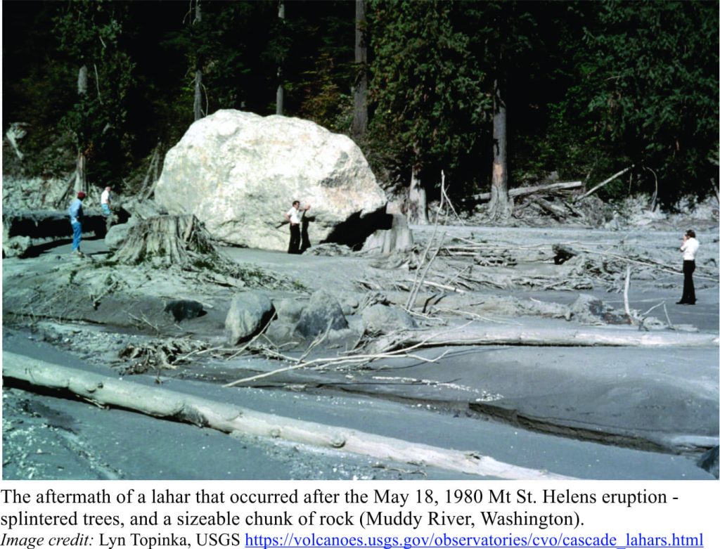
- They are highly mobile, are capable of moving at high speeds, and frequently carry large boulders and trees,
- They eroded river channels through which they tend to be focused, incorporating more debris and water into the flow, such that the lahar can grow in size as it moves downslope.
- Lahars can travel 10s of kilometres from their source.
Some older video sequences shot in Japan, although a bit fuzzy, demonstrate the incredible destructive power of lahars. In the first clip, a lahar generated on the slopes of Mt Unzen grows rapidly, spilling over the river banks. At about 8 seconds into the clip, there is a large surge in flow; surges like this are common in lahars (and other debris flows). Houses, vehicles and bridges are obliterated in seconds in flows of this size.
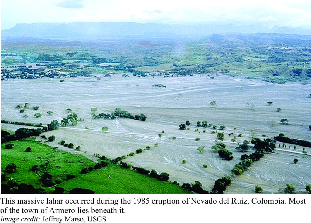
Some of the largest debris flows known are lahars. During the 1985 eruption of the Colombian volcano Nevado del Ruiz, hot pyroclastic flows melted summit ice and snow, providing enough water to generate several lahars; these flows traveled upwards of 100 km, killing 23,000 people. En route, they grew in volume to about four times their original size, by incorporating water and sediment from the river valleys.
By an unfortunate coincidence, the 1991 eruption of Pinatubo (Philippines) occurred while a typhoon was passing overhead. Torrential rain, mixing with the new influx of ash and debris, generated a lahar that killed 1500.
Lahars pose risks in regions of both active and dormant volcanoes, and hence are commonly the subject of geological mapping, modelling, and experimentation. One such experimental site is a USGS facility in Oregon, that uses an artificial flume (channel) to examine and measure the attributes of debris flows. Data from experiments and geological studies like these are used to evaluate the efficacy of lahar early warning systems.
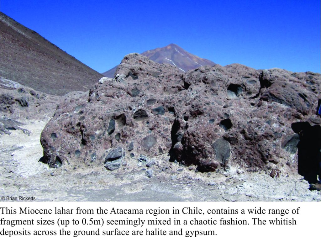 As a geologist, I have come across several examples of ancient lahars; they are fascinating deposits in their own right. We can identify common physical attributes, even in rocks many millions of years old (such as the size range of volcanic fragments in an almost chaotic mix – everything from boulders to mud-sized particles). We also have a good theoretical understanding of the kind of power and mechanics required to move large boulders in flows like these, for example the effects of buoyancy and turbulence. But theories designed to explain ancient events, do not convey a sense of the immediate destructive power, the mayhem and terror that lahars can foist on a landscape. The rock record may contain a few fossilized, broken and shattered tree trunks, but no trains or houses. It is, unfortunately, the observations, images, and historical notes of more recent lahar events that teaches us these brutal lessons.
Some useful links on Lahars and other volcanic rocks
Mount St. Helens: 40th Anniversary
