Geological-logo
Geological-logo

Interpreting Earth

Interpreting the Earth

Practical and philosophical ways earth scientists interpret ancient environments, climates, oceans, volcanoes, fossils, earth events
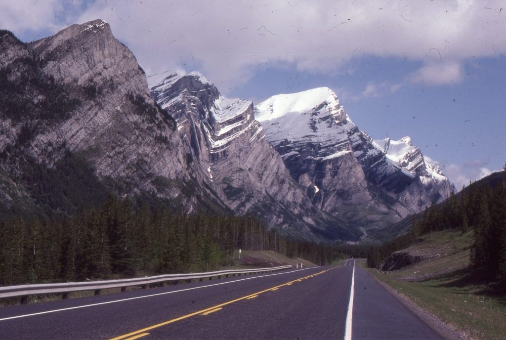
Part of the Alberta Front Ranges fold and thrust belt that acted as a tectonic load, promoting crustal flexure and formation of Alberta foreland basin. Here, the trace of Lewis Thrust runs parallel to Kananaskis Highway, with the fold pair in Lower Paleozoic carbonates in the hanging wall; Lewis Thrust terminates at the base of this fold pair.

How Geologists Interpret Ancient Environments #1. Getting started

How Geologists Interpret Ancient Environments #2. Ruffles and Desiccation

How Geologists Interpret Ancient Environments #3. A Philosophical Interlude

How Geologists Interpret Ancient Environments #4. Someone passed by this way – Tracks, trails, impressions and foot prints

How Geologists Interpret Ancient Environments #5. Sand to Stone = Sandstone; A remarkable Transformation

How Geologists Interpret Ancient Environments #6. When Time Goes Missing

How Geologists Interpret Ancient Environment. #7 Budget Surpluses and Budget Deficits

How Geologists Interpret Ancient Environments.  #8 A Forty Million Year Old Fossil Forest

How Geologists Interpret Ancient Environment, #9. The Oil Kitchen Rules

Marrying Fossils, Isotopes and Geological Time

Throwing the celestial dice

Submarine landslides; danger lurks in the ocean deep

When nature casually flicks a finger at us

Liquefaction; more than a sloppy puddle at the beach

A Gaggle of Goose Barnacles

Biomarkers; forensic tools for hydrocarbon fingerprinting

The (not so) Great Dying; Permian extinctions

Burnt soles: black sand beaches in New Zealand

Darwin Day, with apologies to Abraham Lincoln

Polar bears do not live in the Antarctic, there are no Penguins in the Arctic. The asymmetry of the poles

Ropes, pillows, and tubes; modern analogues for ancient volcanic structures

Rip currents – you have been warned

Crème brûlée, jelly sandwich, and banana split; the manger a trois of layered earth models

Tidal waves; prisoners of celestial forces

Crossing the harbour bar

Difficulty breathing: The Atacama salt lakes

Beneath the ice; Greenland’s bedrock

Archives
Categories
dip and strike compass
Measuring dip and strike
sandstone classification header
Classification of sandstones
Calcite cemented subarkose, Proterozoic Altyn Fm. southern Alberta
Sandstones in thin section
poles to bedding great circles
Stereographic projection – poles to planes
froude-reynolds-antidunes-header-768x439-1
Fluid flow: Froude and Reynolds numbers
Stokes Law for particle settling in a schematic context of other fluid flow functions
Fluid flow: Stokes Law and particle settling
sedimentary-basins-distribution-1-768x711
Classification of sedimentary basins
Model are representational descriptions are written in different languages - diagrammatic, descriptive, mathematical, and conceptual. They commonly contain variables and dimensionless quantities that permit quantitative analysis of the physical systems the models represent.
Geological models
Scroll to Top