Pucon, Chile
Kayaking on a volcano
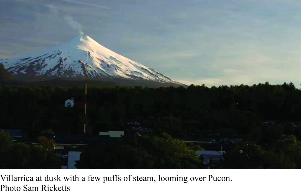
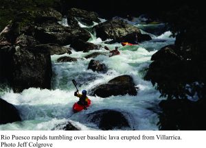
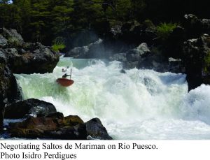
Pucon is a tourist destination, nestled between rugged hills and Largo (Lake) Villarrica in central Patagonia, Chile. One of its attractions is rivers with a bit of everything for kayakers and rafters, from Class V to Class II rapids and waterfalls, through bush and steep gorges. Idyllic? Normally yes, except that the most active volcano in Chile is right on your doorstep – in fact at times it’s in your living room. Most of the rivers here drain directly from the slopes of Volcán Villarrica, fed by small glaciers, seasonal ice and snow, and summer rain. Rio Trankura, Rio Puesco and Rio Maichin are the most popular. Rio Trankura boasts Classes IV and V in its upper reaches (check out the Saltos de Mariman video) and Rio Maichin Classes III to IV in gorges. Rio Puesco is Class V and is the most technical of the three; it was included as one of the 5 stages in the 2012 Chilean Whitewater Grand Prix. Sam’s video of the Puesco says it all
Photos of the Puesco Fest can also be found here.
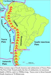
Many young, dormant and active volcanoes are located in the central and southern parts of Chile. They are the products of plate tectonics. Crust beneath the eastern Pacific Ocean (here the plate is called Nazca Plate) is being thrust (subducted) under the South American Plate along the Peru-Chile Trench at rates that vary between 70-80mm/year. Subduction results in forces that fracture, fold and uplift large slabs of the crust to form the Andean Mountain chain. Friction between the two plates also causes intermittent slippage; the largest earthquake ever recorded was 9.5 magnitude in southern Chile in 1960. The latest event in Ecuador (M7.8, April 16) was one of several high magnitude, devastating earthquakes over the last few decades. Most of these powerful earthquakes are generated at depths 10-60km below the earth’s surface which, in geological terms is quite shallow.
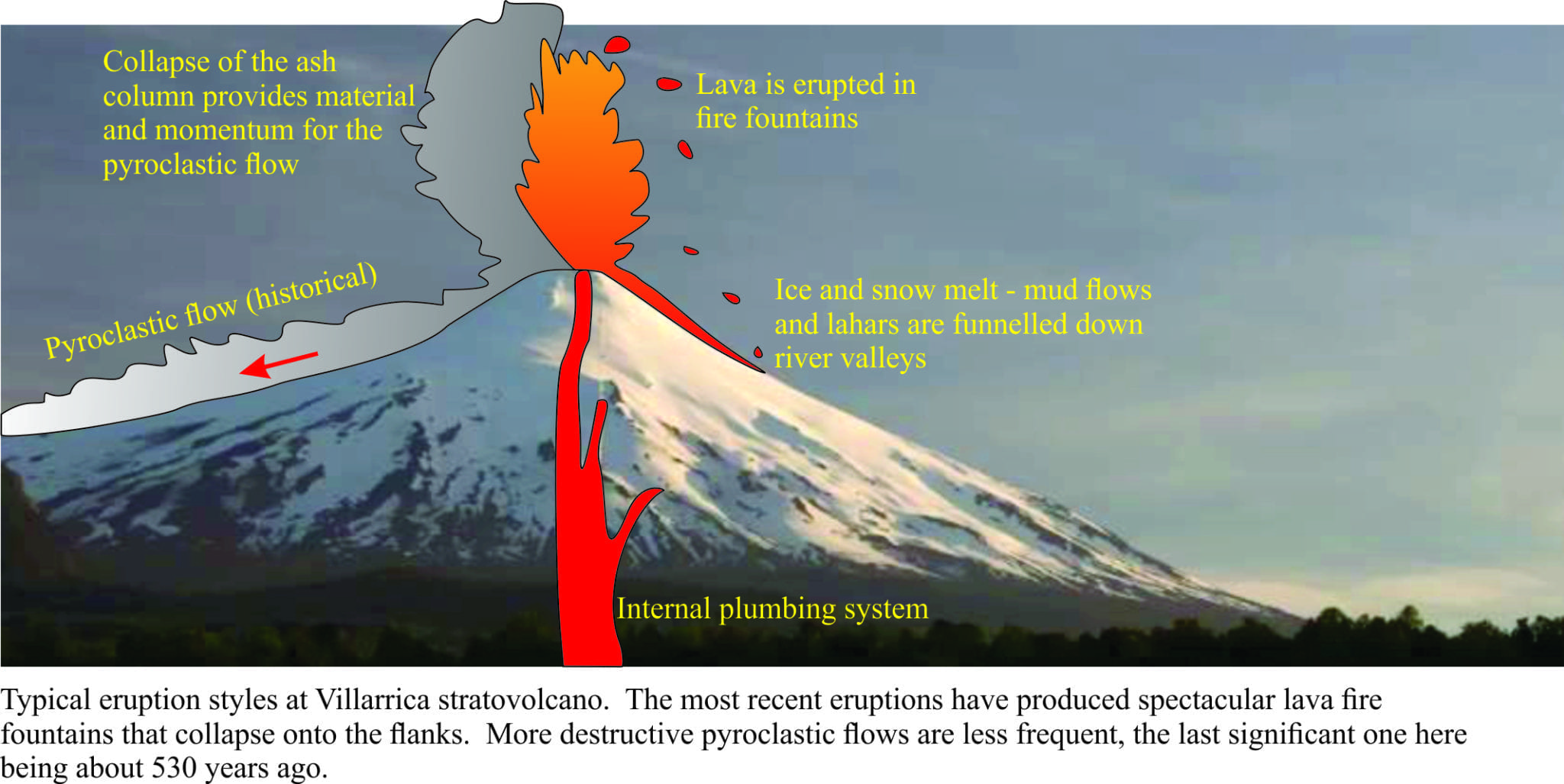
The heat generated at depths of 150-200km by these massive plate tectonic forces also forms magmas (1000oC and more). Buoyant magmas rise through the crust via a plumbing system that exits at the surface. The kind of volcanic activity that ensues depends on several factors such as the type of magma (whether it is fluid or viscous), the amount of gas in the magma, and how much water (seawater, groundwater) interacts with the magma. Thus, eruptions can vary from catastrophic explosive types (plinian eruptions) like the Taupo, Tamoboro, Krakatoa eruptions, to spectacular fire fountains (Strombolian eruptions), and relatively sedate effusion of flowing lava like the eruptions of Mauna Loa and Mauna Kea (Hawaii; the word “sedate” is used rather loosely here).
Volcán Villarrica is a stratovolcano. It is an almost perfect cone built from successive layers of volcanic ash (explosive activity), lava flows, mud flows and lahars (boulder mudflows) and pyroclastic flows (check out the Taupo eruption here); the last significant pyroclastic flow was erupted only 530 years ago. It has a central crater that frequently is filled by a lake of molten lava. Villarrica was built on the bones of older volcanic eruptions that took place over the last 100,000 years; the modern cone is less than 3500 years old. It is one of the most active volcanoes in Chile, having erupted dozens of times over the last 500 years.
Although Villarrica had been rumbling (and glowing in the dark) for some time, it was in the early hours of March 3, 2015 that lava from the crater lake spewed forth in spectacular, glowing fire fountains up to 1000m above the summit. Some of the lava fell back into the crater lake, but enough collapsed onto the mountain flanks to melt some of the glacial ice. The resulting torrents of muddy, ash-laden water flowed down the river valleys. One of these, Rio Turbio, courses its way through the town of Pucon. At the peak of the eruption this river changed from its normal trickle to a raging mix of water, mud and boulders. Most of the local population was evacuated during the main eruption. Thankfully there were no fatalities.
Life for kayakers and everyone else in Pucon is back to normal, although for Volcán Villarrica ‘normal’ may be when it is letting off steam. There is also the possibility that future eruptions will change river flows and kayaking lines by adding a few boulders here, a few there. But this will only increase the challenges facing those who live on the edge.
