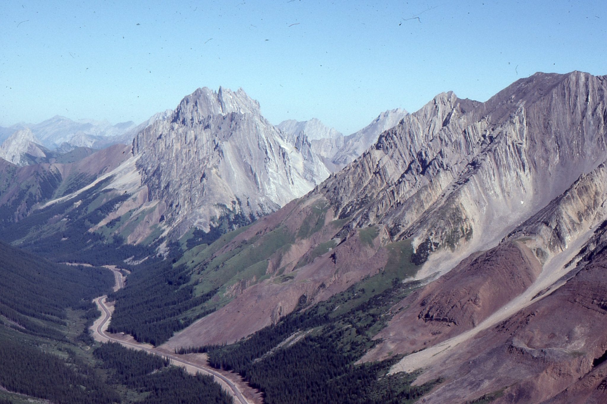
Something is amiss!
Dam construction has been completed, an engineering marvel, to applause and congratulatory handshakes. All we need to do now is watch and wait while the water level rises in the reservoir – all that pent-up energy. But something is amiss. As filling proceeds over the next few months, a portion of the left bank (as you look down stream) has begun to move toward the reservoir, in places up to 3-4 cm/day – an alarming rate. Higher up the slope a large extension crack has propagated about 1700m across the hillside. A few months has now extended to 3 years and still the open fracture grows; now the rate of movement of soil and rock towards the reservoir is 20 cm/day.
All of these natural processes culminate on a certain evening, about 10.30 pm. The slowly moving slope fails completely and slides catastrophically into the reservoir. A small village on the opposite shore is swamped by a massive wave. The wave, now 240m higher than the dam spills over the lip. Millions of tonnes of water cascade down the valley, completely annihilating several small villages along its path. About 3000 people die.
I haven’t made this story up, although I have left out many technical details. This disastrous event has taken its place in engineering and geotechnical lore; it was the 1963 Vajont landslide in Northern Italy. It is, sadly, one of many geotechnical-engineering disasters, many although not all involving the loss of life, arising from constructions like the Vajont dam that have resulted in changes to hill-slopes, mountain sides and other geomorphic features. Of course, catastrophic slope failure also occurs in environments that haven’t been tampered with. It’s just that the geotech-engineering related failures have a certain piquancy. Groundwater is implicated in many of these events.
The stability of natural slopes
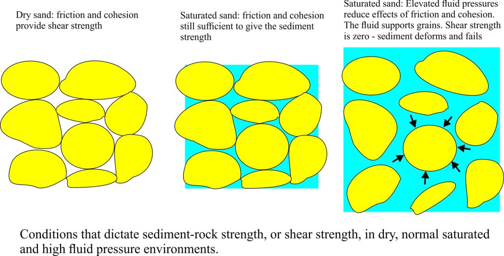
Land surfaces are underlain by soil, soft sediment and hard rock. Steep terrains commonly are rocky and lack significant sediment. When these materials are dry, the stability of slopes is determined by friction and cohesion (think stickiness) among the sediment and rock components. In this case pore space among grains or open fractures in rock are filled with air. We refer to this inherent strength of sediment and rock as shear strength.
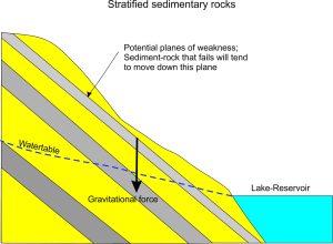 Sedimentary rocks are usually layered and it is generally understood that the planar contact between layers (called bedding planes) are also planes of mechanical weakness where layers may slide against one another. The concept and theory of shear strength also applies to these planes.
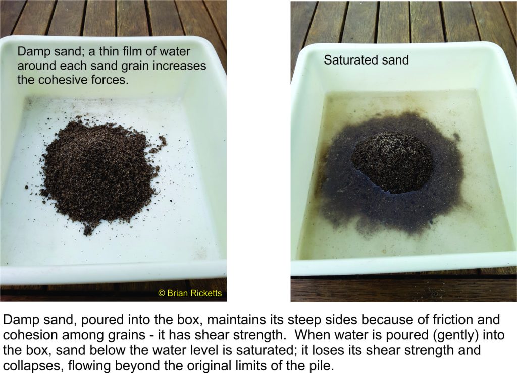
Below the watertable, the pores and fractures are filled with water which exerts pressure (i.e. fluid pressure) that tends to negate some of the friction and cohesion forces; in other words, the presence of groundwater reduces the shear strength of the earth materials. Under normal conditions these slope materials remain stable. But if fluid pressures rise significantly they can completely negate the forces of friction; in such cases the shear strength of sediment and rock is reduced to ZERO and it is at this point that our slope materials will fail. Check out the simple experiment below.
Circumstances contributing to this condition include:
- Precipitation events where water infiltrates pores and fractures; note that this also adds weight to the slope materials,
- Rising watertables caused by precipitation, rising lake-reservoir levels, or modifications to groundwater flow and drainage that accompany excavations, quarries, open-cast mines and stream diversions, and
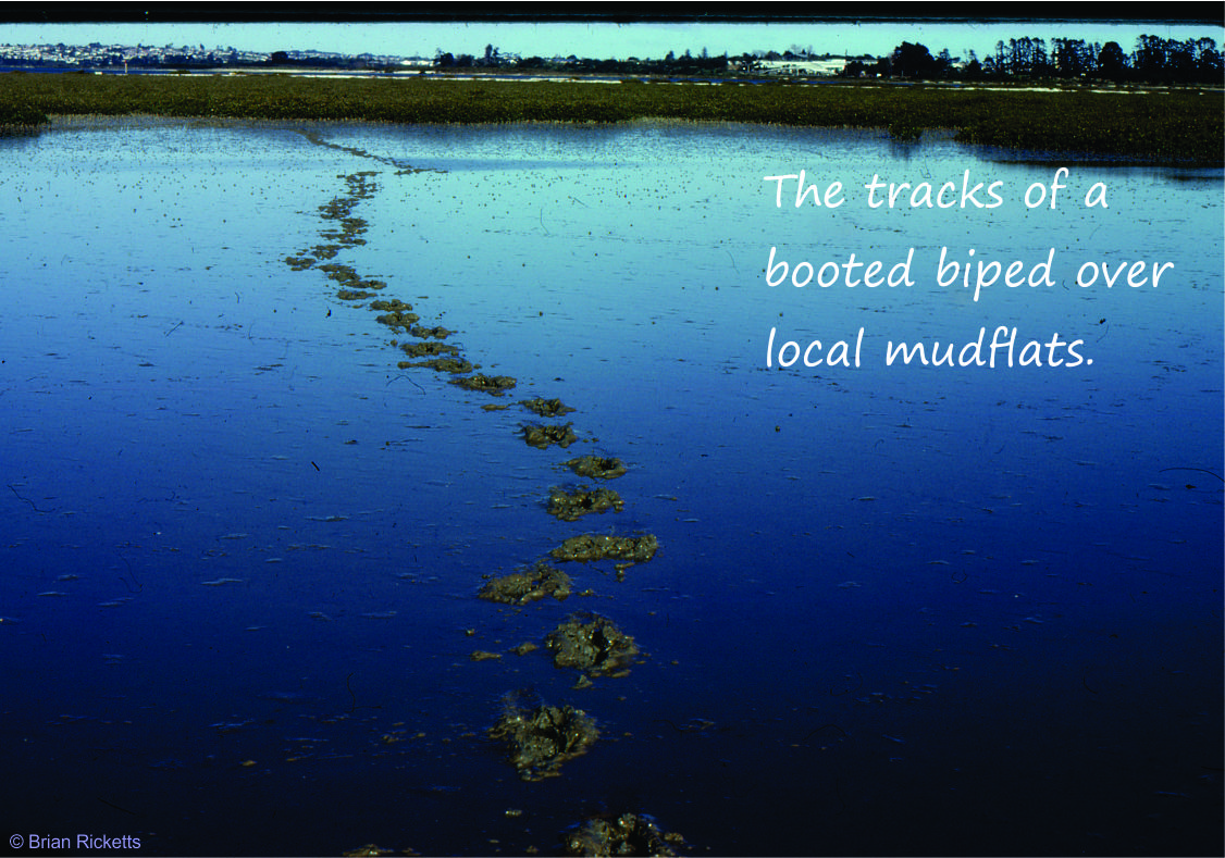
- Seismically induced fluid pressures. A common product of seismic ‘shaking’ is liquefaction where abrupt increases in fluid pressure force sediment grains apart so that they are basically floating in water. How often have you seen kids (old and young) doing this by stamping on wet beach sand?
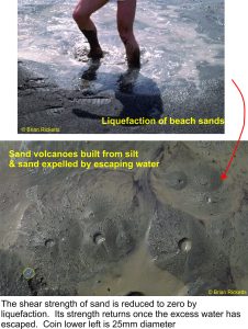 Liquified sediment has no shear strength. Under these conditions building, bridge and dam foundations can become completely unstable. The Christchurch (New Zealand) 2011 earthquake provides an excellent example of this process. Much of Christchurch is built on low-lying coastal and alluvial floodplain where watertables are naturally close to the surface. During the M 6.3 event, severe shaking liquefied large areas of sandy sediment. House foundations floundered, and buried infrastructure such as water and sewerage pipes were broken. Sediment was also fluidized where groundwater was forced to the surface and hundreds of small sediment volcanoes vented sand, silt and mud across wide areas (fluidization is similar to liquefaction but occurs where the fluid is forced upwards through the sediment).
Back to Vajmont, 1963
The landslide was likely caused by a combination of factors in which groundwater fluid pressures played a major role (Note there was no earthquake):
- The dam was built across folded sedimentary strata such that layers of alternating weak and strong rock were inclined towards the reservoir. Any movement of rock along planes of weakness between layers would also be directed towards the reservoir. Some of the weaker layers contained abundant clay.
- The watertable beneath the adjacent valley slopes rose in concert with the rising reservoir level. Thus, previously unsaturated rock became saturated and with this an increase in fluid pressures.
- Heavy rainfall immediately prior to the landslide provided added weight to the sedimentary layers as well as increased fluid pressures as pores filled with water.
Although the Vajmont slide had been moving slowly for almost 3 years, it was a combination of hydrogeological and geological factors that reduced the shear strength of slope sediment and rock to the point where sudden, catastrophic failure was complete.
Landsides are common, natural phenomena. Many are initiated by earthquakes, of which historically there are some brutal examples (the 1970 Yungay landslide in Peru buried two villages, killing 20,000; 67,000 were killed by the M7.8 earthquake).
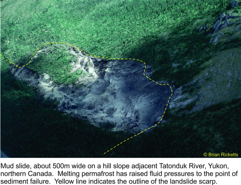
Elevated fluid pressures that developed in weak muddy rocks led to significant property damage during the 1964 Alaskan earthquake (some great photos are reprinted in this 2014 issue of The Atlantic).
Elevated (groundwater) fluid pressures are directly or indirectly involved in most landslides whether they are seismically induced or not. It pays to do one’s homework before tampering with natural slopes.
There is an excellent blog by Prof. Dave Petley (Durham University) that describes in greater detail these and many other landslides.
Postscript
October 21, 1966. I remember seeing the news on our black & white TV; 116 kids, who were all in school, and 28 adults were buried in an avalanche of spoil from the local coal mine – this was the Aberfan disaster, in a small Welsh town. Dave Petley, in a series of AGU Blogs, describes the event and the subsequent inquiry, an inquiry that found the local Coal Board utterly delinquent in their management and location of the spoil dump, despite abundant local geological, hydrogeological and geotechnical evidence available to them at the time (including detailed geological maps). There had also been a slope failure on another part of the spoil dump in 1944, but this fact too was ignored.
(The link above to the blogs takes you to the 3rd in the series – you can go to the earlier posts by clicking on the appropriate link in the text)
