 Mud
Mud
It supports geological processes.
It flows, subsides, and leads to failure, sometimes catastrophically.
It can be beneficial, forming fertile river floodplains.
It can be a pain in the neck, clogging infrastructure.
It oozes when soft; dries brick-hard
People bathe in it. Pigs love it.
And it erupts, as volcanoes.
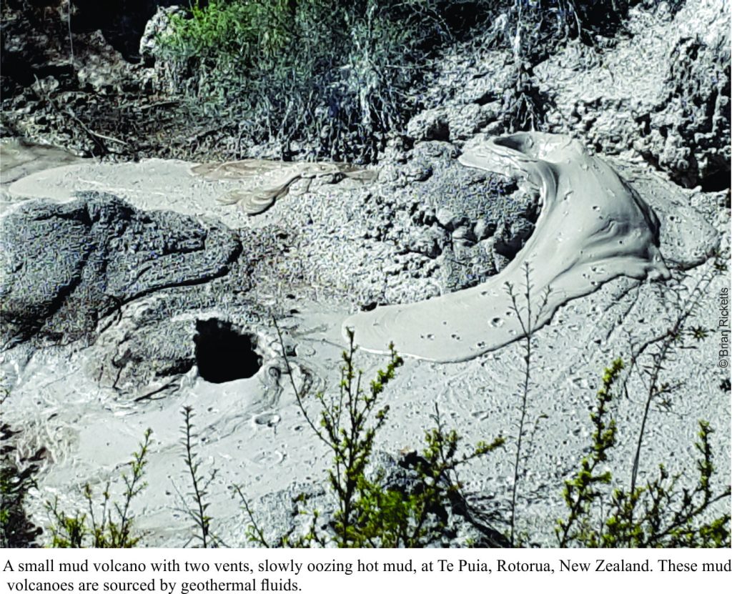
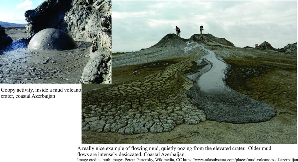
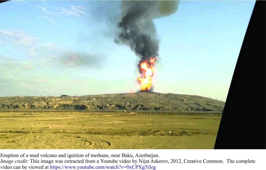
Not the magmatic kind, with 1000oC lavas or explosive ash columns, but eruptions nonetheless. Most mud volcanoes are much smaller than their magmatic counterparts; some only a metre high, others 10s of metres. Eruptions may be the quiet, oozy kind where mud flows, slithers and slides down slope, or more violent, shooting sticky stuff 10s of metres into the air (or water); some even ignite in a cascade of fireballs. And yes, they do form on the sea floor. One example in 2015 along the Sea of Azov coast (land-locked between Russia and Ukraine), sent mud and water several metres into the air; you can see the muddy jetsam gradually expanding across the sea surface.
Mud volcanoes are surprisingly common and occur in a variety of geological settings: geothermal fields (geysers, boiling pools and so on), near active faults or regions prone to seismic activity, on large river deltas, and above oil fields. Many are located close to the boundaries between tectonic plates, particularly where plates are moving together in collision or subduction (where one plate slides beneath another plate), such that sedimentary strata are being compressed, or where plates slide past one another.
The source of the mud is deposits of clay and silt buried anywhere up to 2-3km depth, that may be liquified by earthquake shaking, or have retained their softness even during burial. Muds at this depth will have been heated by virtue of being buried (at these depths 60o-90oC), or by geothermal activity that may also be associated with hot magma and volcanism. The muds rise through conduits such as rock fractures and faults, partly because they are buoyant, but also because they are pressurized – a bit like squeezing a tube of toothpaste. They usually cool on this upward journey, although in geothermal environments they may still be very hot.
Mud eruptions also occur in proximity to oil and gas fields – in fact the presence of mud volcanoes has been used in the past to identify possible oil fields. However, in this case, the muds will usually contain methane that is released during the eruption, along with salty water and sometimes oil. Ignition of the methane may produce a brief flare, or a spectacular, sustained fireball. This kind of mud volcano can produce spectacular eruptions. An eruption at Baku near the Caspian Sea, Azerbaijan, is a great example. In fact, Azerbaijan has about 400 mud volcanoes – almost a third of the known examples world-wide. The largest there is 700m high. More than 100 of these occur in the Caspian Sea.
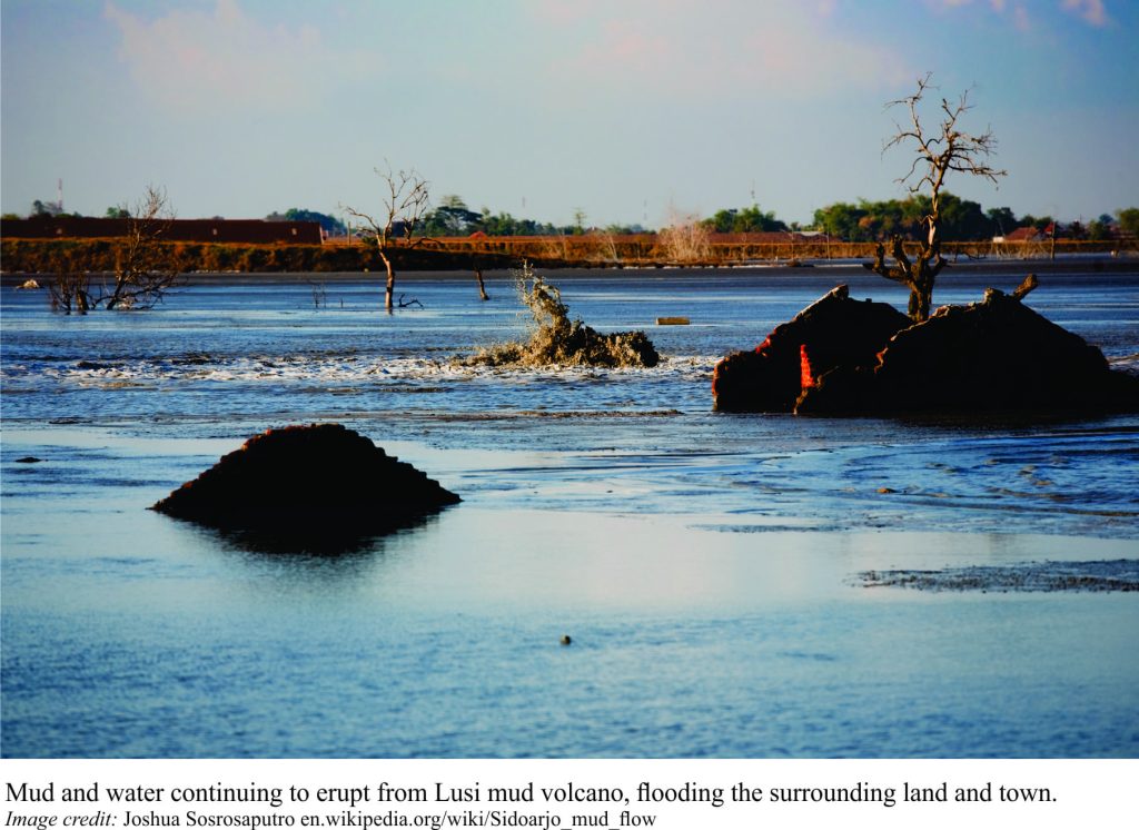
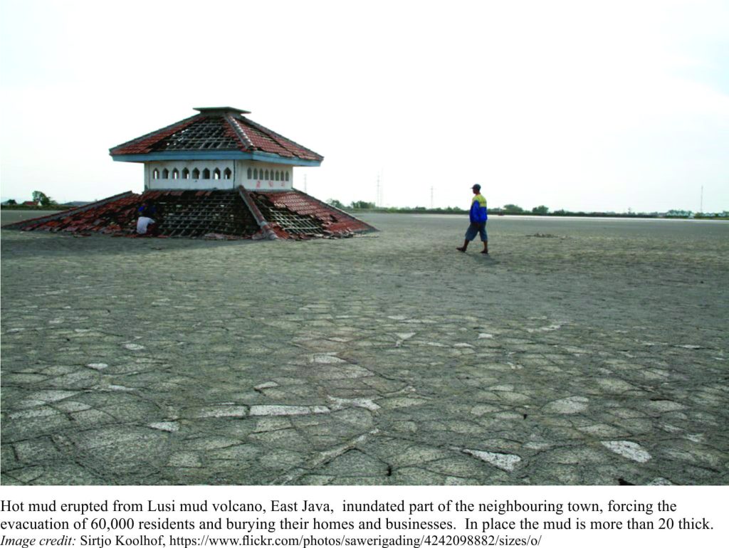
Most mud eruptions are short-lived (hours, days), intermittent affairs. Bucking the trend for longevity is an eruption in Lusi, northeast Java, that began May 2006 and has wreaked havoc ever since. The Lusi mud volcano is located in an oil province that also has a neighbouring volcanic chain and is close to active faults. Boiling mud, rocks and gas have been issuing from a low vent almost continuously for 11 years, forcing the evacuation of 60,000 people as their homes were inundated. At peak eruption, 180,000 cubic metres per day sloshed over the sides of the vent, spreading rapidly over an area of about 7 km2. Stop-banks have prevented further encroachment on the adjacent neighbourhood but the eruption still produces mud at about 80,000 m3/day (about the volume of 30 Olympic swimming pools).
Explanations for the eruption, and not a little blame, have focused on a distant earthquake several days prior to the event, and on active drilling nearby. Early investigations suggested that well-control on the gas drilling project failed to stem a sudden increase in gas pressure and water influx, and that this triggered the eruption. Of course, the drilling company has denied this. The drilling industry at large has debated this.
More recent investigations (Journal of Geophysical Research, 2017) using seismic records from the neighbouring district, reveal a hot plume of fluid at about 6km deep below the eruption vent. This hydrothermal (or geothermal) plume is connected, via a series of conduits several kilometres deep, to hot magma chambers beneath the active volcanoes 10km and more to the southwest. Thus, heat and fluids sourced from the volcanoes have reacted with oil-bearing muddy rocks beneath Lusi, producing the hot muds that ultimately spew from the vent.
If the hot, geothermal plume explanation is correct, it might be argued that an eruption would have occurred at some point in time, regardless of any other activity, natural or otherwise. Shaking during the distant earthquake may have acted as a trigger although it seems the amount of shaking was small. So, while there is a good explanation for the longevity of the eruption and its source of heat, it seems the jury is still debating the actual triggering mechanism for this disastrous event; earthquake, drilling failure, or coincidence. Here is a good summary of the arguments presented up to 2015.
Lusi mud volcano is still erupting. Who knows for how much longer. Perhaps until the supply of mud buried beneath the vent runs out. But that could be quite a while. Most mud volcano eruptions tend to be short-lived and very few result in loss of life or property. But natural phenomena like these don’t always follow the law of averages – perhaps the next surprise is just around the corner.
Addendum:
Here is the link to a 2018 article, published in Marine and Petroleum Geology, that revisits the data and concludes that the drilling blowout coincided with and was the primary cause of the Lusi eruption.
