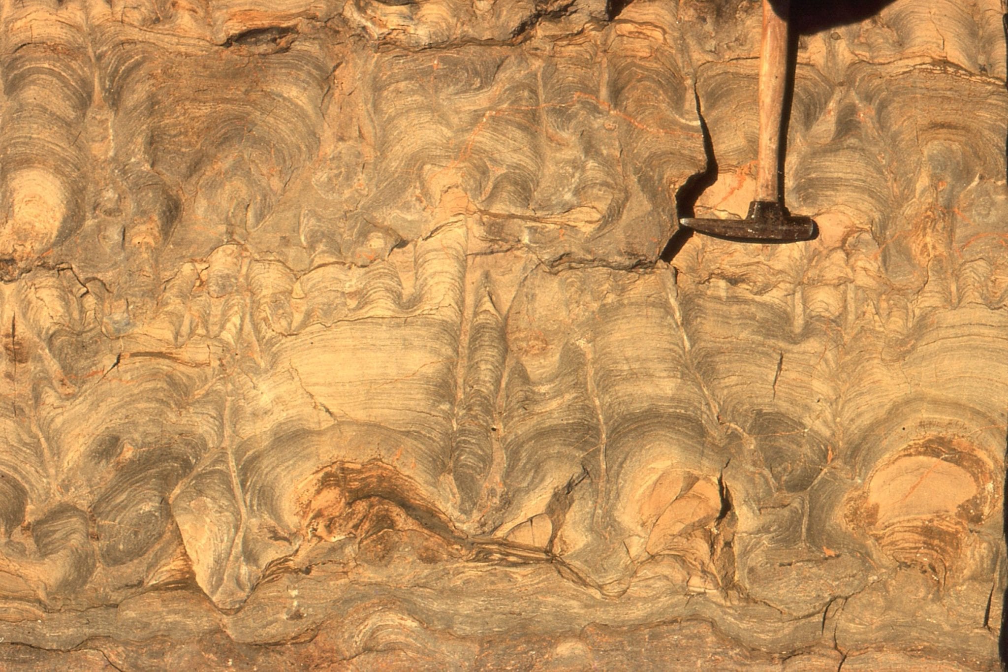
Some things in science are just too difficult to comprehend: the temperature at the center of the sun (15,000,000oC), the age of the earth (4.6 billion years), the size of a nano-particle (1-100 nanometres, or billionths of a metre). We can include in this list of imponderables, the skinny outer layers of the earth: the one we are in daily contact with (the crust), and other layers beneath it. Our familiarity with the crust is usually in terms of the dirt, rock, and water we work with. But what is it like 30km down? And, beneath the crust, the upper mantle is beyond reach of our senses. What does this layer look like? How does it respond to being pushed around?
Some scientists (geologists, geophysicists) spend a great deal of time pondering questions like these. The crust and upper mantle layers are collectively referred to as lithosphere. Beneath the continents it averages 150 km thick; beneath the oceans, it is as thin as 10 km below mid-ocean ridges. Given we spend our entire lives on the uppermost veneer, a reasonable person might ask ‘why is it important?’.
A few common answers include: Most earthquakes are generated in the lithosphere; Magmas erupted at volcanoes melt at these depths. But the overarching reason is that all tectonic plates are born and destroyed as lithosphere. Plate tectonics governs pretty well everything that happens on earth over geologically short and long time-scales. So, what appears arcane at first sight, does have practical applications.
Enter the dessert trolley. There are three choices: a crème brûlée, a jelly sandwich, and a banana split. Proposed as models of the layered earth, they serve a dual purpose: they provide visual descriptions of how the lithosphere might be structured and, after evaluating the merits of each, they can be consumed.
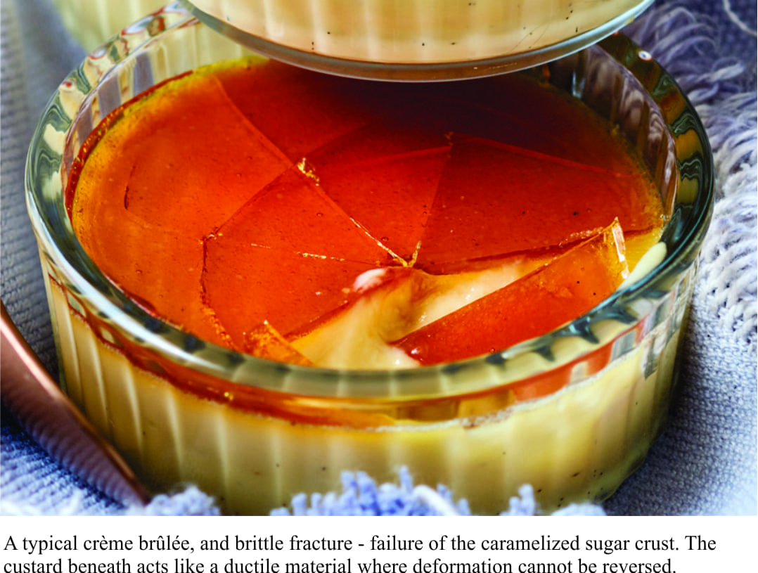
The crème brûlée is a two-layered model. A viscous fluid base (custard) is capped by a thin crust of caramelized sugar. The crust behaves in two ways. Poke it gently in the centre, and it will bend slightly – release the pressure and it will return to its original shape. This represents elastic behaviour (think also of wire springs, or rubber bands). Press it too hard and it will break into several ragged pieces; in this instance, you have exceeded the elastic limit, or strength, and induced brittle failure. Earthquakes represent brittle failure where earth’s crust fractures, is displaced, and in the process causes mayhem. The crème brûlée model is probably the simplest of the dessert trio in terms of its relevance to the lithosphere.
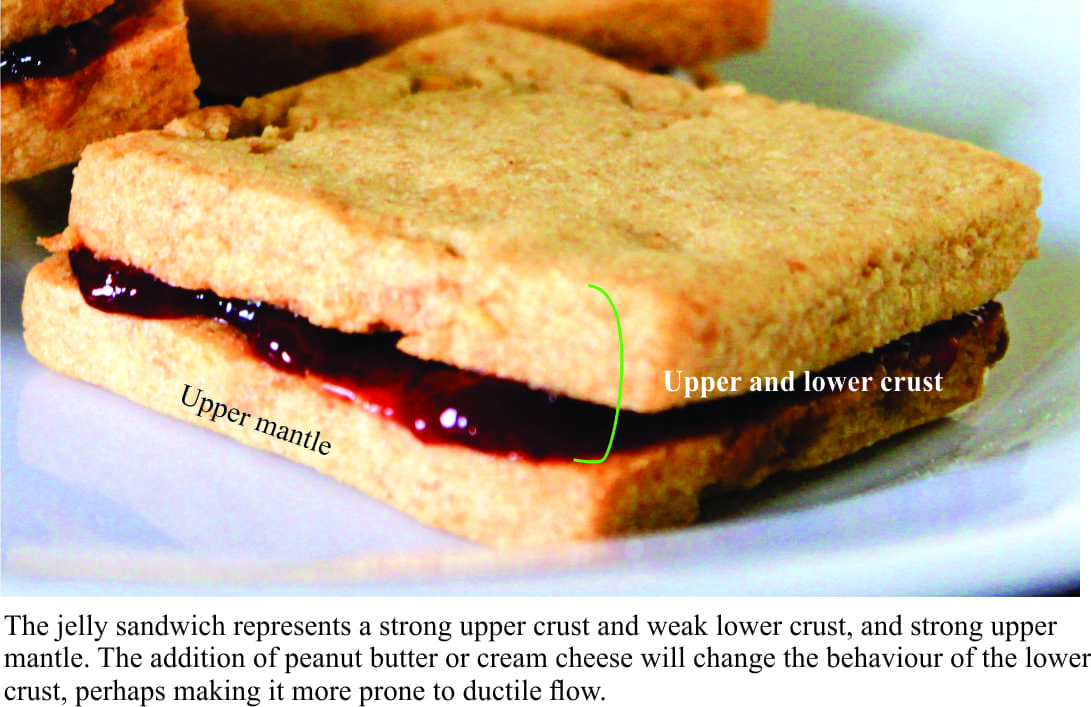
The jelly sandwich is potentially the more variable of the three analogues. It is a three-layered model where two pieces of bread are separated by a layer of jelly. Here, the upper bread layer represents a strong upper crust, and the jelly a weak lower crust. The bottom bread layer is compared with a strong upper mantle – in contrast to the weak custard (mantle) layer in the crème brûlée. The upper and lower bread layers are both quite bendy (unless you have toasted the bread). If you use plain white bread, then bending will be uniform. But if you prefer whole-grain slices there will be lots of lumps and greater heterogeneity, and hence a less predictable response to the application of pressure, or stress. The jelly is much less fluid than custard. It can behave elastically – witness the wobbling, that represents deformation from which it recovers, but at a certain point it too will fail. Bread is less rigid than a crème brûlée crust; any kind of twisting or bending will probably result in some permanent deformation (i.e. it doesn’t bounce back to its original shape). Unlike the crème brûlée crust, bread is less prone to brittle failure.
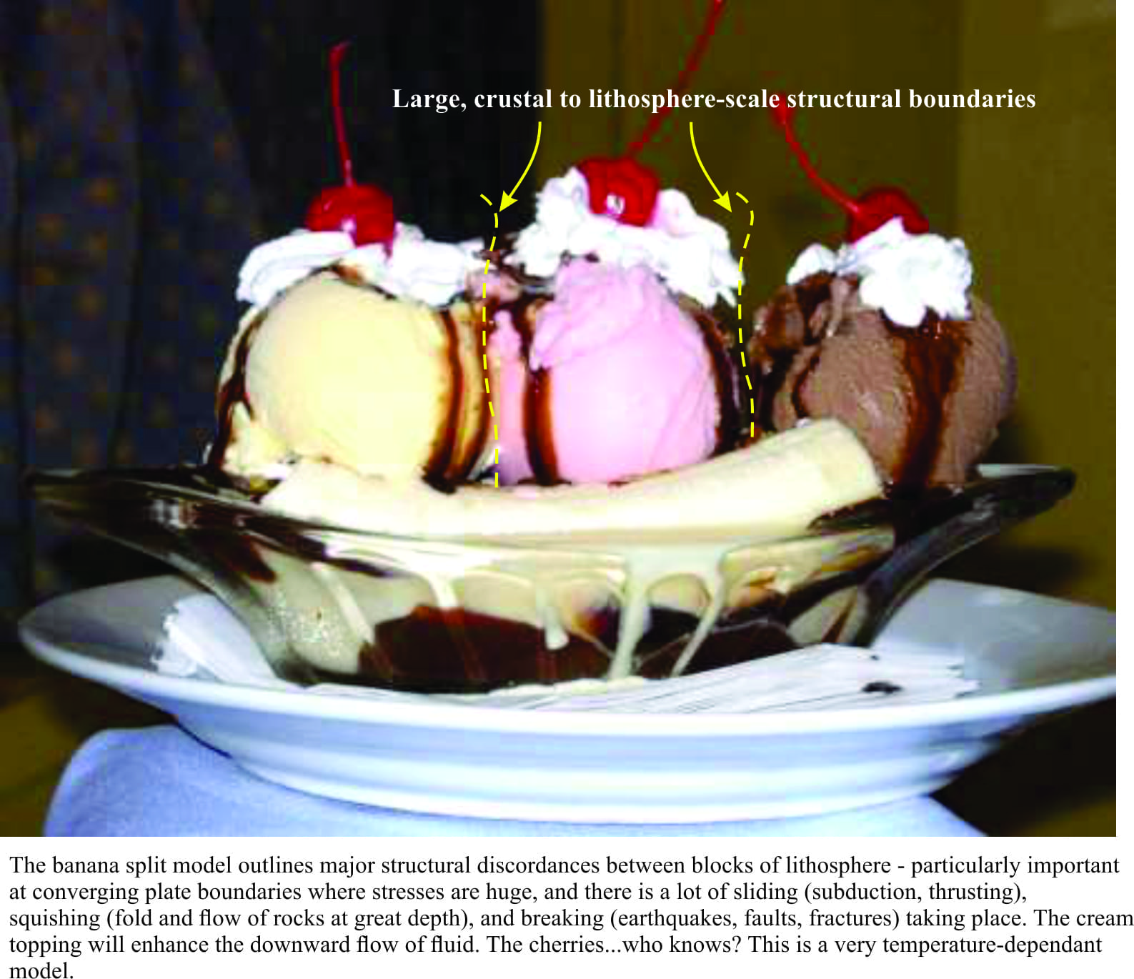
The banana split adds another level of complication to models of the lithosphere. The rationale for this model is that the lithosphere contains zones of weakness, particularly near the boundaries of tectonic plates – imagine these plates colliding or sliding past one another, where the forces are large enough to create mountain belts and consume oceans. Here, scoops of ice-cream represent blocks of crust and mantle that are separated by large, very deep faults. This is a very temperature-dependant model. As the ice-cream melts there is a zone of weakness between it and the adjacent scoop (block). The presence of fluid, particularly water, exacerbates this weakness. In this dessert, we need to translate the fluid boundary between scoops of ice-cream, to structures 10s of kilometres deep. Modern examples include the Alpine fault in New Zealand, and San Andreas Fault in California. Some of these large structures can last for very long periods of geological time (100s of millions of years), and potentially influence events in the crust-upper mantle long after they first formed.
All models in science are simplifications of the things we try to explain. It may be the case that some consider the dessert trio to be trivial, even silly, providing little useful scientific information for the representation of the crust and mantle. But the utility of models and analogues is not only in scientific explanation, but to present a complex world in visually interesting, and yes even amusing ways. Models and analogues need to stir the imagination of folk who are not directly involved in this kind of research but have a vested interest in it. In this regard, the dessert trio works, even if folk can relate to them only via our taste buds.