Prevailing scientific wisdom tells us that volcanic seamounts and oceanic islands are forged from magma hotspots fed by mantle-derived plumes. The plumes originate deep in the mantle, possibly the core-mantle boundary. Plumes are considered stationary relative to the motion of the overlying oceanic lithosphere – a condition based on the age progression observed in many seamount chains like the Hawaii-Emperor and New England chains.
The standard hotspot theory has been challenged on two fronts:
- Some magma plumes originate from shallower depths, perhaps in the mantle lithosphere along regions of extension in subducted oceanic plates, or along leaky fracture zones and transform faults.
- Hotspots can move independently of the overlying oceanic plate (e.g., O’Connor et al., 2013).
The Cook Island seamount-island chain has become an unwitting accomplice in this discussion. Cook Islands are part of the northwest-trending Cook-Austral lineament, a 2,200 km long array of seamounts and islands. The Cook-Austral array is, in turn, part of a ‘hotspot highway’ that continues into the Samoa chain. The length of the highway matches that of the Hawaii-Emperor chain, but there is a fundamental difference between the two – the Hawaii-Emperor chain is the product of a single hotspot, whereas the Cook-Austral array is thought to have formed over three overlapping hotspots.
The Cook-Austral seamount chains
The fly in the hotspot anointment (sic) relates to recent volcanism on Rarotonga and Aitutaki. The two volcanic islands are the sole representatives of the hypothesized Rarotonga hotspot track that is partnered with two other seamount tracks: Macdonald track and Arago track. Both tracks show a consistent age trend; the Macdonald track, named after its active seamount namesake, is progressively older to the northwest, increasing in age to 74Ma. Likewise, Arago track contains Cretaceous seamounts (73-74 Ma) with progressively younger volcanoes southeast (Jackson et al., 2020; OA). The problem child in the Cook-Austral lineament is Aitutaki – apparently it belongs to both Arago and Rarotonga tracks.
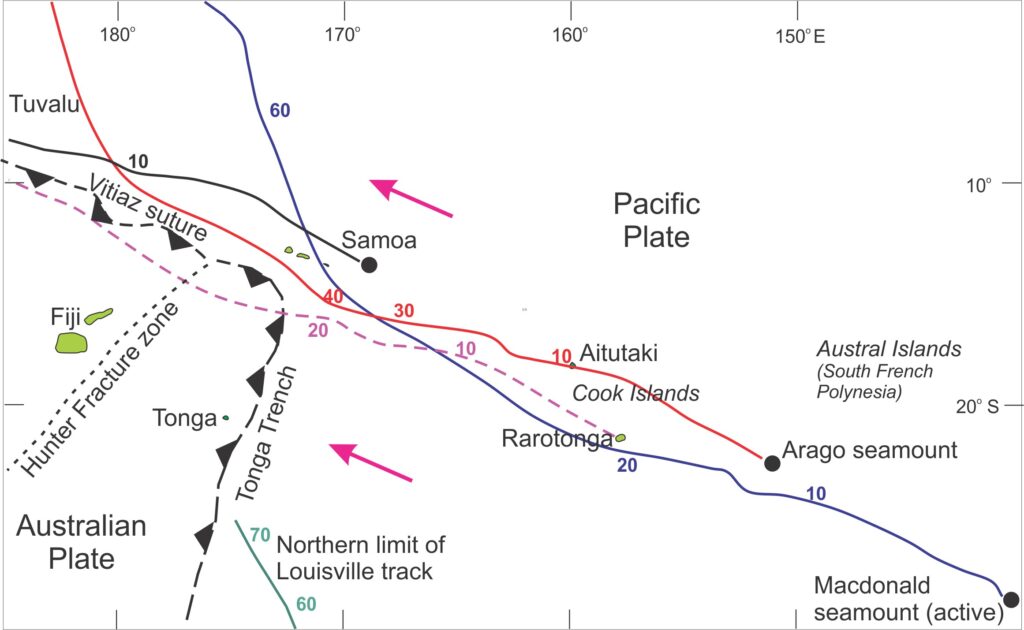
Jackson et al., 2020, Figure 1.
Rarotonga volcanism
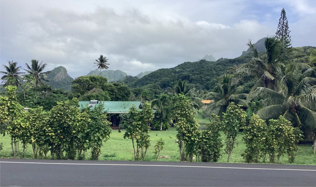
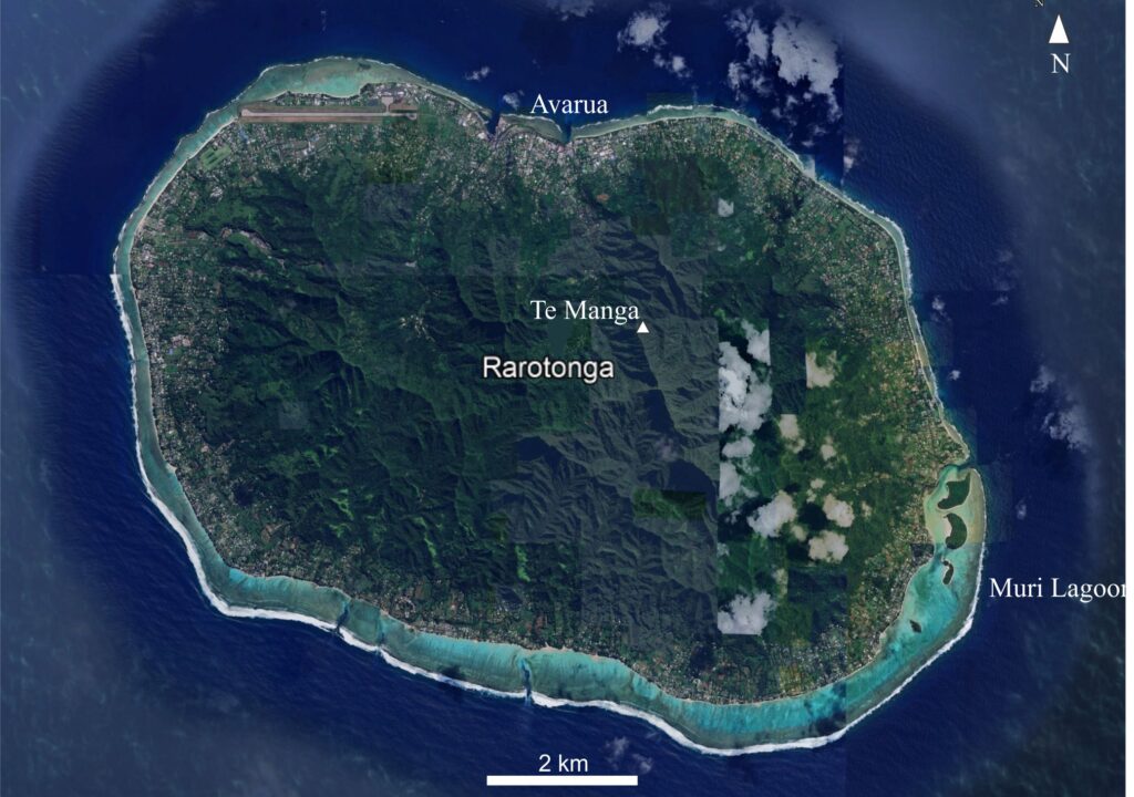
Rarotonga is the main island in the Cook Islands group. It is also the largest at 11 km maximum diameter on an elliptical outline. It is a highly dissected volcanic edifice with erosional pinnacles to 653 m a.s.l. A fringing reef and relatively narrow lagoon or back-reef surround the island. The eruptives are dated at 1.157 to 1.697 Ma, overlapping with the youngest phase of volcanism on Aitutaki (Jackson et al., op cit).
Thompson et al., (1968) describe the volcanic rocks as alkali basalts with nepheline, olivine, and augite-diopside varieties. Two main episodes of activity are represented by an initial basalt-ankaramite phase, followed by a more fractionated phase of sodalite-bearing phonolite lavas and volcaniclastic deposits. Both episodes produced flows, dykes, and volcaniclastic deposits. Subaerial lava flows are commonly interbedded with volcaniclastic rubble and ash.
[Sodalite is a sodium-rich silicate typically found in alkali igneous rocks (commonly with nepheline and sanidine). Phonolite is a sodium-potassium rich volcanic rock of intermediate composition, usually associated with partial melting in the lower crust.]
Mapping by Wood (1967) and Thompson et al., (1998) identified flows associated with a central cone, although that original structure is no longer preserved. A later stage of caldera collapse also produced lava flows, airfall ash, and pyroclastic deposits around the caldera rim.
Aitutaki volcanism
Aitutaki is referred to as a near atoll – not a fully-fledged atoll because 15% of the area inside the reef is an island of volcanic lava flows with a veneer of volcaniclastic deposits. The lava flows and tephra clasts have a tight span of radiometric ages from 1.382 to 1.941 Ma (K-Ar and 39Ar/40Ar – Rose and Koppers, 2019; OA). This volcanic episode overlaps that recorded from Rarotonga (1.157–1.697 Ma). An older stage of volcanism on Aitutaki at 9.39 Ma is based solely on a few breccia clasts.
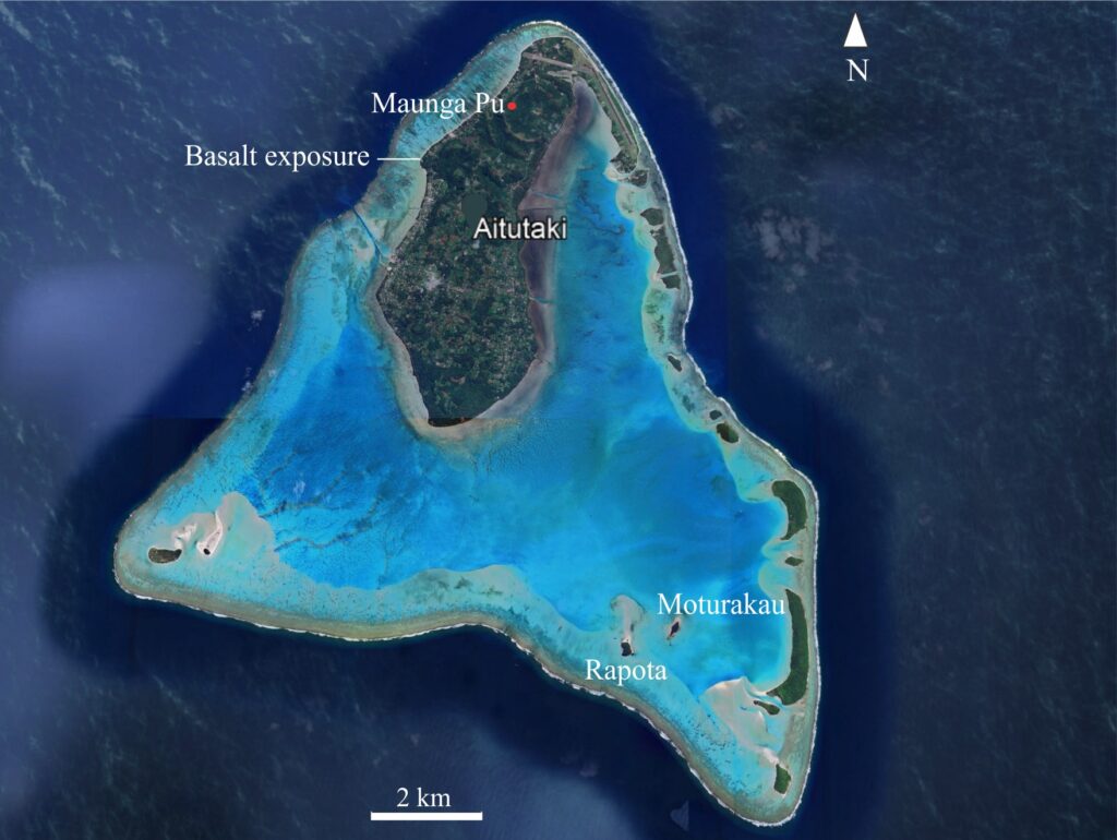
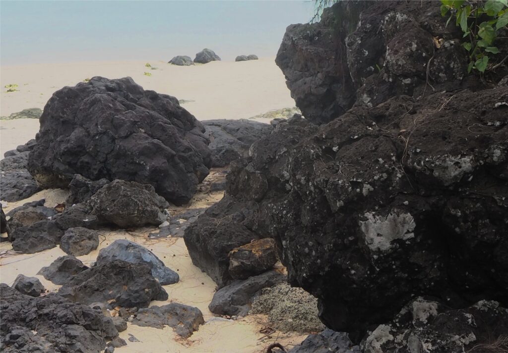
Basalt lavas (locally called black rock) are well exposed along sections of the west coast of the emergent island, and on a couple of small islands in the southeast corner of the main lagoon (Rapota and Moturakau islands). Basalt compositions in the younger volcanic series are typically alkali, including olivine-nepheline basalts and ankaramites (pyroxene is more abundant than olivine). Small peridotite inclusions are common. The one or two clasts assigned to the older volcanic series are also alkali basalts but may include more tholeiitic components.
Aitutaki volcaniclastics
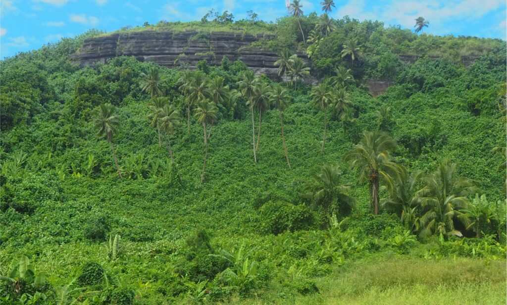
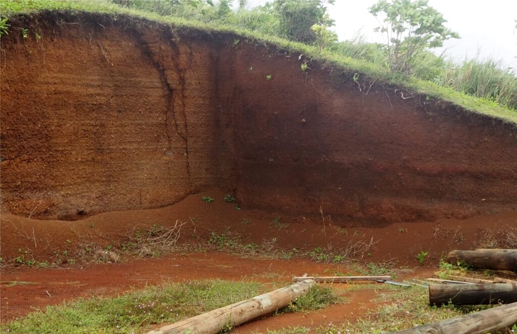
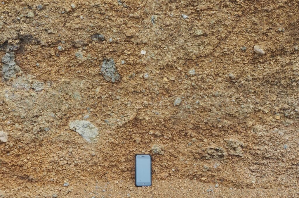
The summit of Mauna Pu at 123 m, the highest elevation on Aitutaki, is underlain by thin (1 to 20 cm), well bedded volcaniclastics. Parallel bedding extends at least 200 m laterally. Beds are also exposed in road cuts near sea level, so the sedimentary carapace could in places be 100 m thick. The deposits are mostly ash and lapilli size with the occasional 20 cm-wide block. Most fragments are angular. Layering is obvious from a distance, but less so at closer observation because clast sorting within each layer is poor. There are no obvious bed forms and no indications of sediment reworking. Clasts are mostly basaltic but definitive identification in hand specimen is thwarted by alteration and the mobilization of Fe(III) – chemical weathering and mineral oxidation extends many metres below the surface.
Bed thickness, geometry, the grain size variations between layers, and their stratigraphic position suggest an airfall origin from multiple eruption pulses, possibly from subaerial Strombolian, Vulcanian, or Surtseyan type eruptions.
Aitutaki geochemical signatures reflect plume rejuvenation
The two volcanic series on Aitutaki are geochemically distinct, particularly in their radiogenic lead – Pb (208/204), Pb (207/204), neodymium – Nd (143/144), and strontium – Sr(87/86) isotope ratios. The younger series (1.382 to 1.941 Ma) is compatible with data from similar aged rocks on Rarotonga. However, the older (9.39 Ma) volcanic series isotopic signatures are like those found on Arago hotspot seamounts (Jackson et al., 2020, op cit.: see their Figure 5). Both Arago and Macdonald hotspot tracks are long-lived (like the Hawaii-Emperor, Louisville, and New England tracks) and each formed over a single mantle-derived plume. The older volcanics on Aitutaki may be part of the Arago trend.
The younger Aitutaki volcanics lack the isotopic signatures usually associated with deep mantle sources – instead they are interpreted by Jackson et al., (op cit.) as volcanic systems that have been rejuvenated from an older hotspot not associated with either the Arago or Macdonald hotspots. If correct, their data supports the contention that seamounts can arise from reactivation or rejuvenation of old plumes within the mantle lithosphere or lower crust, although the mechanism for this process remains unclear. This does not completely invalidate Tuzo Wilson’s (1963) original hypothesis for the origin of seamounts, but it does mean we need to consider additional explanations about their origin.


