We are regular visitors to the beach; walks with the kids-grandkids, the dog, swimming, fishing, or just sitting and cogitating. It’s easy to get lost in the timeless rush of waves, their impatient foam. My mind reels at the thought that the sea has been doing this for more than 4 billion years. It’s a bit like getting lost in the night sky. There’s so much to discover.
Beaches are geological domains – part of a continuum that extends to the deep ocean, but a part that is easily accessed. Geological stuff happens there. My attention is always grabbed by the small streams that drain across beaches at low tide. Whenever we came across one of these my kids would scatter, lest they be regaled yet again about the fascination of miniature worlds. I admit it was a bit over the top, so it goes…
Some beach outflows come and go with the tides, others are more permanent leakage from inland drainage. Some trickle, others rush. They are all fascinating, as microcosms of grander floodplain or massive deltas. Project this microcosm to the real world of geological process, of cause and effect. In doing this, you are engaging in the scientific process of creating your own analogy, an insight into a larger universe.
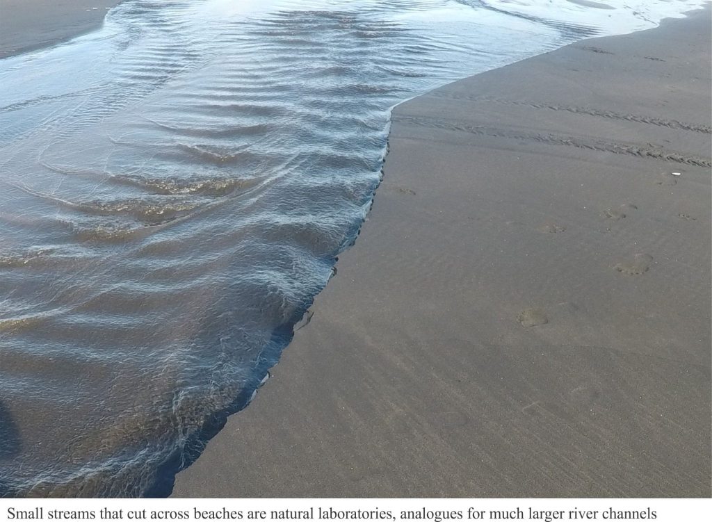
The streams usually start afresh with each tidal cycle. As tides recede, stream flow begins to erode its channel, deepest at the top of the beach. The channels may be straight and narrow, or broad networks of braided sand.
Look at the three videos below. Each small channel has cut (incised) into beach sand as the tide recedes and base-level falls (the level at which river and sea meet). The example from Waihi Beach shows linear notches cut into the sand above the active channel; these indicate successively lower levels of channel erosion, or incision. In this case the lower limit for base level is low tide. The channels cannot excavate deeper than base-level; we know this to be true for much larger rivers.
The channel floors tend to be asymmetric – deeper on one side, shallower on the other. The deeper part of each channel tends to flow faster, carrying more sediment (sand), and eroding the adjacent bank. You can see this when chunks of sand along the bank collapse into the channel. In eroding its bank, the channel also moves sideways (along the beach), a process that is common in large rivers, particularly those that meander across broad floodplains.
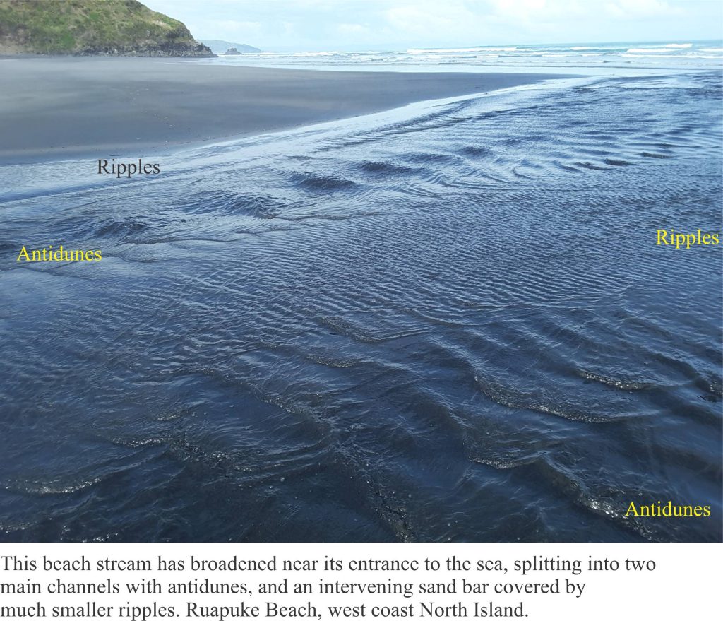
Stream flow is sufficient to move sand along the channel bed. The movement of sand grains produces ripples along the channel margins and in areas of more expansive stream flow. If you watch these structures carefully, you will see them migrate in the direction of stream flow. (Many of these ripples are exposed when water levels fall during outgoing tides. Structures like these are common in larger river channels, and tidal channels in lagoons and estuaries. Ripples are also common in ancient river deposits.
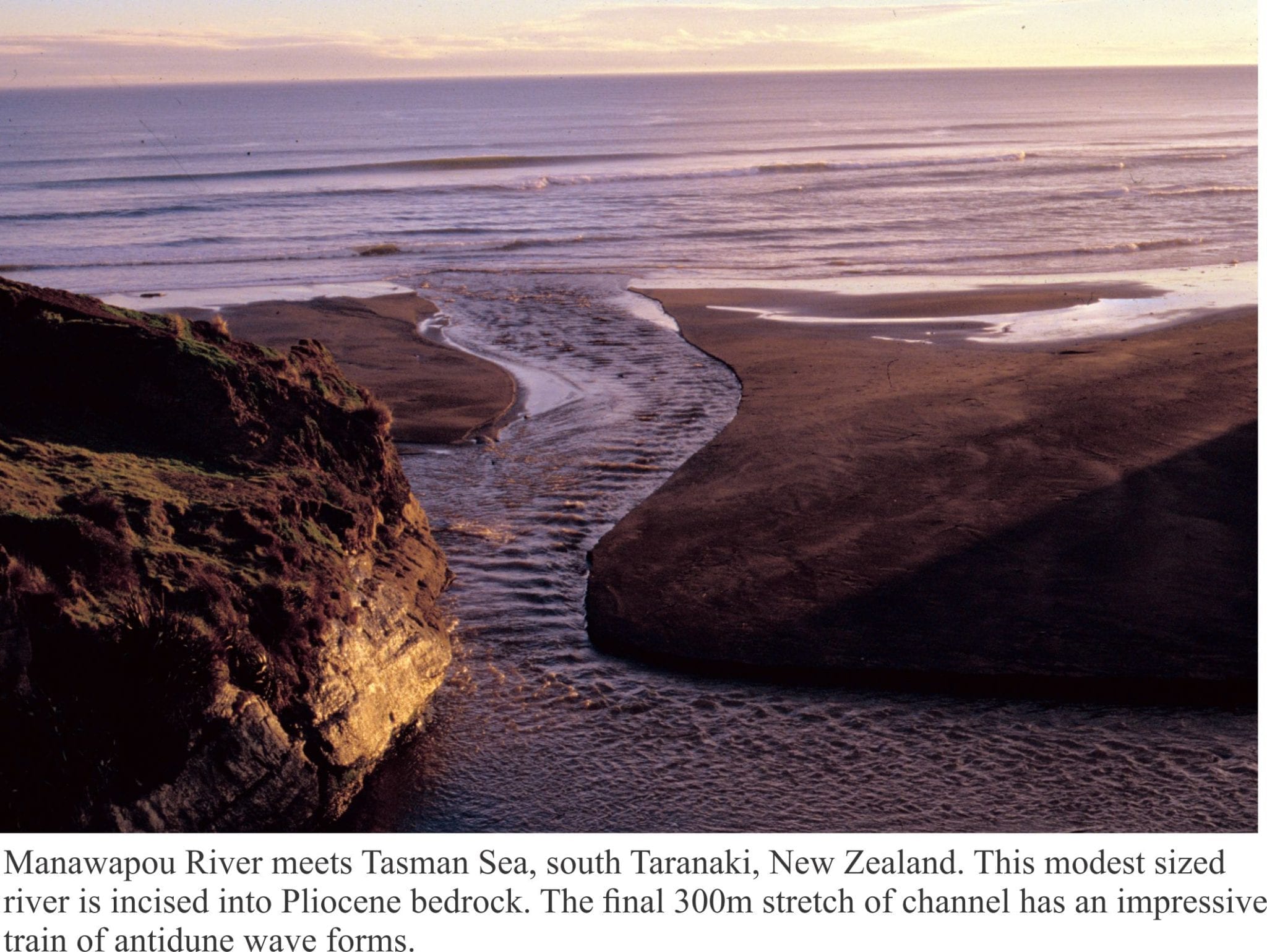
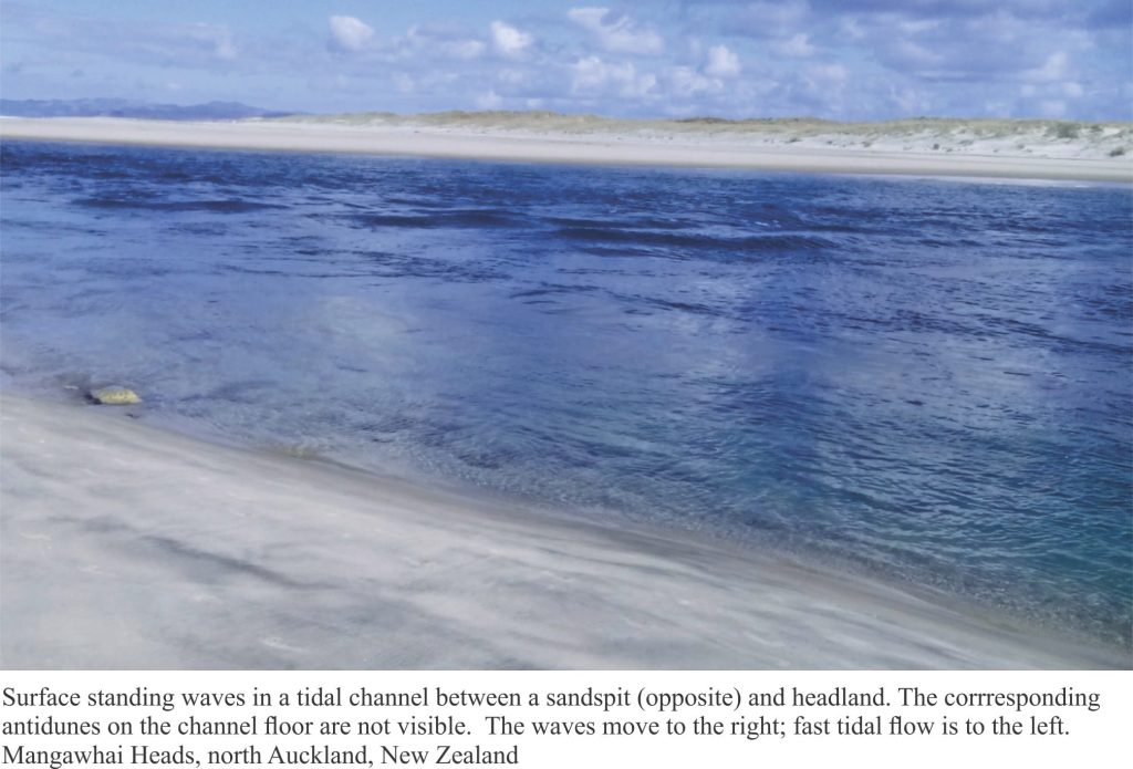
Flow in the deeper parts of channels is more rapid, capable of carrying sand in suspension as well as along the channel floor. One of the more fascinating developments here are surface waves that appear to stand still, even migrate upstream (against the flow); these are called standing waves. Ripple-like structures also form on the channel bed beneath the surface waves, but unlike the more common ripples one sees in shallow, slow moving water, these structures grow in the upstream direction. These are antidunes. They form in the fast-flowing reaches of large rivers and tidal channels, but the best, and safest places to observe them are the small streams that cross beaches. They also form in (volcanic) rapid-moving pyroclastic flows.
Real world channels:
Ephemeral streams like these provide simple, qualitative analogies with some of the processes that define large river channels: incision in response to base-level fall, bank failure and lateral migration of channels across a valley floor, and structures that form in river sediment. Beach streams are far from being exact replicas of large rivers, but they are easy to observe – one can wade across them and walk their banks without compromising their safety and get close to antidunes without fear of drowning.
The limitations of using beach streams as analogues for large river systems are mostly related to scale. For example, significant base-level rises and falls in large drainage systems generally take 1000s to 10,000s of years; that of our beach microcosm is 6 hours, after which the tide turns and erases our laboratory. Physical dimensions such as channel width, depth, and length may be several orders of magnitude greater in real rivers. Even the kind of sediment can vary significantly along the length of a river (sand, mud, boulders), whereas it changes little across the beach. In real rivers, this will have a major impact on the style of sedimentary layering and structures produced by channels.
Some of the processes that shape the streams do have direct application to much larger systems, for both modern and ancient rivers. It is important to identify the limitations of analogues like these. But limitations aside, the streams are a natural laboratory. They are fun to observe; they provide a worthwhile excursion for one’s imagination and thought experiments.
For a technical exposé of channels and the dynamics of flow, you can’t go wrong with John R.L. Allen’s Principles of Physical Sedimentology (Chapman Hall publishers)
