Geological-logo
Geological-logo

Atlas of the Burrens, County Clare

The Burrens – a limestone karst landscape

Here’s a selection of photos from the Burrens of County Clare, Ireland. Carboniferous limestones, in a glacio-karst landscape: karst structures, landscapes, vegetation, and fossils, from inland and shoreline exposures.

There is an article on the Burrens here.

The Atlas, as are all blogs, is a publication. If you use the images, please acknowledge their source (it is the polite, and professional thing to do). 

This link will take you to an explanation of the Atlas series, the ownership, use and acknowledgment of images.  There, you will also find links to the other Atlas categories.

Click on the image for an expanded view, then ‘back page’ arrow to return to the Atlas.

New Quay and Abott Hill:

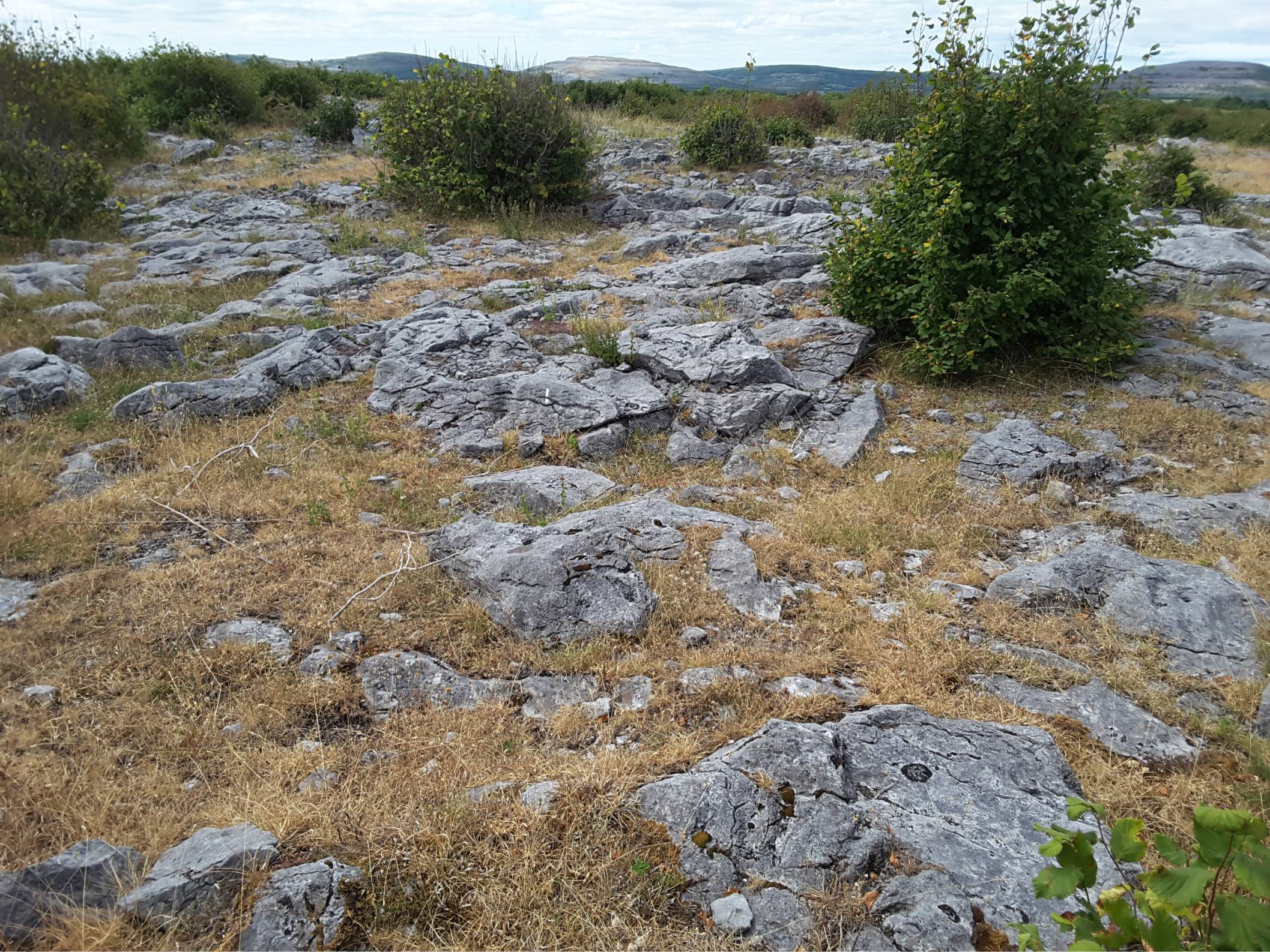
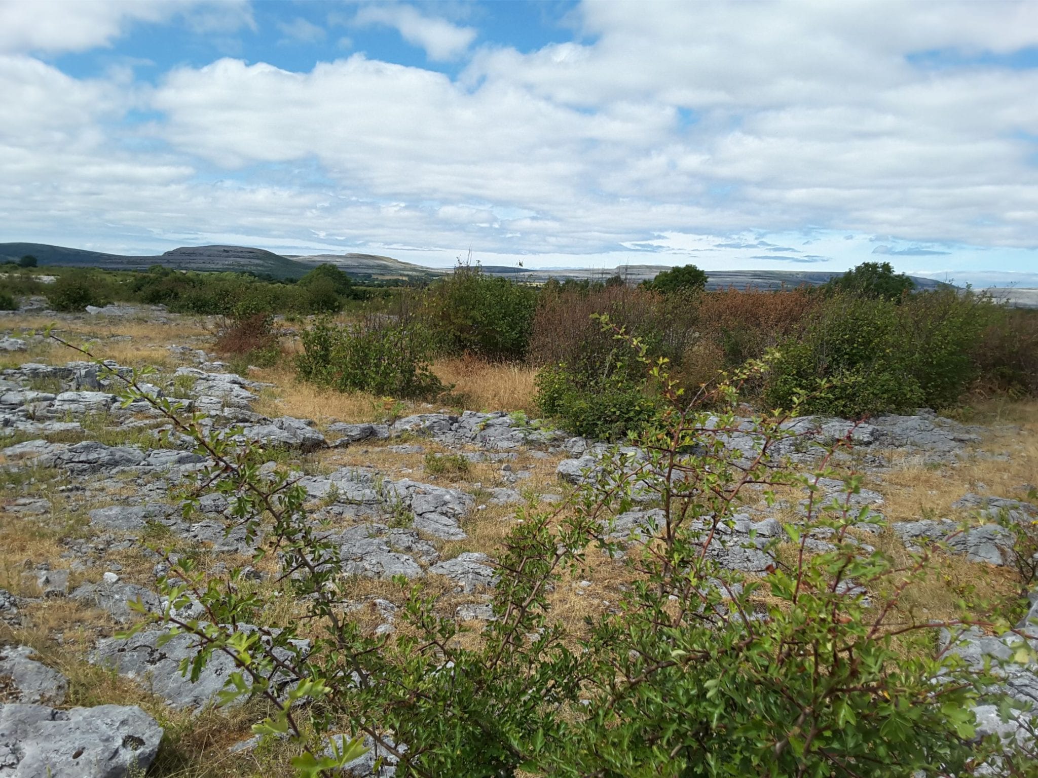
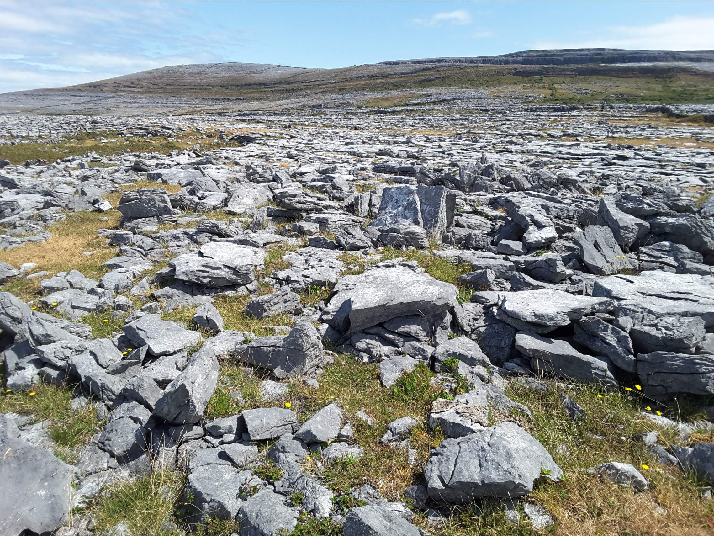
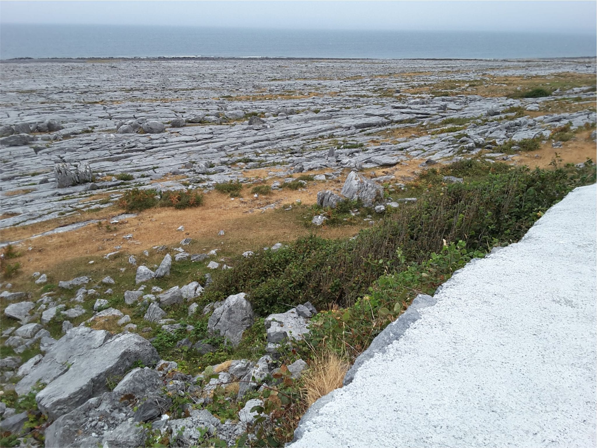
Burrens landscape north of Boston (a few km south of New Quay. Limited soil cover on the limestone bedrock, and scrubby vegetation. Typical rounded hills of limestone in the background.


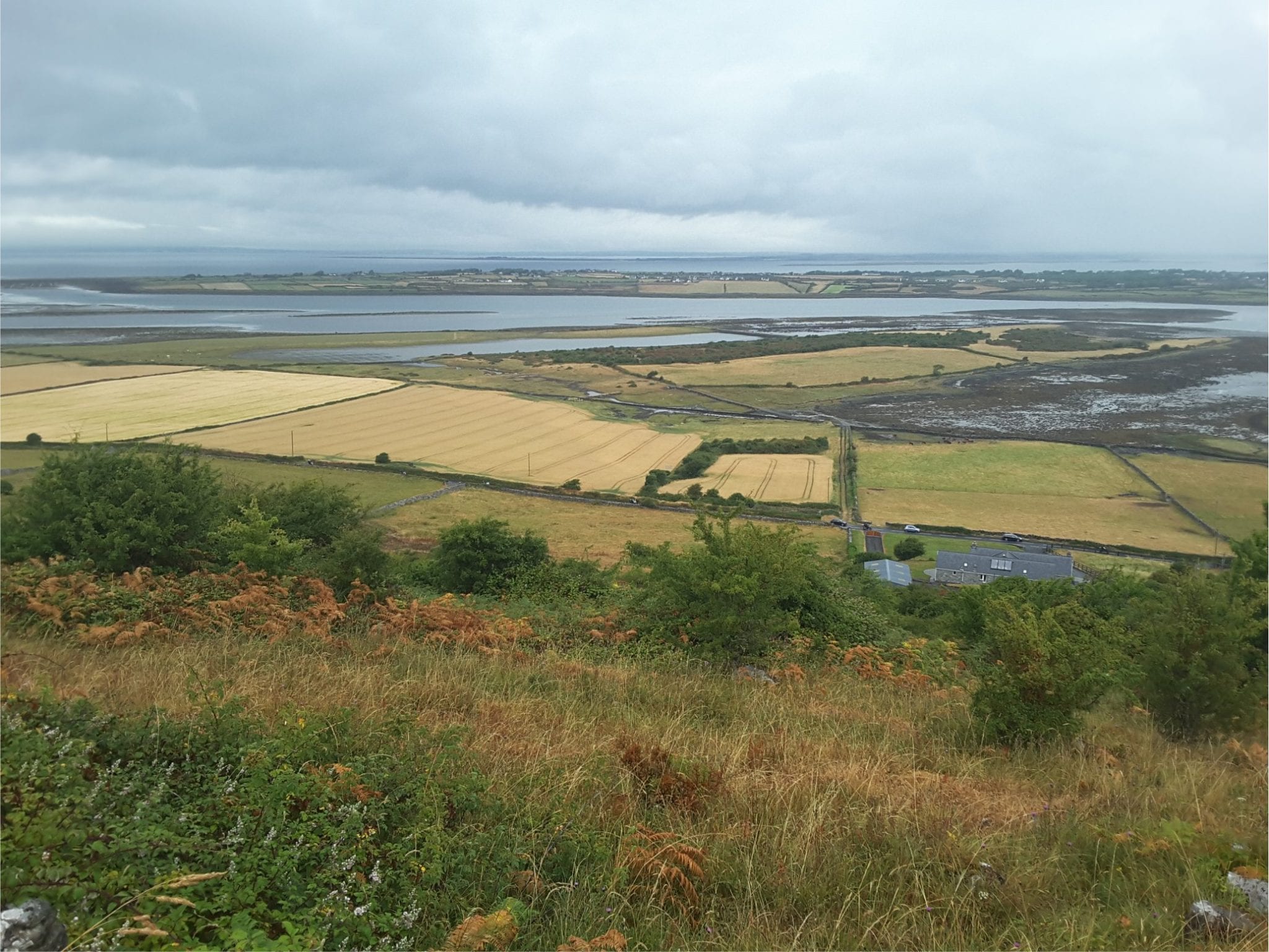
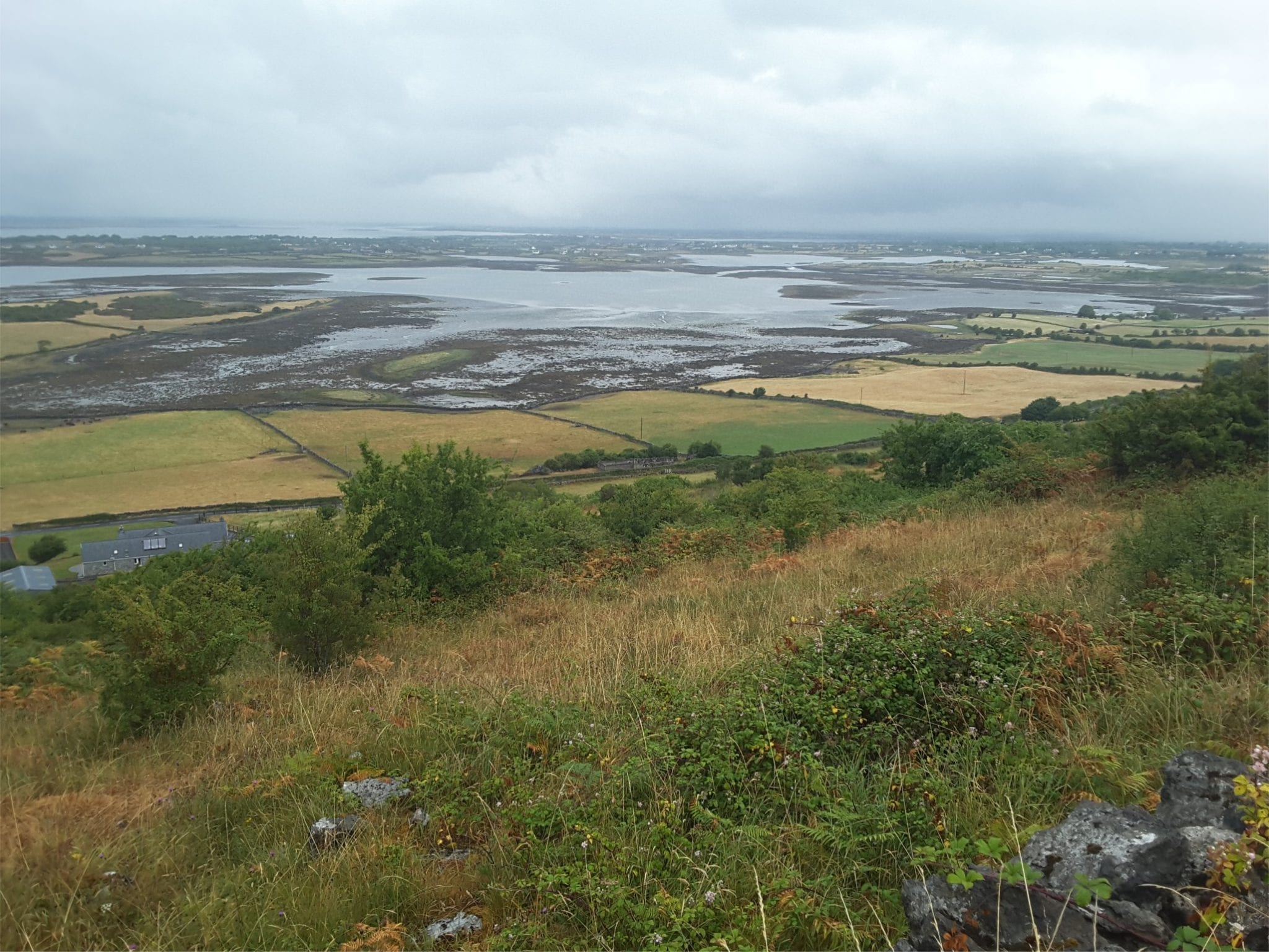
Views north of the estuary and Galway Bay from Abott Hill (between New Quay and Kinvara)


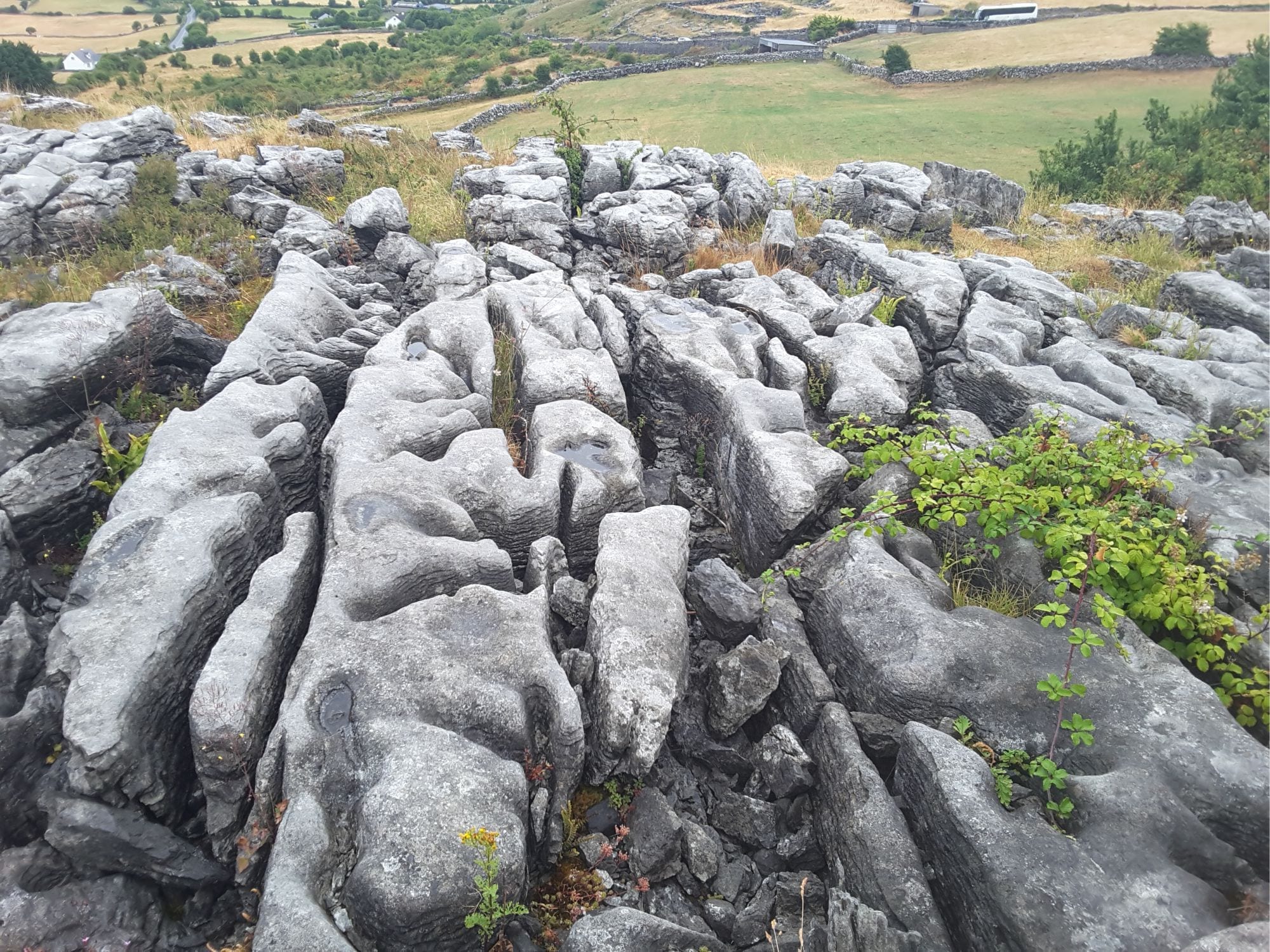
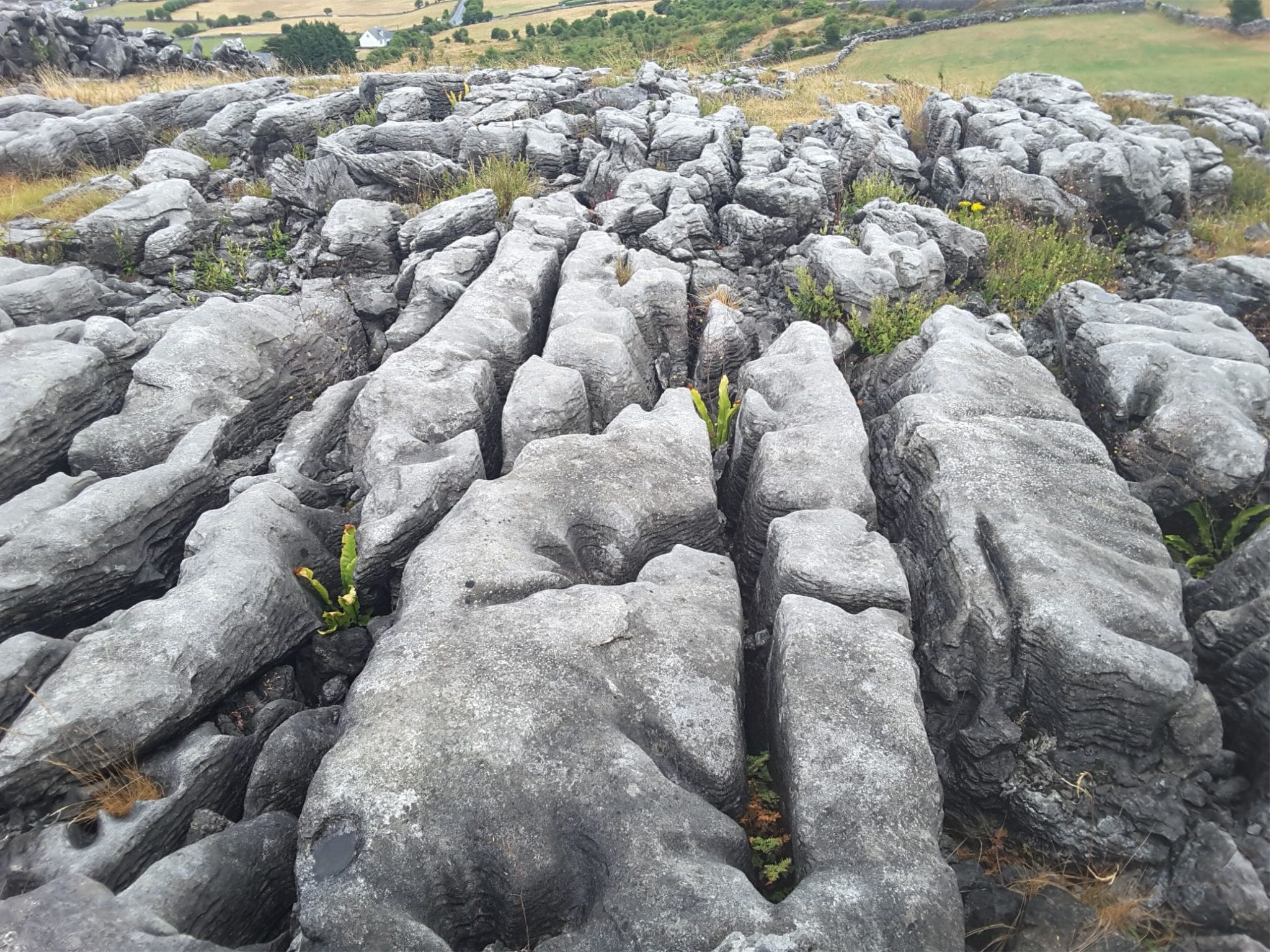
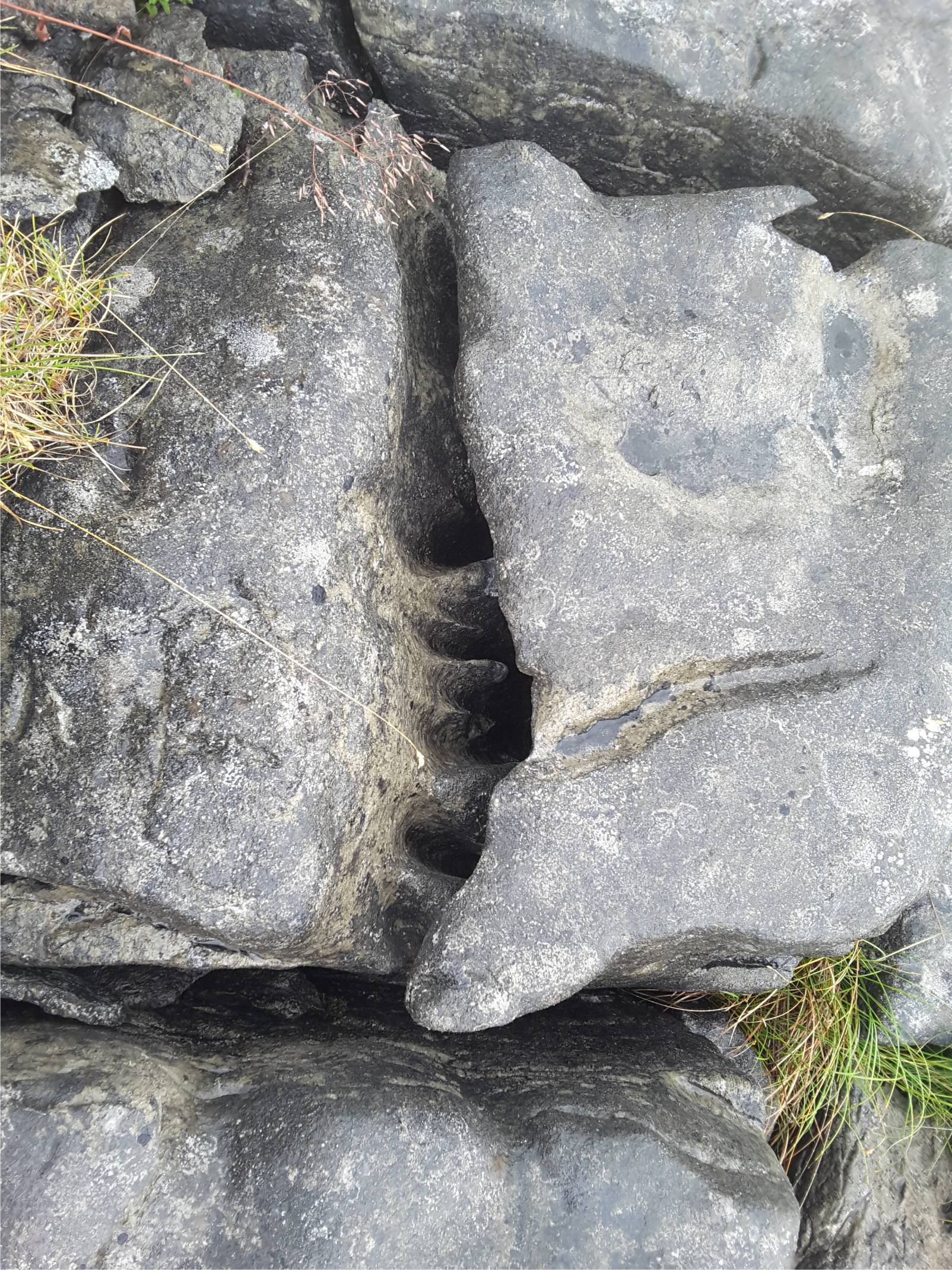
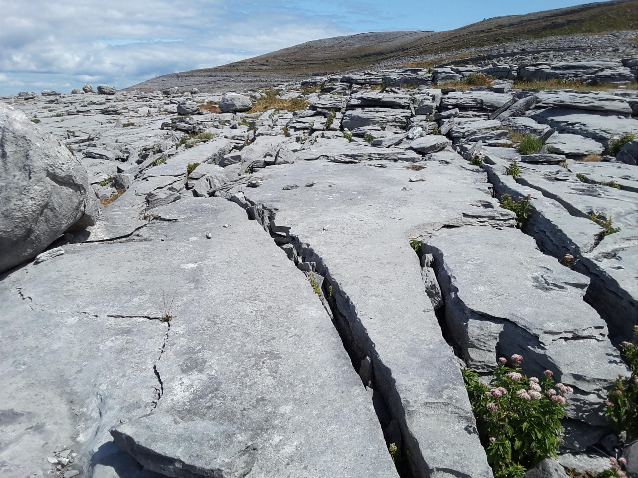
Clints and grykes, Abott Hill, typical Burren karst structures.  Right image: smaller scale dissolution rills.

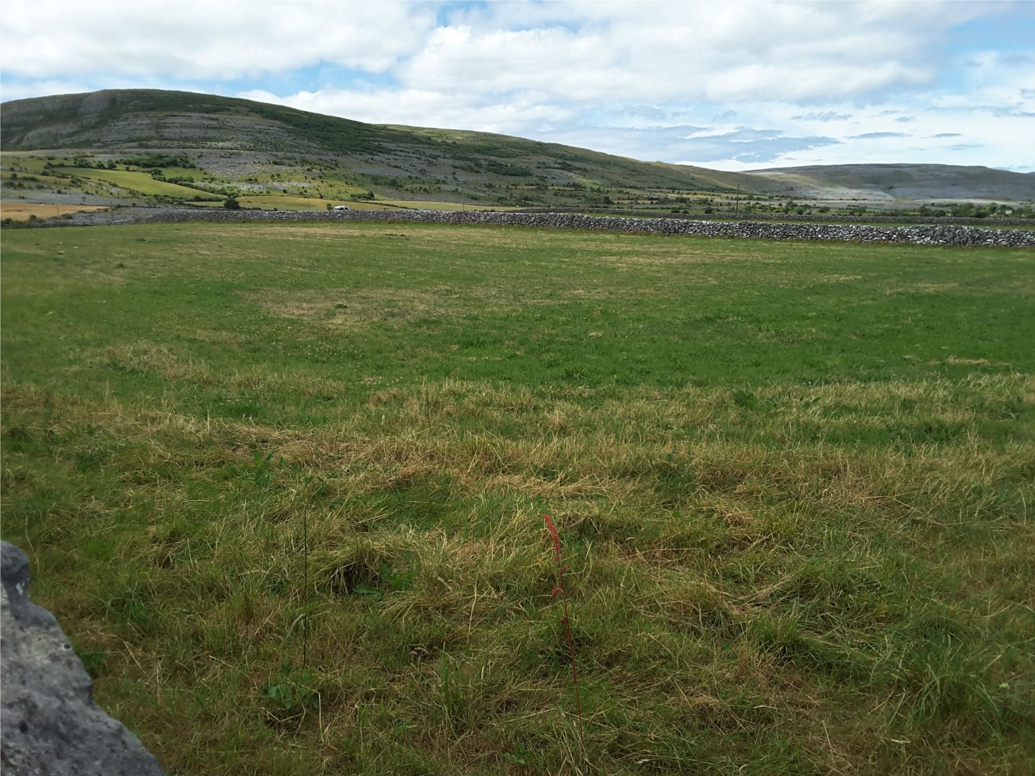
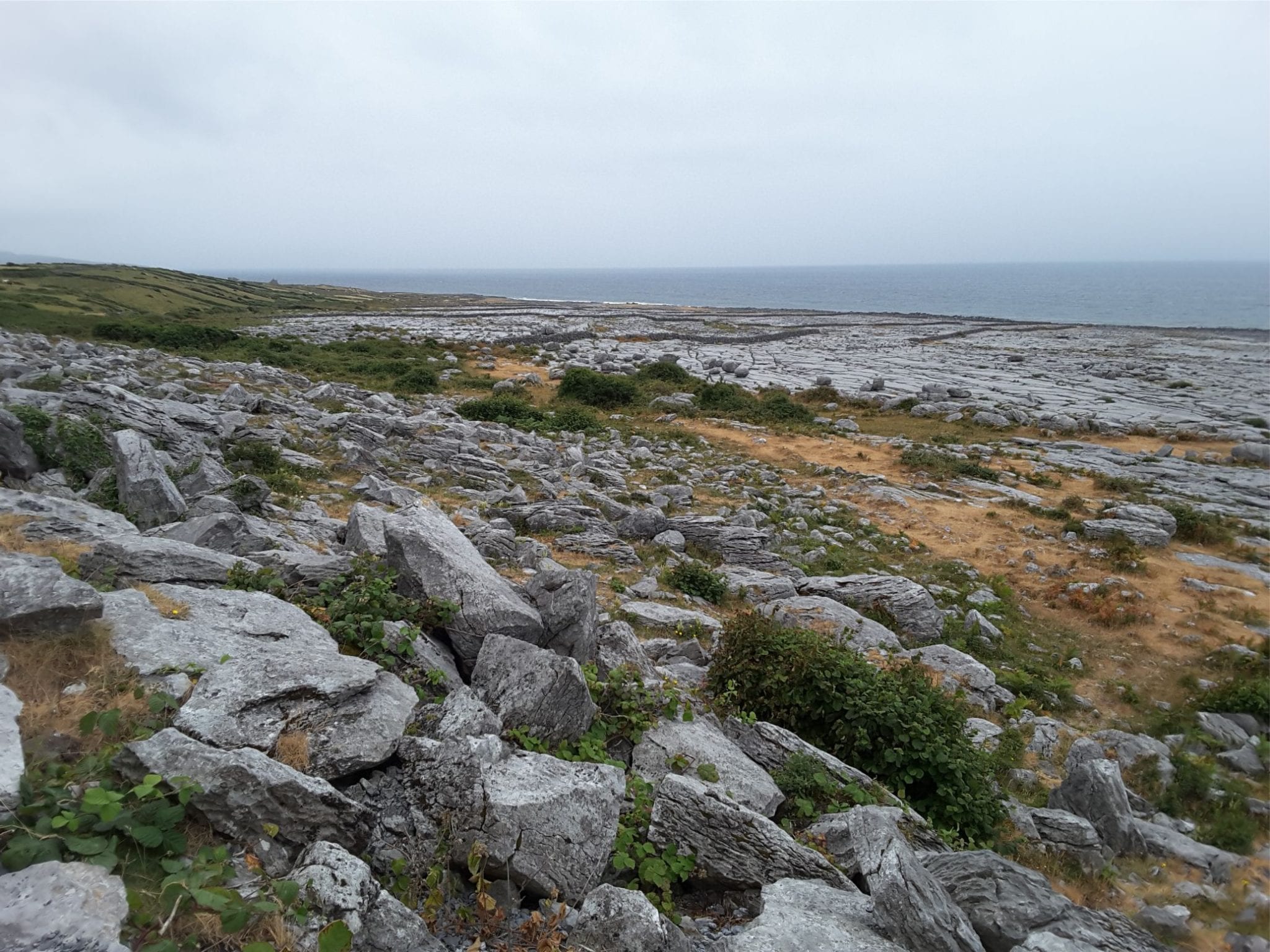
Typical Burren hill and more fertile lowland valley near New Quay

Flaggy Shore (near New Quay):


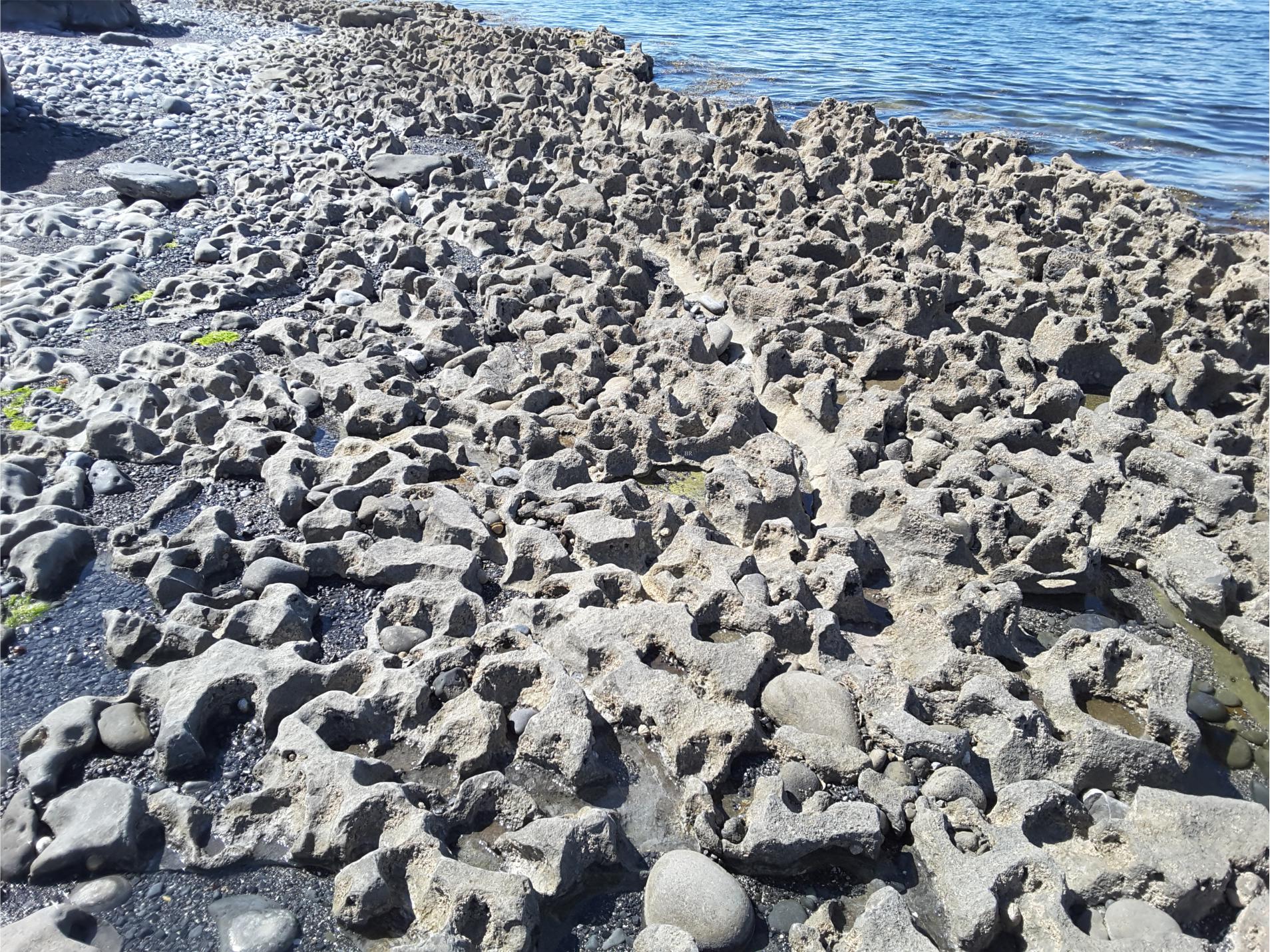
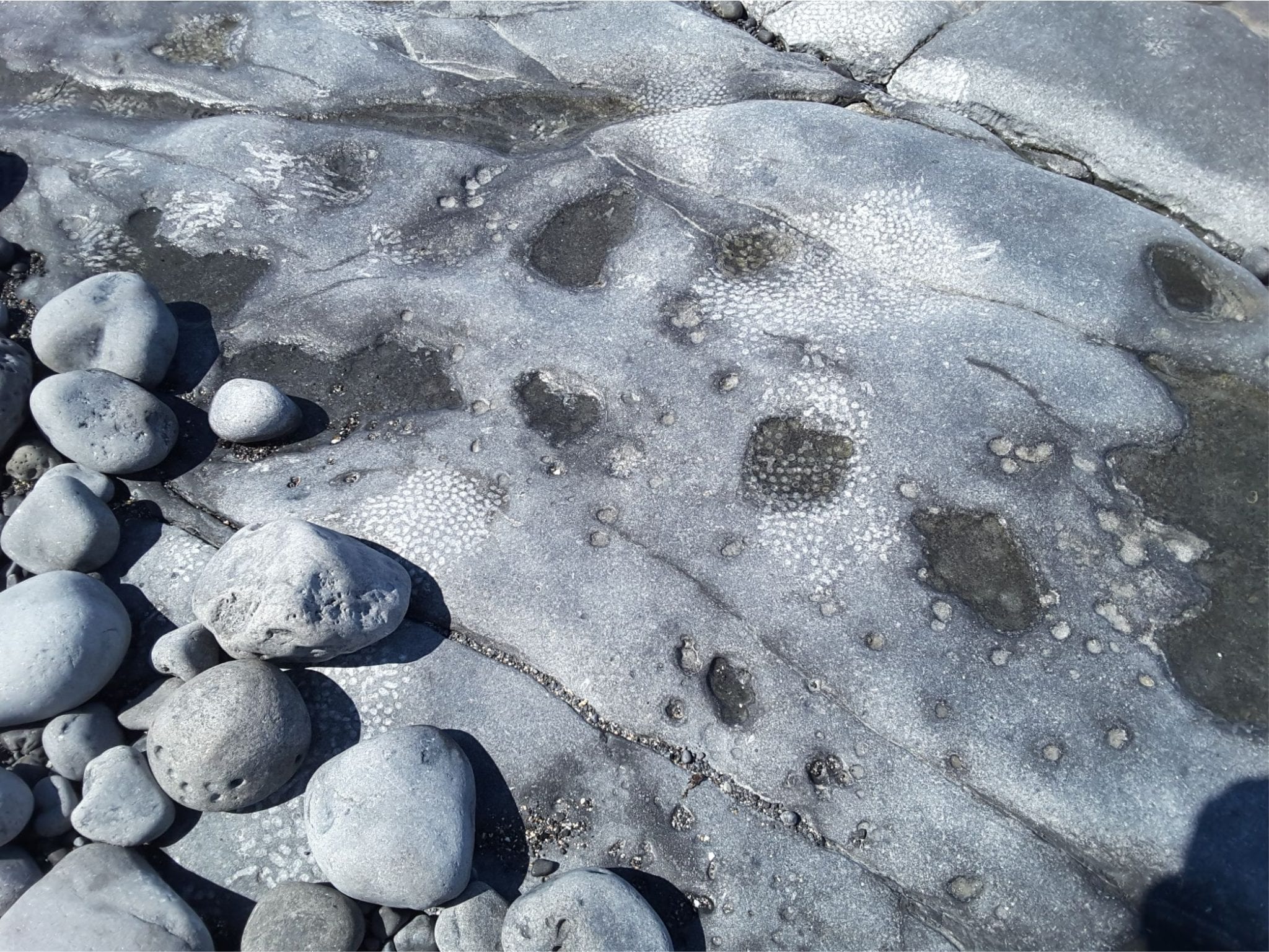
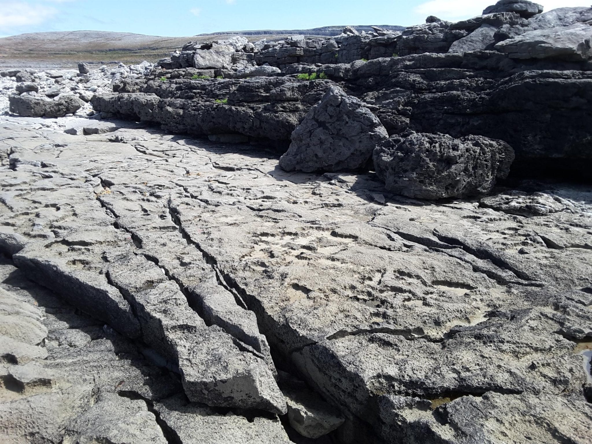
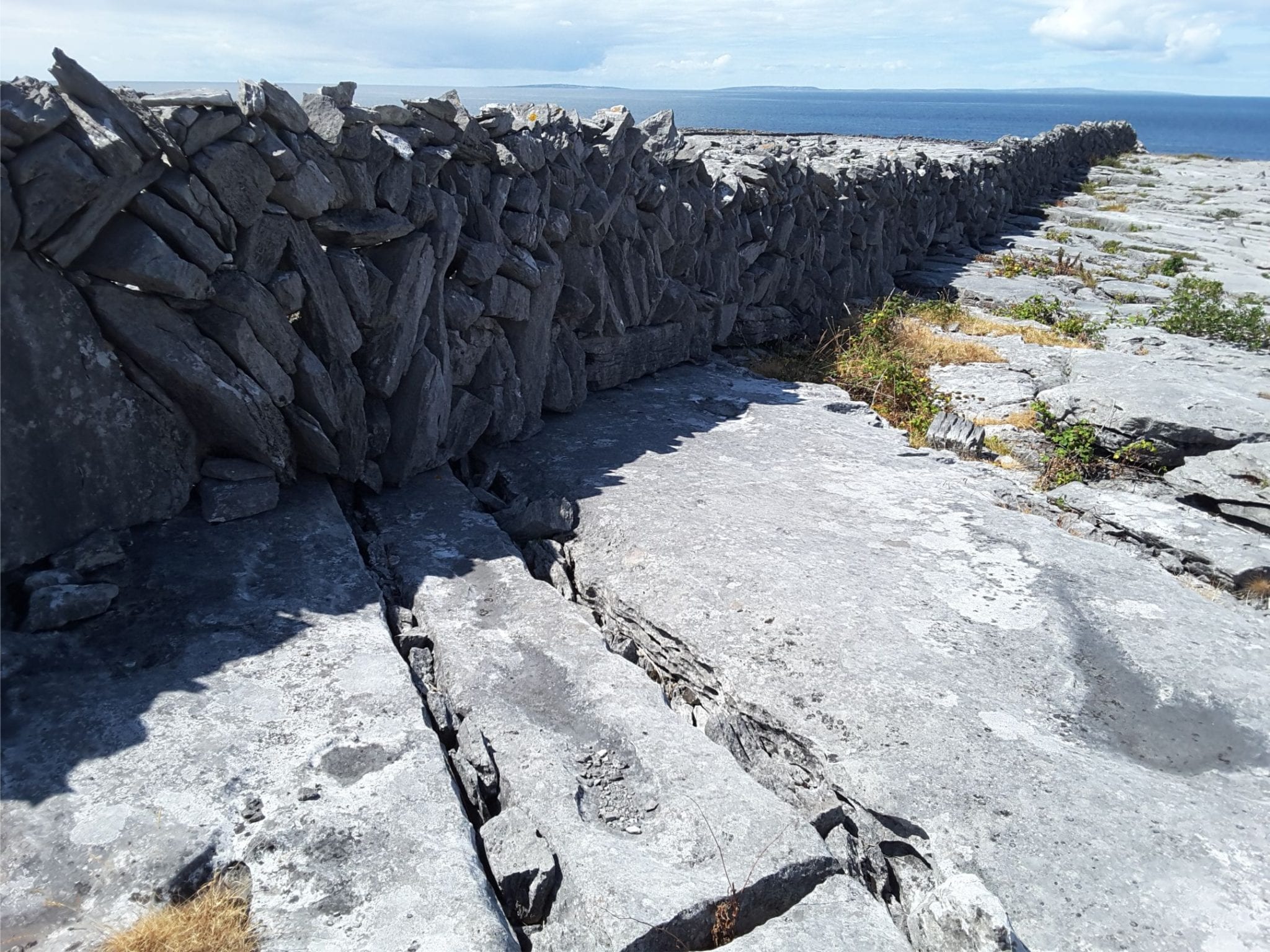
Salt corrosion and erosion of limestone along Flaggy Shore, has modified the clints and grykes. Some erosion is caused by potholed cobbles.


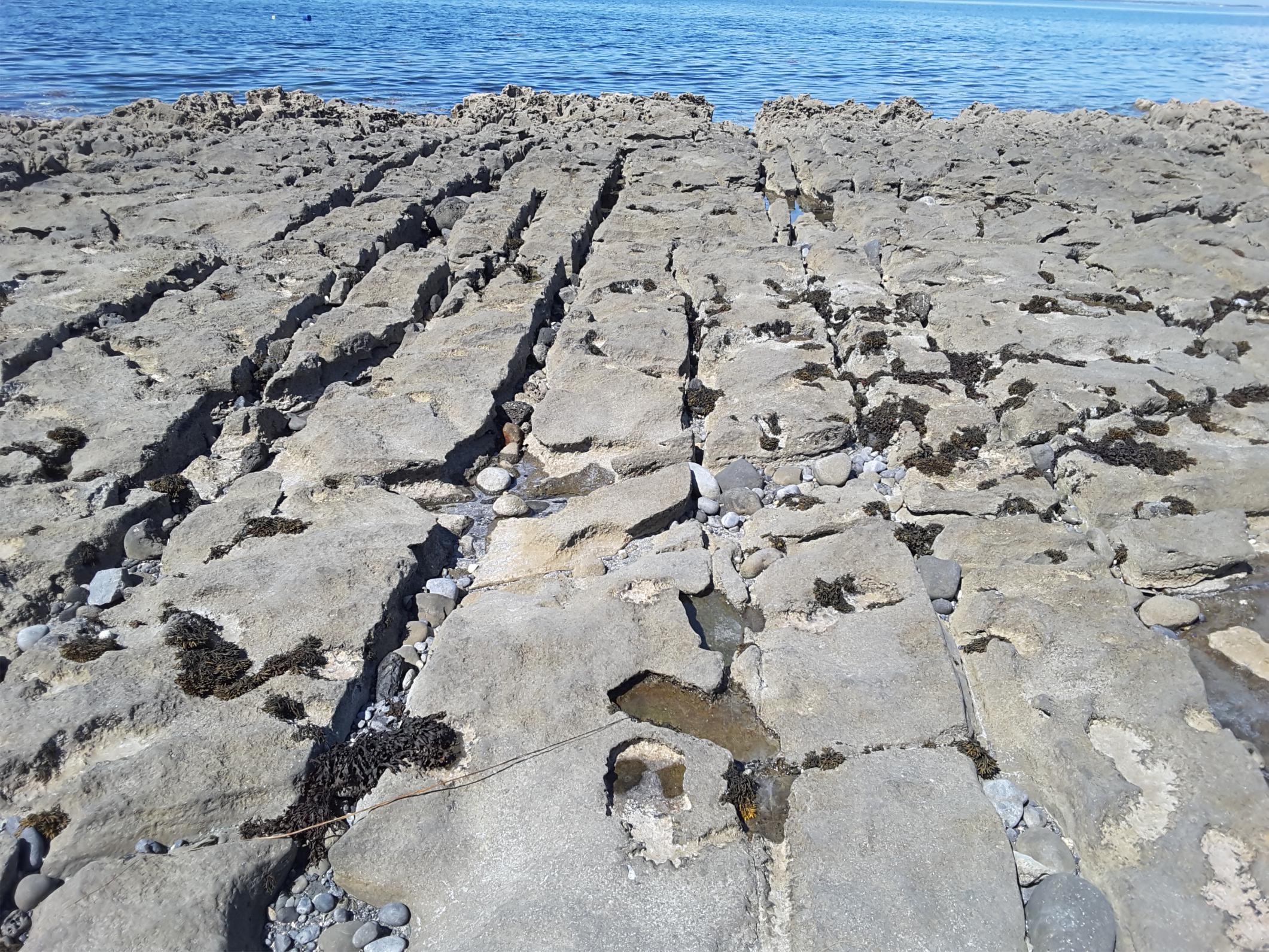
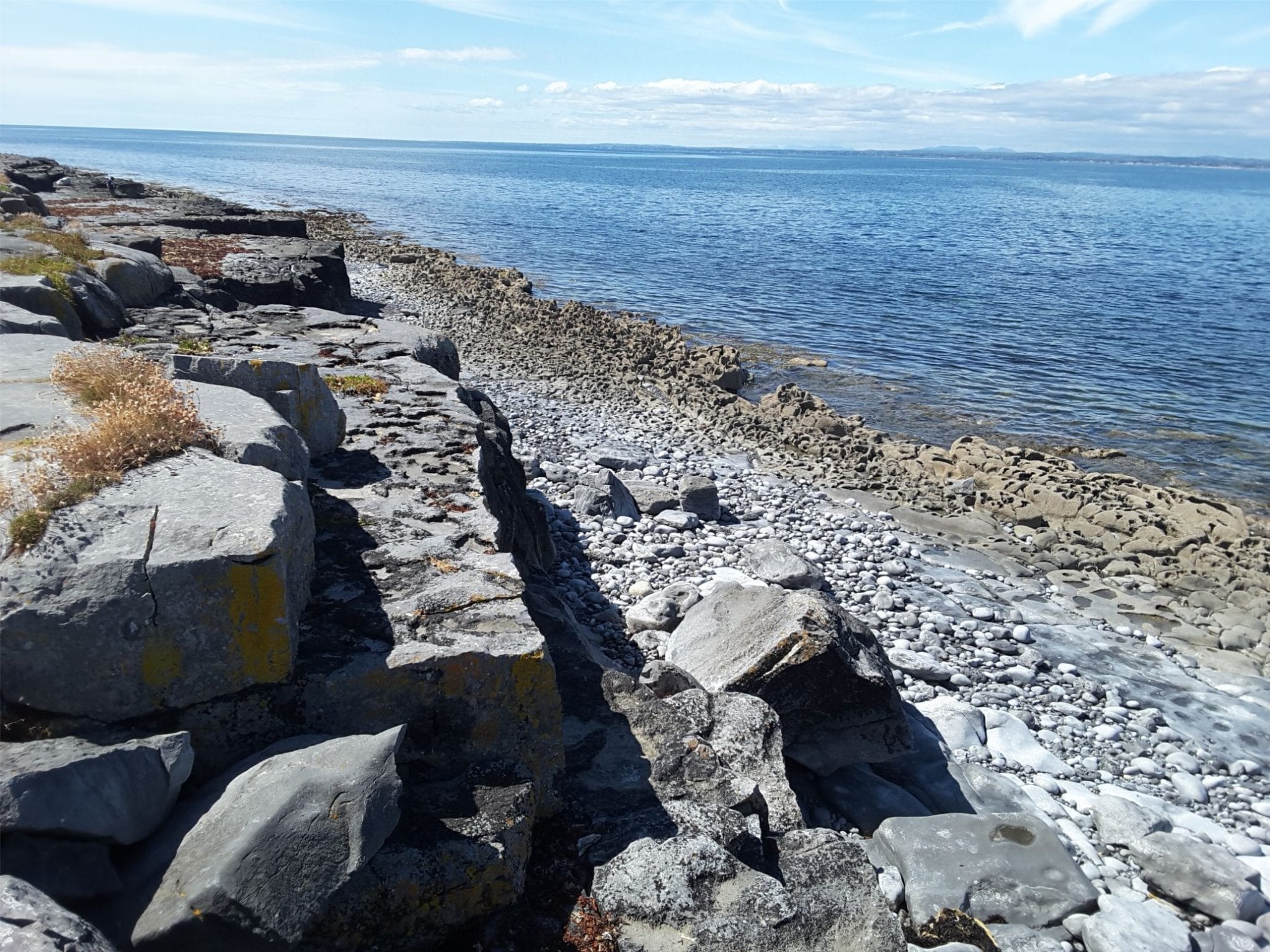
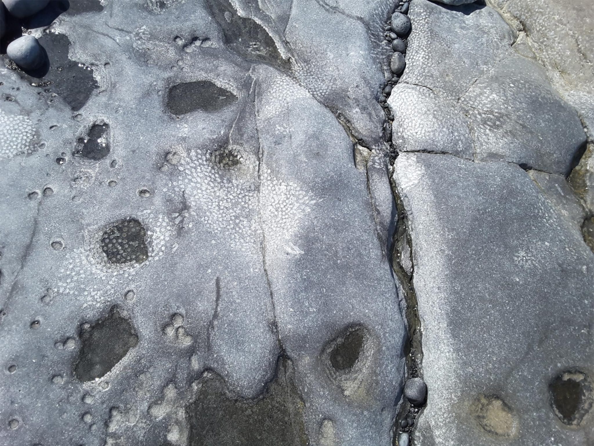
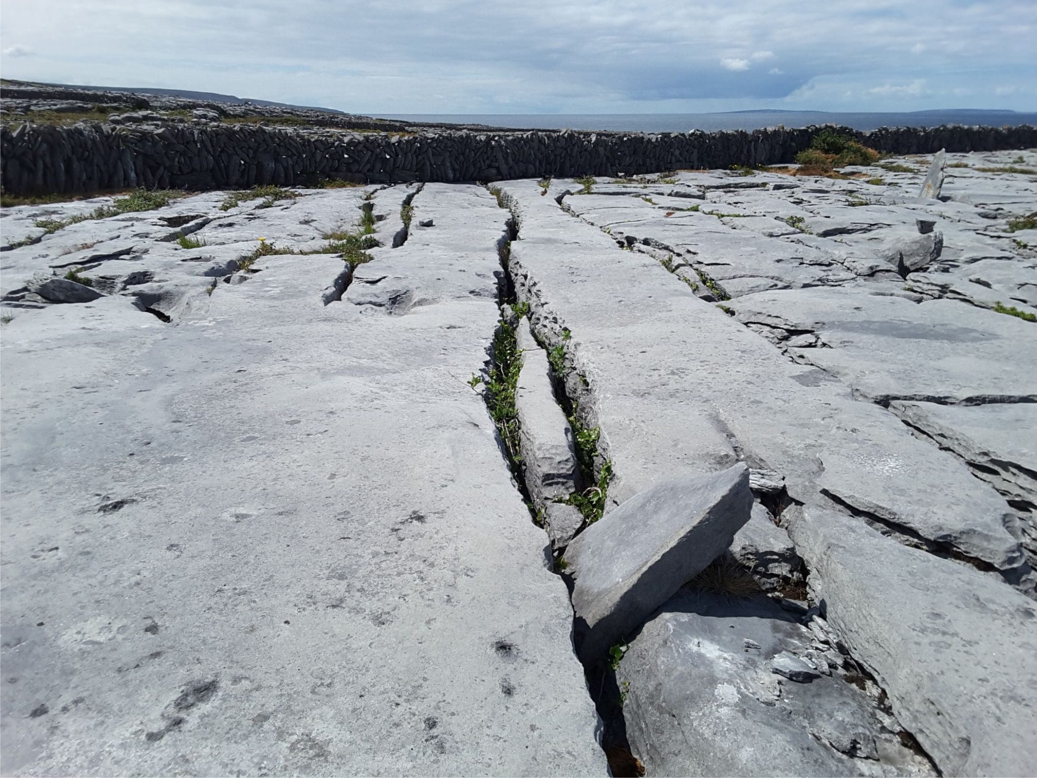
Clints and grykes on the raised shore platform along Flaggy Shore


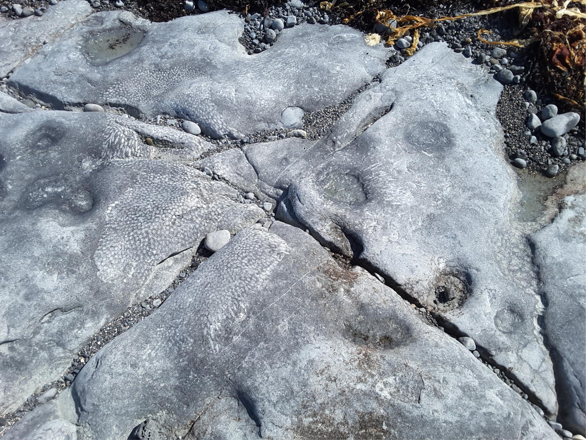
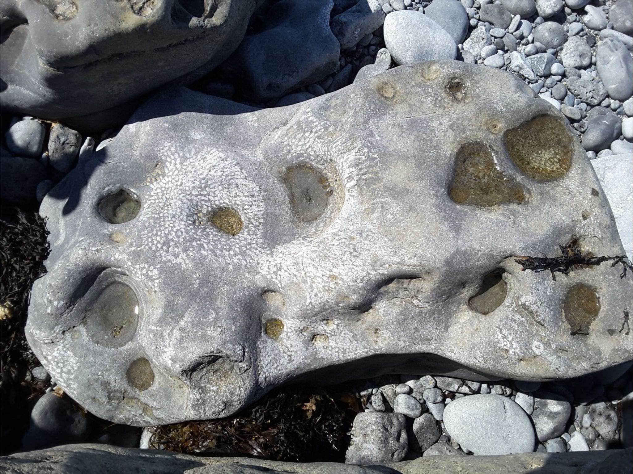
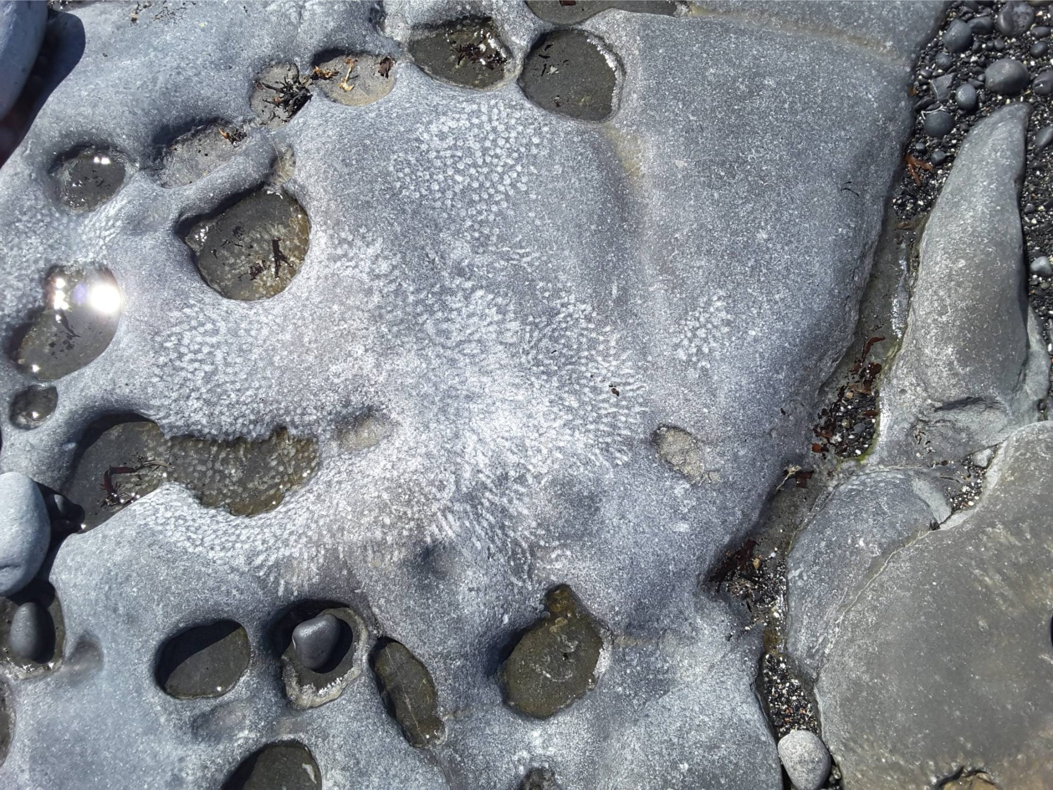
Abundant colonial Visean corals, best seen on semi-polished surfaces along the Shore. These views are oblique and cross-sections of coral columns.
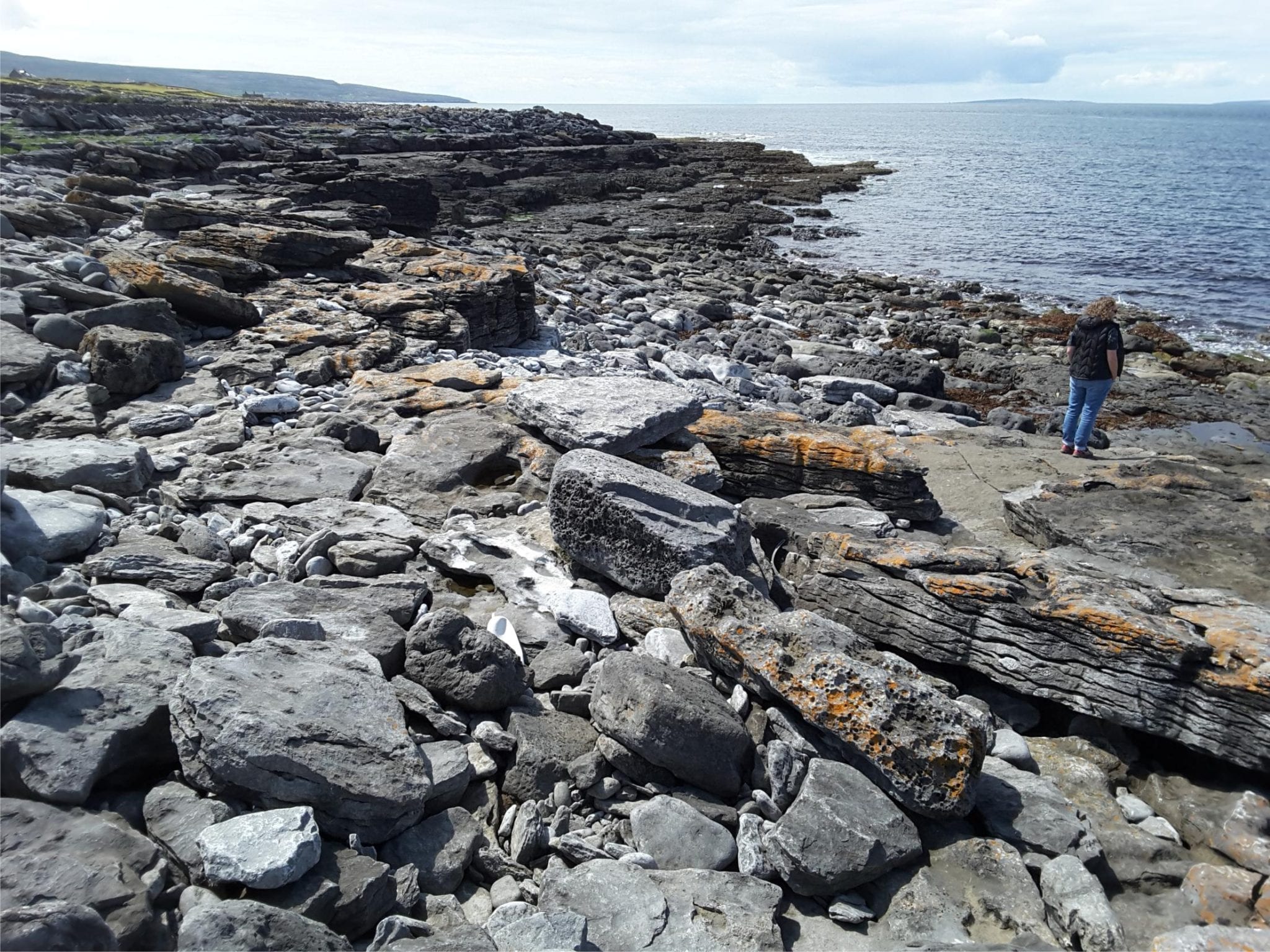
Black Head:


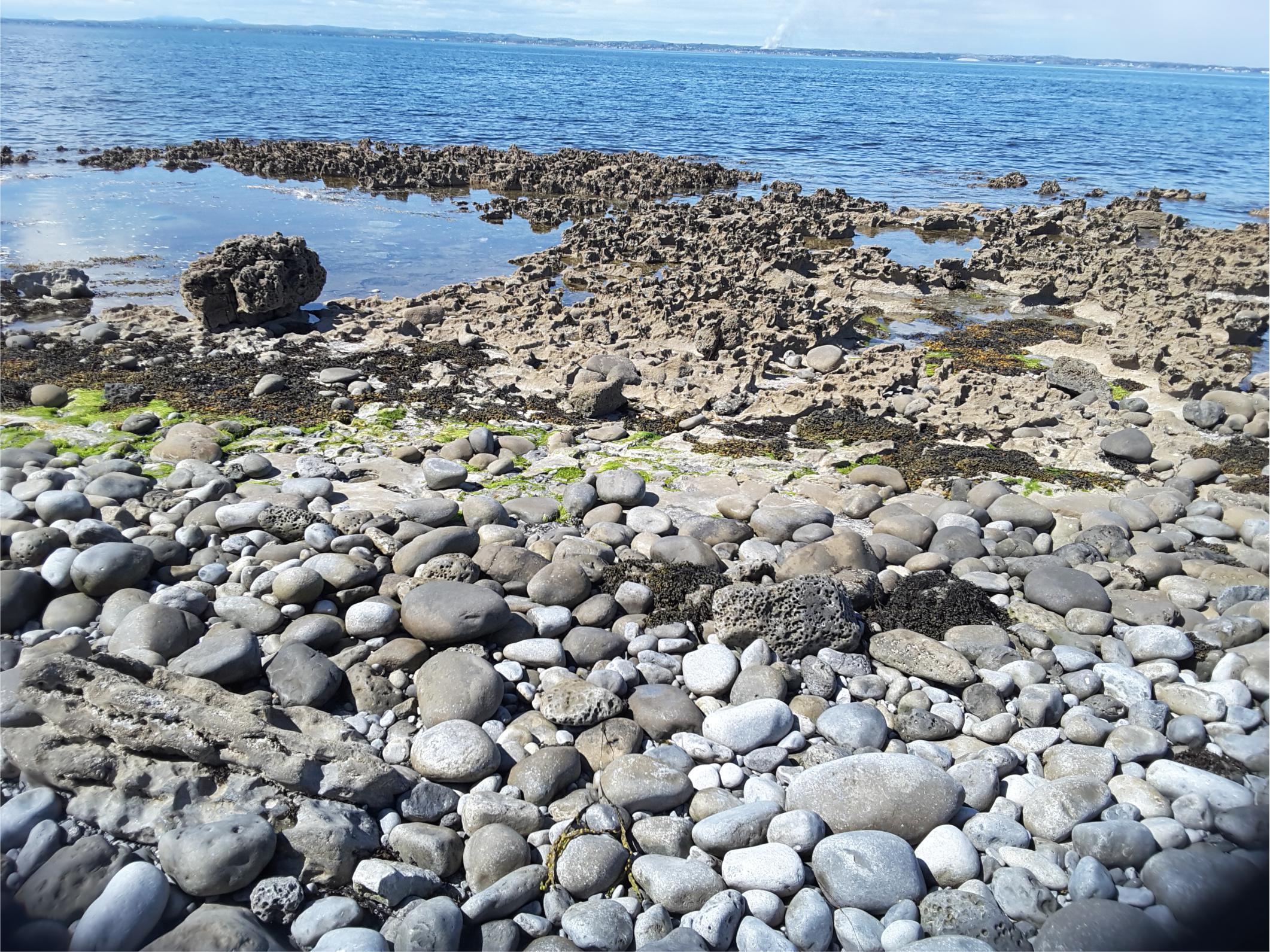
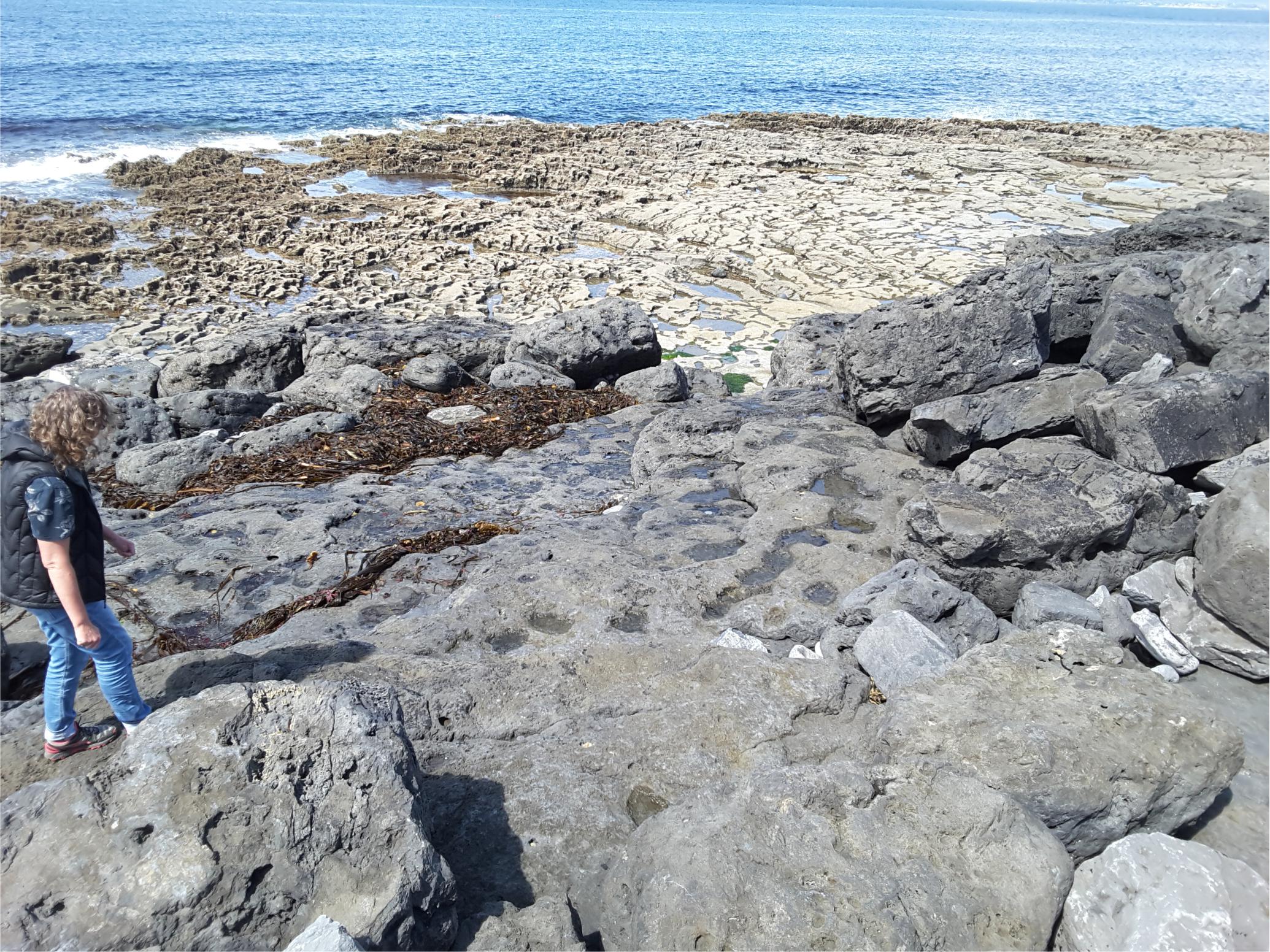
The raised shore platform at Black Head (below the road) consists of several benches elevated during post-glacial rebound.


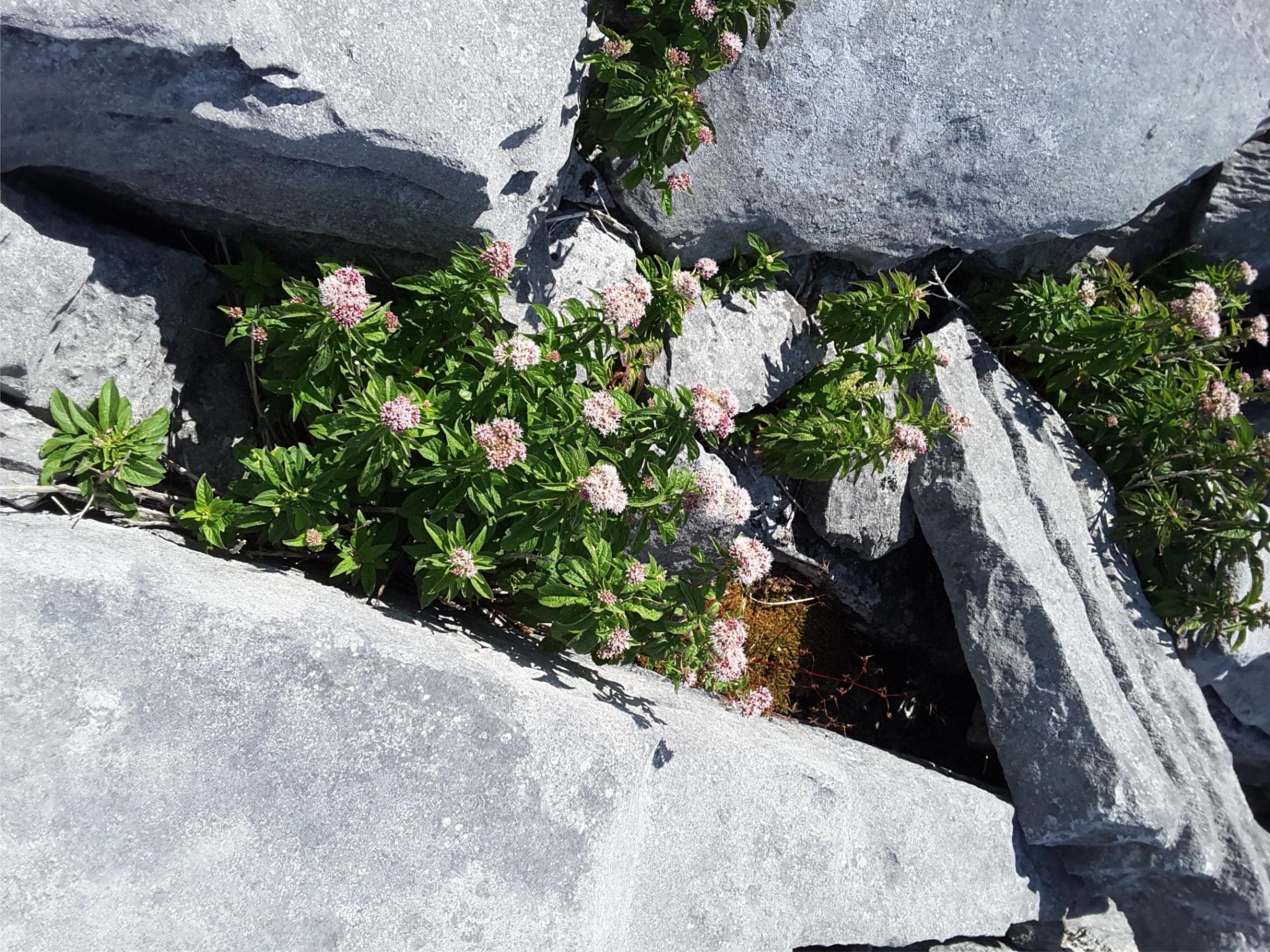
Clints and grykes, typical karst structures, are well developed all over the Black Head platform, controlled by dominant fracture trends. They provide succor and shelter to a variety of small shrubs and wild flowers.

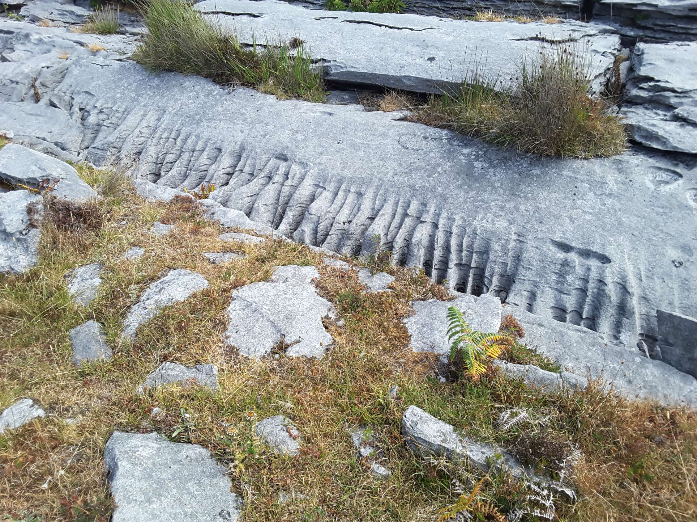
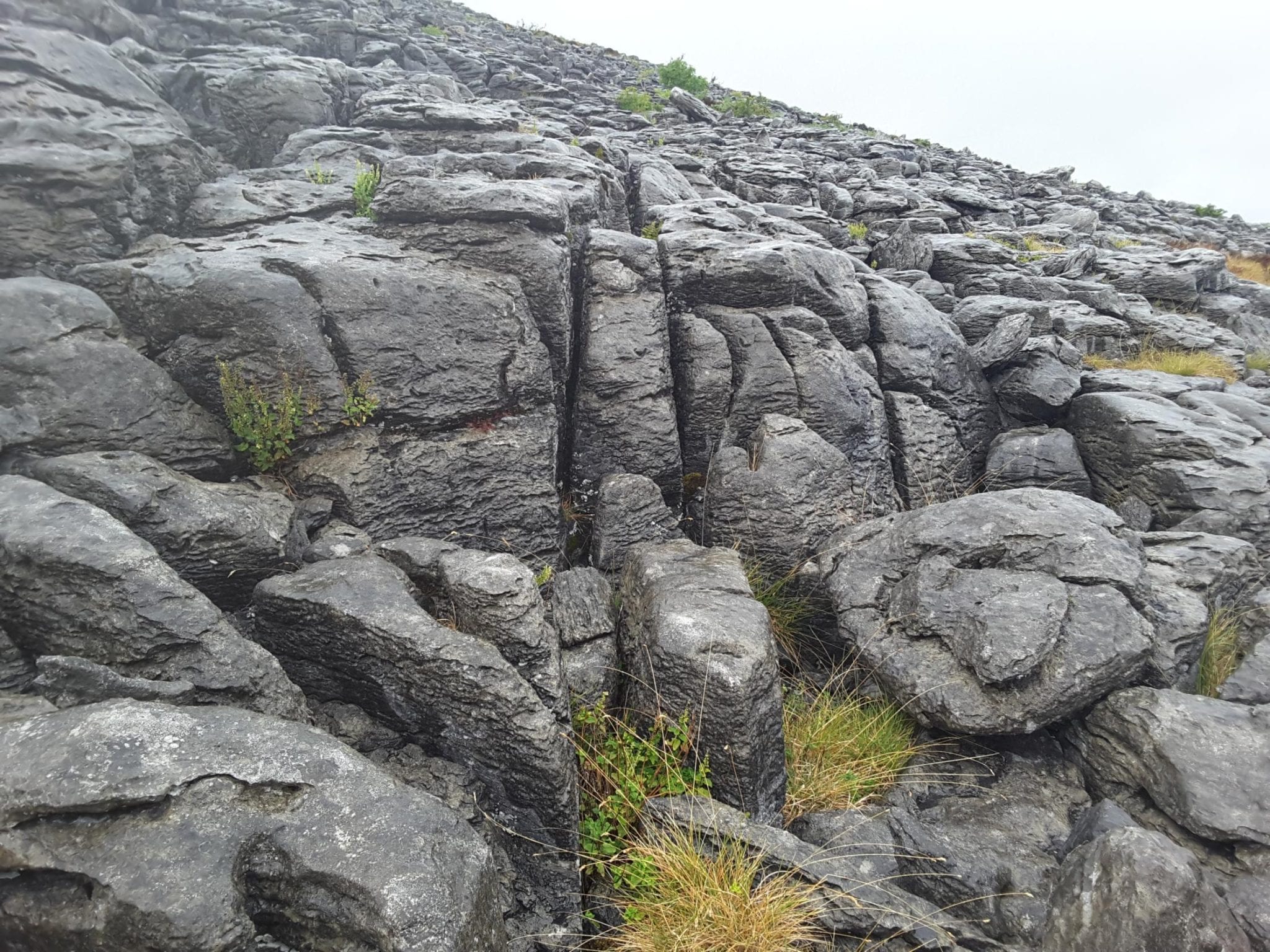
Smaller scale dissolution limestone rills are common along exposed gryke walls


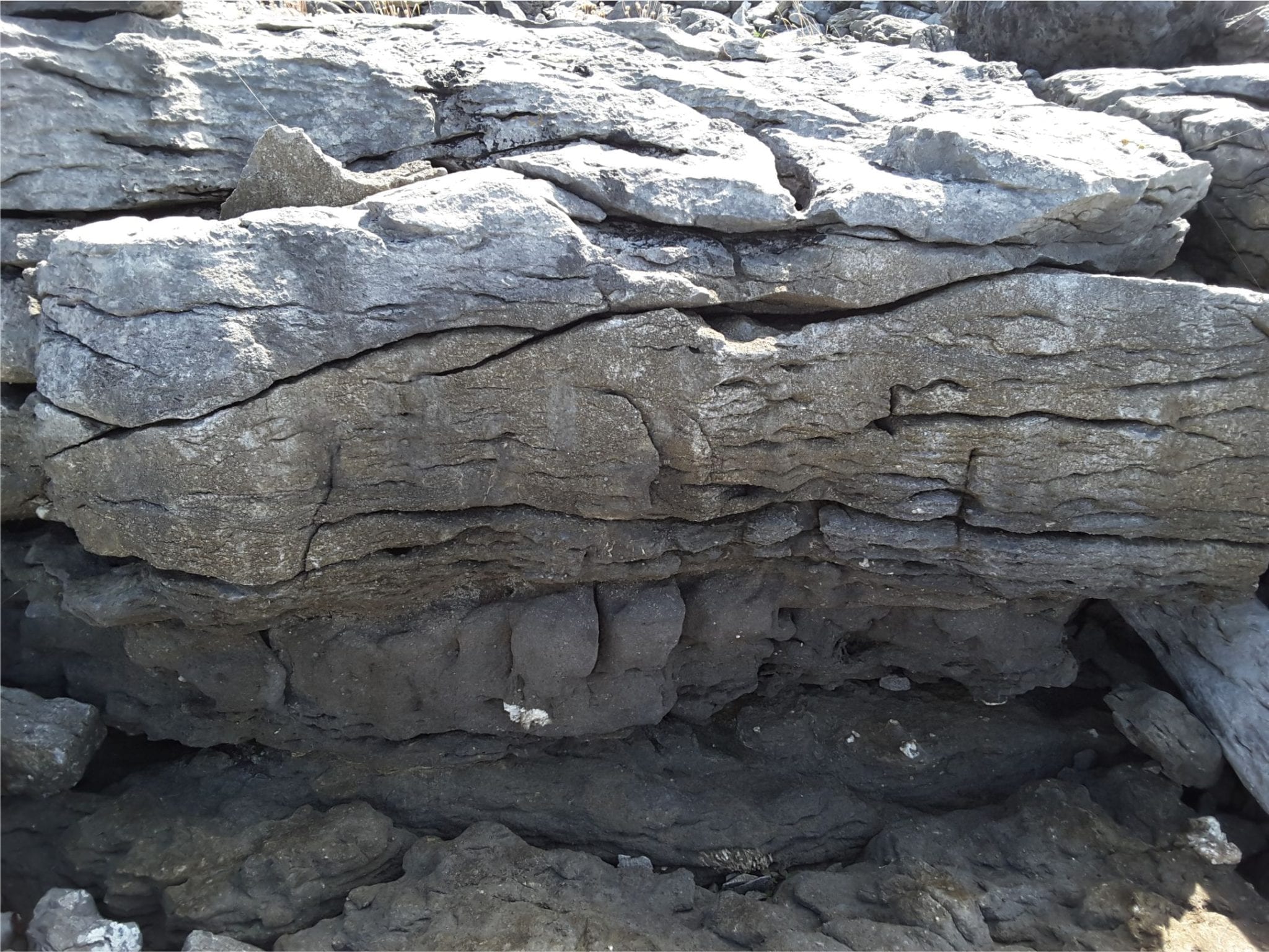
Polished limestone along the Black Head shore reveal fossil corals and brachiopods. The stepped landforms are controlled by dominant fracture trends.


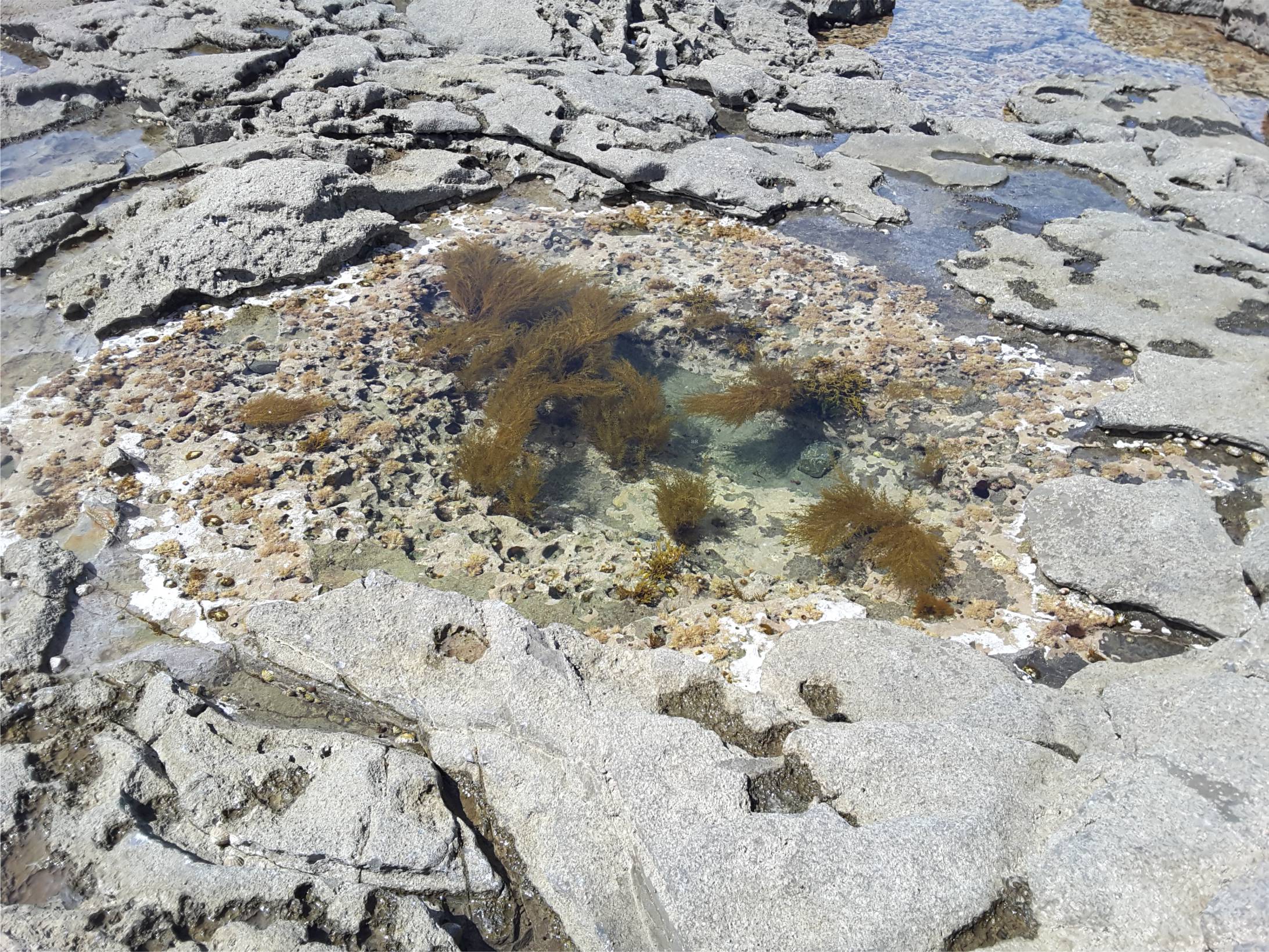
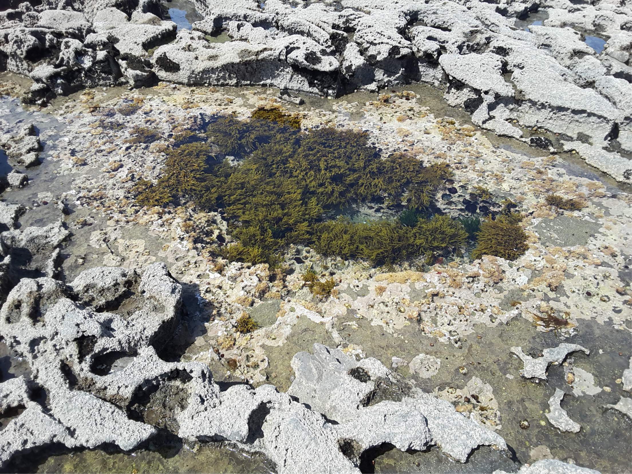
Tidal pools, regularly flushed by incoming tides.


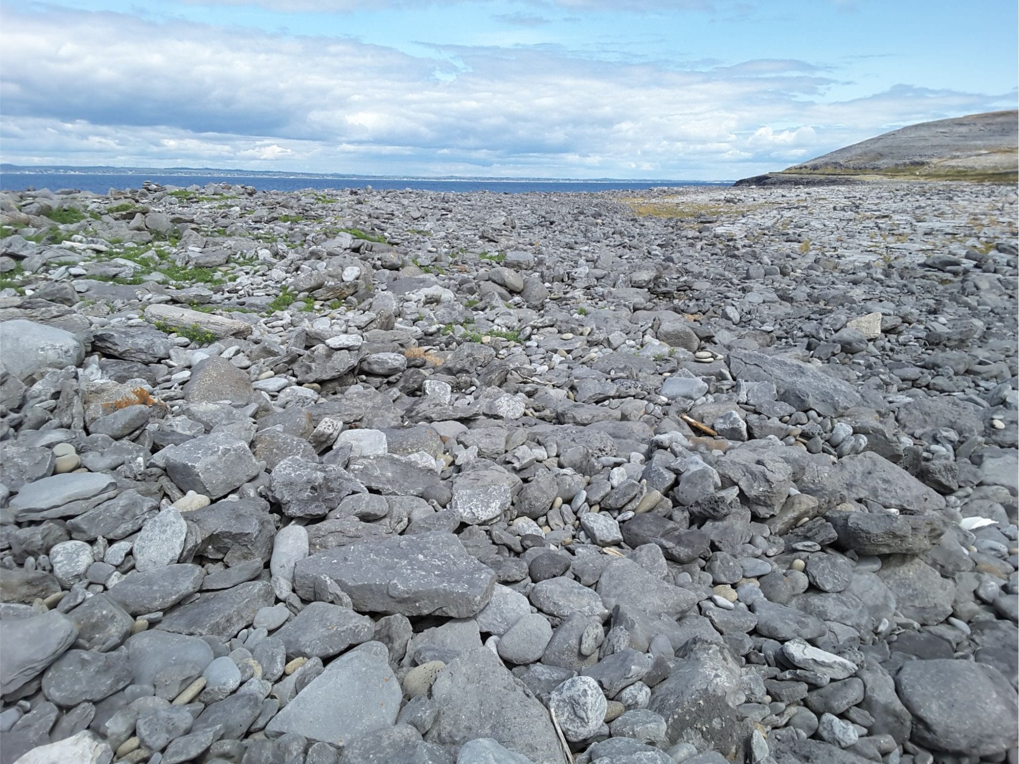
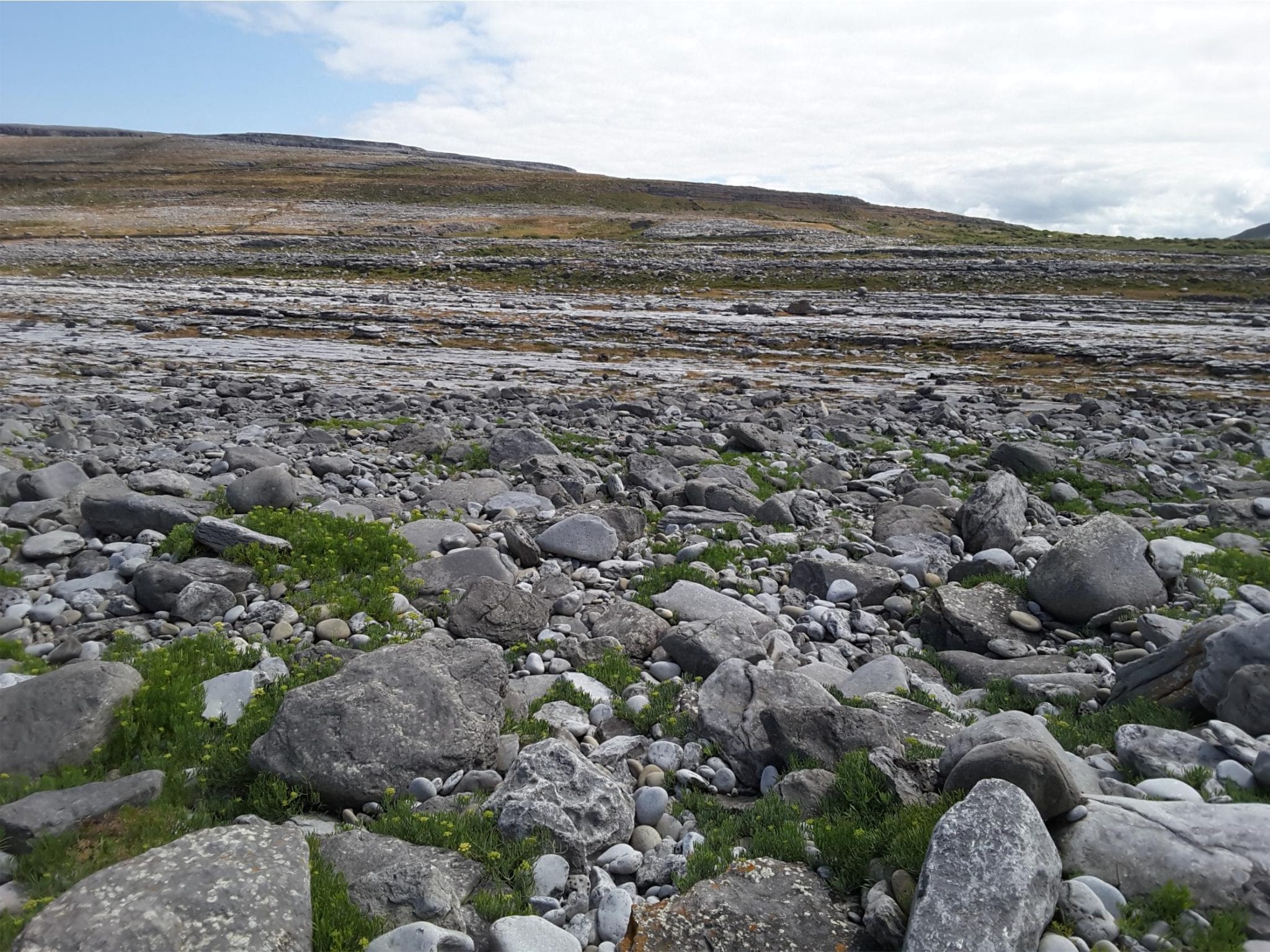
Bouldery storm ridges have been pushed over the Black Head platform by Atlantic storms.


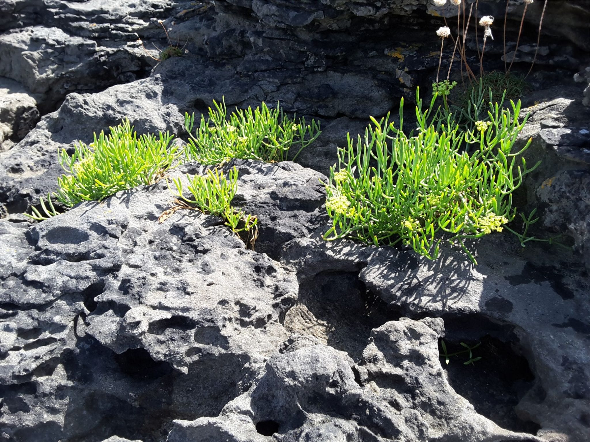
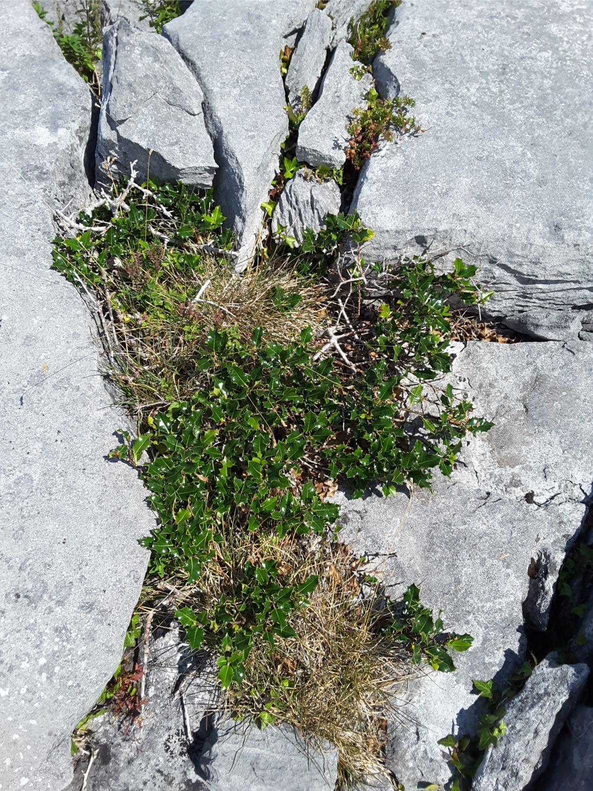
Typical vegetation eking out a living in the grykes. Succulents (left) are most common close to the shore.

Leave a Comment

Your email address will not be published. Required fields are marked *

Archives
Categories
dip and strike compass
Measuring dip and strike
sandstone classification header
Classification of sandstones
Calcite cemented subarkose, Proterozoic Altyn Fm. southern Alberta
Sandstones in thin section
poles to bedding great circles
Stereographic projection – poles to planes
froude-reynolds-antidunes-header-768x439-1
Fluid flow: Froude and Reynolds numbers
Stokes Law for particle settling in a schematic context of other fluid flow functions
Fluid flow: Stokes Law and particle settling
sedimentary-basins-distribution-1-768x711
Classification of sedimentary basins
Model are representational descriptions are written in different languages - diagrammatic, descriptive, mathematical, and conceptual. They commonly contain variables and dimensionless quantities that permit quantitative analysis of the physical systems the models represent.
Geological models
Recent Posts
Palancar cowfish
Atlas of modern coral reefs
Death Valley from Dante's View, looking east towards the Panamint Range (a block-faulted and uplifted metamorphic core complex). Salt flats in mid-view (mostly halite, some gypsum and borax), and a nice succession of (arid) alluvial fans that interfinger with the saline facies.  This is one of the classic Basin and Range couplings between fault blocks and intervening basin.
Atlas of alluvial fans
Close up of Jurassic Navajo Sandstone dune crossbeds with tangential toe-sets, Zion National Park, Utah. Image height is about 2m. Large sand dune complexes in a continental desert, about 180 million years ago.
Atlas of aeolian deposits
Mary Austin Holley
Mary Austin Holley (1784–1846)
orra hitchcock_drawing_of_three_families_of_nummulites
Orra Hitchcock 1796–1863
Elizabeth gray 1923 NHM
Elizabeth Gray (1831 - 1924)
turbidite experiments Kuenen header
Experiments with turbidity currents – three examples
turbidite experiments scaling monterey canyon
Experiments with turbidity currents – scaling laws
turbidite experiments Kuenen header
Experiments with turbidity currents – some historical context
eliza gordon cumming painting
Eliza Maria Gordon Cumming (1795-1842)
Scroll to Top