Geological-logo
Geological-logo

Atlas of syn-sedimentary deformation

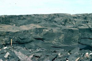
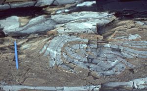
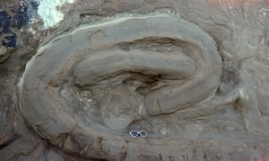
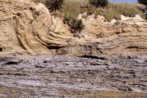
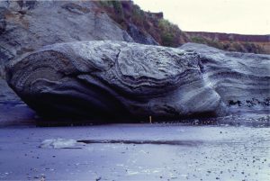
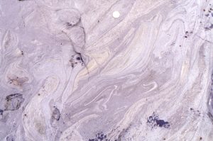
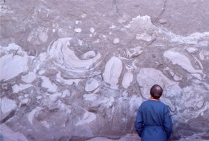
Soft sediment deformation

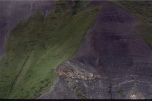
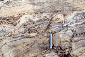
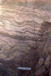
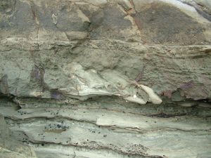
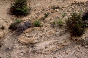
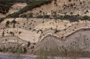
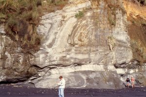
Deformation of sediment while it is soft or semi-consolidated, is common. The rock record is replete with folded and slumped strata, strata that slid in coherent packages, strata that lose their coherence during liquefaction or fluidization, displacement by faults where soft or plastic sediment seemingly acts like its brittle rock counterparts, or dyke-like injections where sediment is locally overpressured.

The term syn-sedimentary tends to be used rather loosely, as deformation that takes place during or soon after deposition; the ‘soon’ is the loose part of this broad definition. Sediment begins to compact almost immediately following deposition, where framework grains begin to move closer together.  Interstitial water is expelled, and this process in itself can deform the sediment. Water expulsion in compacting deeper strata can also increase local pore pressures that in turn reduce sediment shear strength. Other common triggers are gravitational instability  and seismic tremors. Coastal storm surges can also produce instability in sea floor sediments caused by rapid fluctuations in pore pressure.

There are several examples of soft- or syn-sedimentary deformed structures in the Atlas of submarine fans (not duplicated here).

Leave a Comment

Your email address will not be published. Required fields are marked *

Archives
Categories
dip and strike compass
Measuring dip and strike
sandstone classification header
Classification of sandstones
Calcite cemented subarkose, Proterozoic Altyn Fm. southern Alberta
Sandstones in thin section
poles to bedding great circles
Stereographic projection – poles to planes
froude-reynolds-antidunes-header-768x439-1
Fluid flow: Froude and Reynolds numbers
Stokes Law for particle settling in a schematic context of other fluid flow functions
Fluid flow: Stokes Law and particle settling
sedimentary-basins-distribution-1-768x711
Classification of sedimentary basins
Model are representational descriptions are written in different languages - diagrammatic, descriptive, mathematical, and conceptual. They commonly contain variables and dimensionless quantities that permit quantitative analysis of the physical systems the models represent.
Geological models
Recent Posts
Cam Potikohua lst thin section
Atlas of cool-water carbonate petrology
mary lyell portrait
Mary Lyell (1808-1873)
A classic topographic expression of resistant regressive sandstone cycles, each culminating in a maximum flooding surface in parasequences from the Jurassic Bowser Basin, northern British Columbia. The MFS in the foreground occurs just above the prominent bench where it is overlain by coarsening upward shale-sandstone of the succeeding regression. At least four such packages are present in this view (arrows indicate approximate MFS positions). Maximum regressive surfaces are also present below the MFS, as shown in the previous image. In each cycle, the transgressive package accounts for 10% or less of the total cycle thickness.
Atlas of sequence stratigraphy
Strand Fi glacier retreat-moraine
Glaciofluvial - periglacial deposits
Inge Lehman 1932
Inge Lehmann (1888 –1993)
nasa mackenzie_oli_2017200
Atlas of delta deposits
FD Strand Fi 83
Atlas of fan deltas
digitate Mavor stylolites
Stromatolites and microbial laminates
biped tracks
Atlas of trace fossils
Alta Dev-Miss east of Lewis Th
Atlas of Syntectonic sediments
Scroll to Top