Natural analogues for full-sized fan deltas
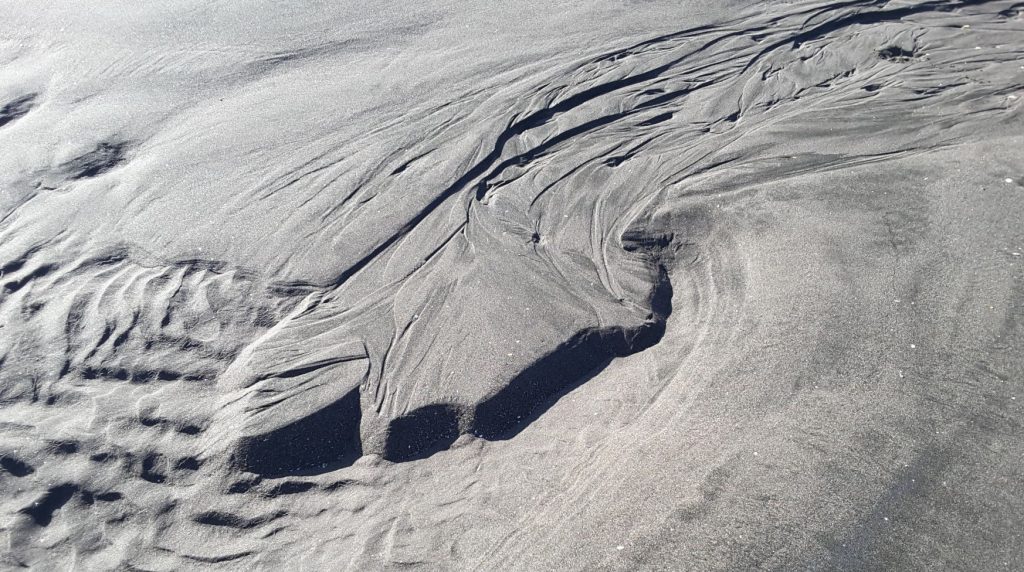
Walk any sandy beach at low water, negotiating flotsam, cusps, bedforms, and pools draining remnants of the previous tide. I can spend hours wandering these microcosmic forces of nature, to the chagrin of anyone accompanying me (including the dog). Here we are witness to grand geological processes, in miniature – bedform migration, flow regimes and stream channelling, incision, and avulsion, and delta evolution in concert with changing baselevel.
In some respects, these microcosms are the natural cousins of sand-box analogue experiments (the lab type) – but without the controls. Experimental analogues generally have well-defined boundary conditions (physical, mathematical, and conceptual), are scaled appropriately, and are capable of controlling variables such as sediment flux, baselevel, and in the more sophisticated models, subsidence. Such experiments are designed to quantify processes that govern much larger-scale depositional systems. In comparison, beach analogues are purely qualitative and, at least for some of us, non-quantitatively enjoyable.
Take a look at some of the great tank experiments conducted by the stratigraphy – sedimentary basins group at St. Anthony Falls Laboratory (Univ Minnesota).
The scenarios developed here all formed in tidal pools during baselevel fall, lowstand, and dwindling sediment supply on an outgoing tide. The pools are gradually partly or completely drained as the tide recedes. Base level rise during the next flood tide obliterates most of the structures, redistributing the sand to bedforms such as ripples and larger sandwaves.
The sand is fine- to medium-grained, extremely well sorted, and composed of feldspar, magnetite, ilmenite, and various ferromagnesians (typical black, iron-sand beaches along some west coast New Zealand).
The river system
Overland flow on many beaches commonly begins where subsurface seepage exits about midway down the exposed beach face. Channel systems are usually braided. Channels migrate across the braidplain during baselevel fall, controlled primarily by subtle changes in local gradient (an autogenic process), and the competition between surface flow and seepage into the underlying sands.
Channels incision keeps pace with baselevel fall. The depth of incision increases downstream. Close to the delta, these incisions tend to be confined to a relatively narrow part of the braidplain where successive episodes of downcutting leave a flight of abandoned river terraces.
The fan delta
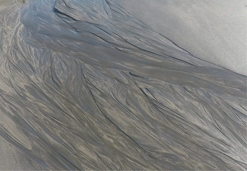
Fluvial channel formation and incision produces sediment that is deposited concomitantly as a micro-fan delta in the adjacent standing body of water (tidal pool). Delta progradation occurs mainly during falling baselevel. The delta top is essentially the downstream extension of the braidplain.
Fine-grained sand is carried by the channels to the shoreline-foreslope break, whereupon it tumbles down the delta front, or foreslope. Under steady-state conditions, the foreslope accumulates at an angle of repose consistent with water saturated fine-grained sand. However, if flow rates and sediment flux vary, the upper slope may oversteepen and collapse, creating small slides and grain flows. As baselevel continues to fall, the shoreline-foreslope break may become incised, forming shelf-edge like gullies that provide focal points for continued offshore sediment supply.
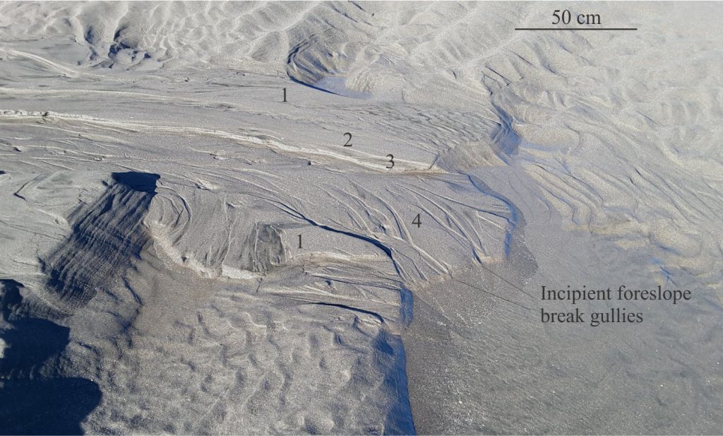
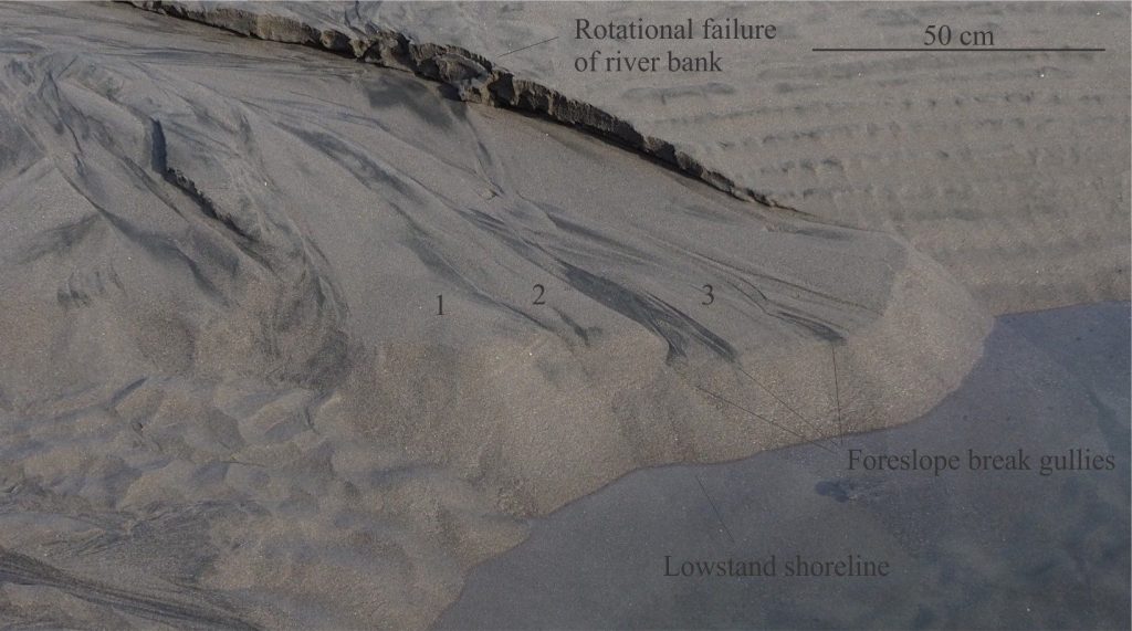
Stream flow volumes gradually decrease over the lifespan of these systems, which means that sediment supply also dwindles. The slow-down depends on the up-dip availability of water in the saturated zone beneath the beach surface (the primary source for stream flow); the availability decreases as the beach sands are drained. However, the supply of water may be augmented by local fresh groundwater. In this situation sediment supply remains sufficiently high during the latter stages of baselevel fall such that the delta continues to prograde, producing a downward-stepping succession that is reminiscent of forced regressive wedges.
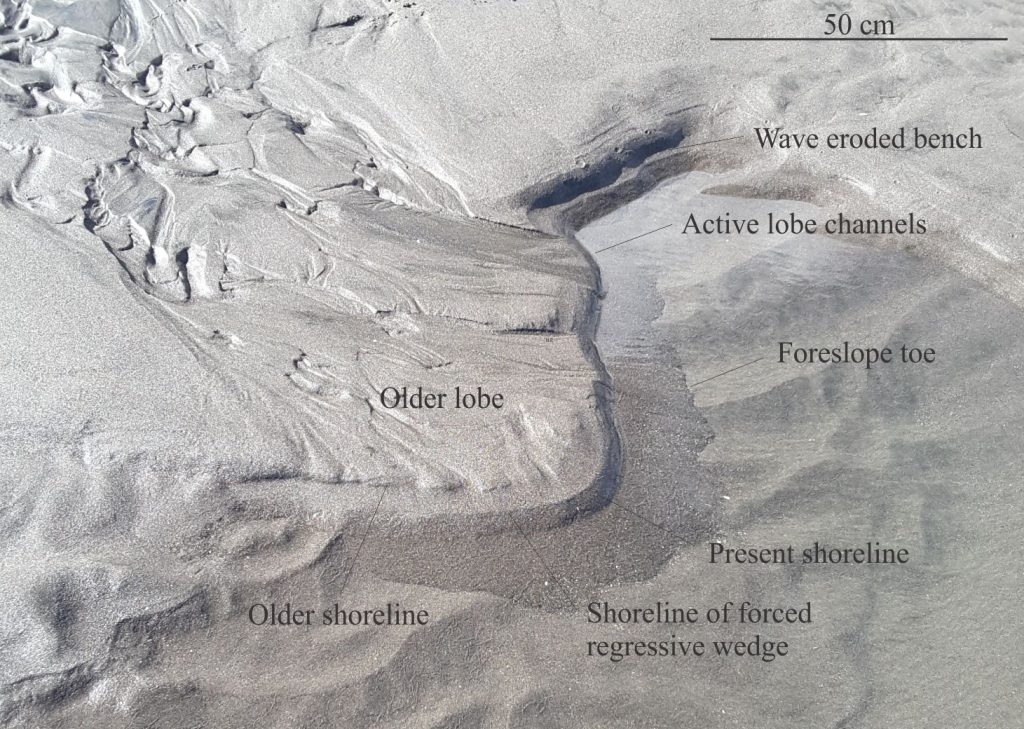
At its lowest, baselevel has usually fallen well below the delta top – foreslope margin. The exposed foreslope may also oversteepen and collapse because of wave action. Baselevel rise, during the ensuing flood tide erodes the deltas and redistributes the sand to other bedforms such as ripples and small sandwaves. An entirely new generation of rivers and deltas will form during the next cycle.
Other posts in the Sequence Stratigraphy series
Baselevel, Base-level, and Base level
Sediment accommodation and supply
Autogenic or allogenic dynamics in stratigraphy?
Stratigraphic cycles: What are they?
Sequence stratigraphic surfaces
Shorelines and shoreline trajectories
Stratigraphic trends and stacking patterns
Stratigraphic condensation – condensed sections


