This post about lapouts (onlap, toplap, downlap, offlap, truncation) is a companion to Clinoforms and clinothems
An important part of stratigraphic analysis involves the identification of stratigraphic boundaries or surfaces – namely, the boundaries between successions of strata that indicate substantial changes in the conditions of sediment accumulation. Such changes include fluctuations in baselevel and accommodation, sediment supply, and depositional environments. We may be lucky enough to find a stratigraphic discordance in outcrop, but the scale of such an observation generally prevents us from seeing the bigger geological picture – is the discordance of local significance, or does it extend across large tracts of the sedimentary basin? What is the angular relationship between the discordance and overlying strata – in outcrop they may appear parallel, but on a regional scale there may be a significant angular discordance? Regional mapping, surface and subsurface, will help answer these questions.
This is where seismic reflection comes into its own because the depth of stratigraphic resolution and its lateral extent greatly exceed what we see in outcrop. In a previous post, we saw that clinoforms, that in seismic profiles are recorded as inclined, arcuate or sinusoidal reflections, are commonly organised into progradational, aggradational, and retrogradational stacks. Identification of the boundaries that separate these clinoform packages is based on the geometry of the reflection at stratigraphic terminations; a relationship called lapout. The geometry and stratigraphic position of these terminations help differentiate the kinds of stratigraphic surfaces associated with stratigraphic sequences.
The common stratigraphic terminations are divided into two groups (Mitchum et al. 1977):
- Onlap and downlap, that terminate above a surface,
- Toplap and truncation, that terminate below a surface.

Onlap: Clinoforms and other stratal packages formed during transgression will terminate in a progressively landward position across the top of a surface. Each termination approximates a shoreline. Onlap units must have a dip shallower than the surface at which they terminate. Onlap commonly occurs across subaerial unconformities and surfaces of maximum regression.
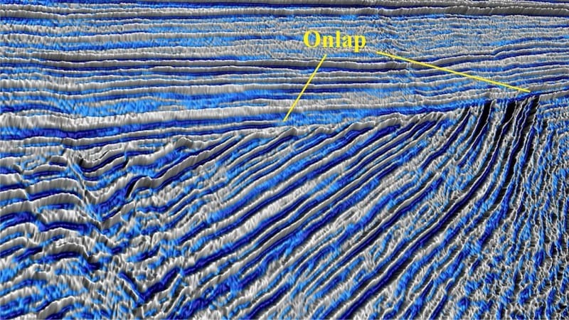
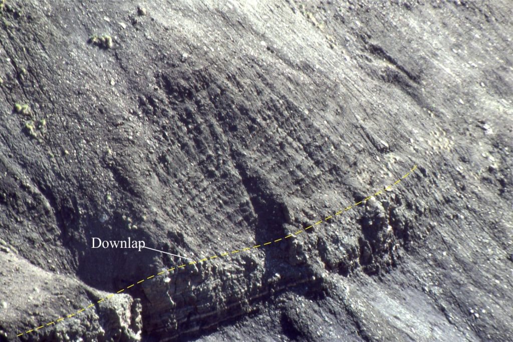
Downlap: Downlapping clinoforms terminate with the basin floor (marine and lacustrine). Downlap units must have a dip greater than the surface at which they terminate. Clinoform profile is typically progradational. In this case, downlap commonly occurs across a depositional surface that represents the end of transgression – the surface of maximum flooding.
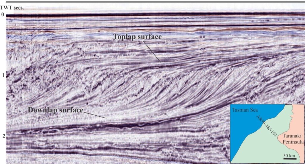
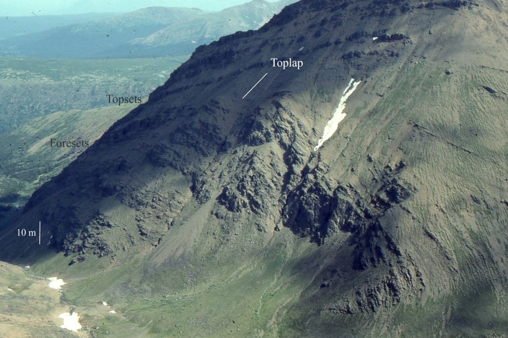
Toplap: From a geometric perspective, toplap is the mirror-image of downlap such that clinoforms or other stratal packages terminate beneath a surface. Toplap units must have a dip greater than the surface at which they terminate. Toplap completes the characteristic sinusoidal clinoform or stratal geometry typical of progradational successions. A toplap surface may be interrupted by a truncation surface.
Truncation: This applies to clinoforms and other stratal packages that terminate below an eroded surface. Commonly this applies to subaerial unconformities during regression, and shoreface ravinement surfaces during transgression.
Offlap: This category, added to the original Mitchum et al. list, describes a surface where stratigraphic terminations downstep basinward during forced regression. Depending on the degree of baselevel fall, the surface may become a subaerial unconformity or its marine equivalent – a surface of maximum regression. However, there may be additional complications if shoreface ravinement removes any part of these records during the subsequent transgression.
This post is part of the How To…series on Stratigraphy and Sequence Stratigraphy
Other posts in this series on Stratigraphy and Sequence Stratigraphy
Stratigraphic surfaces in outcrop – baselevel fall
Stratigraphic surfaces in outcrop – baselevel rise
A timeline of stratigraphic principles; 15th to 18th C
A timeline of stratigraphic principles; 19th C to 1950
A timeline of stratigraphic principles; 1950-1977
Baselevel, Base-level, and Base level
Sediment accommodation and supply
Autogenic or allogenic dynamics in stratigraphy?
Stratigraphic cycles: What are they?
Sequence stratigraphic surfaces
Shorelines and shoreline trajectories
Stratigraphic trends and stacking patterns
Stratigraphic condensation – condensed sections
