How to picture groundwater flow beneath the surface.
Analogues and analogies. Standard dictionaries define these as a comparison, correspondence, or similarity between one thing and another, that can apply to concepts, ideas or physical entities. They are tools, used to illustrate concepts, particularly abstract ideas, to help explain phenomena or theories. Science makes frequent use of analogies. It does so because many phenomena that it attempts to investigate and explain extend beyond normal human experience, beyond what is visible to the unaided eye, beyond what we can touch. Well-chosen analogies can help us understand the universe without, and the universe within.
Some classic examples come to mind. The structure of the atom has been compared with our solar system; an analogy that is perhaps less appropriate now than it was 100 years ago but still allows us to conjure an idea in our mind’s eye of entities rotating around a nucleus; crude perhaps, but it works. Did hitch-hiking a ride on a beam of light give Einstein some kind of creative advantage over the physics of relativity? I expect John McPhee’s coining of the expression deep time (in his Basin and Range) may have made the distant geological past a little easier to intuit, just by adding that simple descriptor ‘deep’ with all its connotations.
Groundwater flow is one of those processes that, on average, 30% of the world’s population relies on but never gets to see. Whatever observations we make of groundwater tend to be remote; geophysical tools that utilize radar or acoustic signals, or poking skinny holes into aquifers for a glimpse of what lies within. Analogues are useful tools that help us visualize what is going on at depth, within aquifers. Aquifers are sometimes likened to sponges that soak up and release water. Comparisons with underground rivers or lakes is still a common form of description, even if in most cases it is incorrect (underground rivers do exist, particularly in limestone country, but they are not the norm).
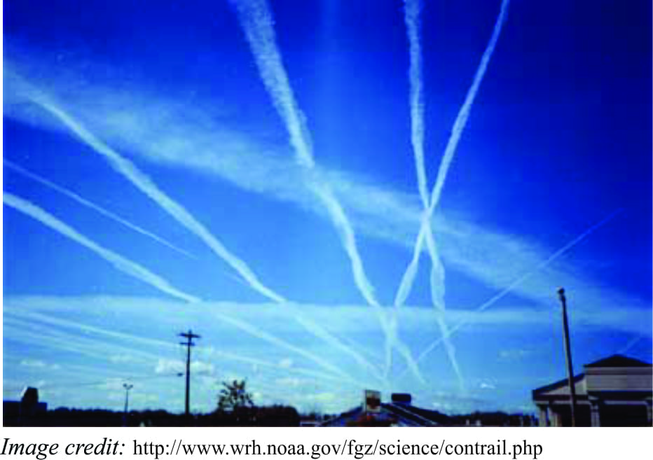
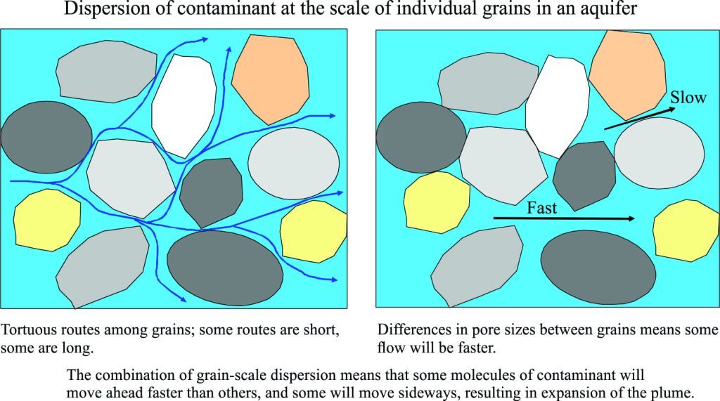
When I was teaching hydrogeology I used contrails as a visual analogue for the actual movement and spread of contaminants in groundwater. It seemed to work. There are two processes that describe the passage of groundwater. Groundwater that moves en masse through the aquifer framework (sands, sandstones, limestones, fractured shale or igneous rock) is referred to as advective flow. For example, if a contaminant from a chemical spill enters groundwater, the chemicals will move with the groundwater.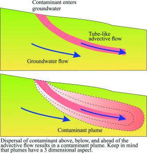 If advection is the only process at work here, then the contaminant flow would look approximately like an imaginary tube; a crude analogy for this might be a common garden hose, except that in the aquifer there would not be any ‘sides’ to the tube. However, we know from experience that contaminants do not strictly follow this kind of flow, but spread beyond our imaginary tube. We refer to this spreading process as dispersion.
Dispersion takes place in two ways. Molecular diffusion occurs when molecules of contaminant gradually mix with molecules of water. For a simple experiment to demonstrate this, take a glass of hot water, let it sit for a while to settle, then drop in a few grains of instant coffee. As the coffee dissolves, it will gradually mix with the water. In this case the mixing is caused by molecules interacting with each other, rather than flowing water. Secondly, Mechanical dispersion occurs when contaminant molecules are carried away from the source by local eddies around grains or through fractures; this kind of flow is taking place at a scale much smaller than the en masse advective flow. Both mechanisms of dispersion operate simultaneously and independently of advection. Whereas advection tends to form tube-like flow patterns, dispersion acts to expand the contaminant plume.
Contrails form at high altitude when water vapour in air and aircraft engine exhaust condenses and freezes around aerosol particles. The characteristic white trail is a familiar sight. The analogy begins with the initial formation of the trail, as a thin white line that has well-defined boundaries; the head of the trail basically keeps pace with the aircraft. This stage of trail formation is analogous to tube-like advective flow; in this case, the leading edge of the contaminant keeps pace with the en masse groundwater flow.
Over time, the contrail widens and the boundaries become diffuse because of mixing with air and mechanical dispersion by cross-winds (commonly the jet-stream). This stage is analogous to groundwater dispersion that takes contaminant molecules beyond the limits of advective flow.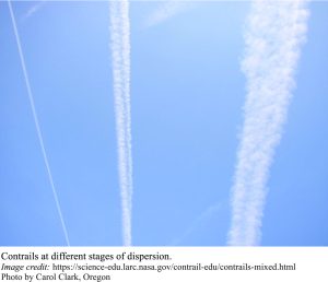
The role of analogues is not to duplicate the system or process under investigation, but to provide an alternative or comparative view that helps provide insight into what is going on. The contrail analogy may be a bit simplistic, but from a visual point of view it does provide an account of the transition from a focused, tube-like condition to a dispersed condition. The physics of contrail formation and dispersion are basically the physics of air as a fluid. The contrail itself can also be thought of as a contaminant that gradually disperses through the atmosphere. The analogue, while not perfect, does provide an alternative image of groundwater processes that we cannot observe directly.
