The Dalaradian, a 15+km-thick sequence of metasediments and metavolcanics occupies a broad swath through central Scotland. This is the Grampian Terrane, a patch of rock that originally accumulated on the Late Precambrian – early Paleozoic margin of the ancient continent Laurentia, washed by the equally ancient Iapetus Ocean. The Grampian Terrane is now sandwiched between two crustal-scale sutures: Great Glen Fault in the north, and the Highland Boundary Fault. Dalradian rocks overlie Laurentian basement.
Dalradian polyphase deformation, metamorphism, and syn- and post-kinematic intrusions have been the subject of intense study, conjecture and debate since the 1800s. In 1893 George Barrow published his discovery of a coherent metamorphic zonation in the Dalradian sequence, that ever since has promoted theoretical concepts of crustal processes such as pressure-temperature effects during burial, elucidation of structural complexities, and exhumation of deep crustal realms. Barrovian metamorphism and deformation took place during the late Cambrian – Ordovician Grampian Orogeny, an early phase of Caledonian mountain building during closure of the Iapetus, and collision between Laurentia and an oceanic island arc.
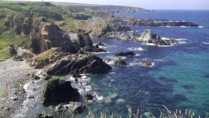
Below are some images taken during a recent visit to Macduff and Portsoy (coastal Moray Firth, Banffshire, Scotland), and Connemara, County Galway, Ireland.
Have a look at this post – Bits of North America that were left behind
Some useful references
B.E. Leake, 1986. The geology of SW Connemara, Ireland: A fold and thrust Dalradian and metagabbroic-gneiss complex. J Geological Society of London, v.143, p. 221-236.
D.M. Chew and R.M. Strachan, 2015. The Laurentian Caledonides of Scotland and Ireland. Geological Society of London Special Publication 390, p. 45-91
Banffshire coast – an excursion – introduction to geology. British Geological Survey, 2015
Macduff
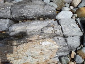
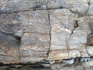
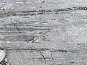
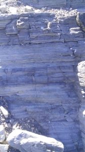
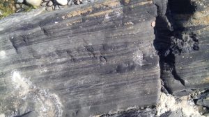
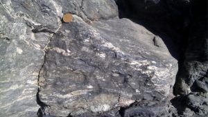
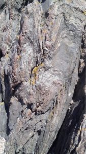
On the coast near the old swimming pool, thick bedded psammites, possibly crossbedded, with thinner intervals of pelite-shale, with a suggestion of ripple, despite the garnet-zone metamorphism. There is some penetrative fabric here, but not as intense as that seen along the Portsoy coast. An excellent Cullen Skink can be sampled in any of the local cafes in the nearby town of Cullen.
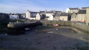
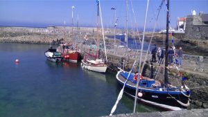
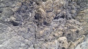
Portsoy
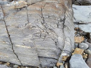
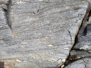
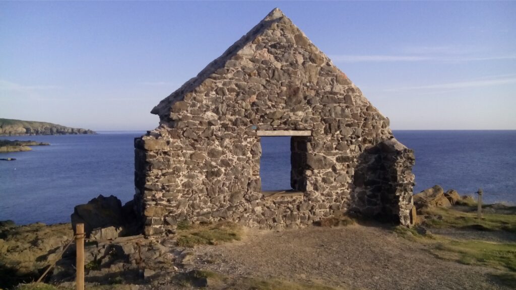
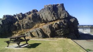
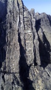
Portsoy (about 5km east of Cullen). The old harbour here was constructed in the 17th century and has stood the test of time and North Sea storms. Stone blocks (mostly psammite) in the original harbour walls were oriented vertically. Dalradian outcrop (from the disused swimming pool west of the village, to East Point) are part of the Portsoy Shear Zone. Kyanite-zone metamorphism produced well developed micaceous foliation; folding and cleavage records 3 or 4 stages of deformation. Post-tectonic pegmatites intrude the sequence. The first set of images are west Portsoy near the disused swimming pool. The second set is along a coastal transect towards East Point.
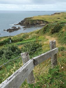
Clifden coast, Connemara
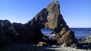
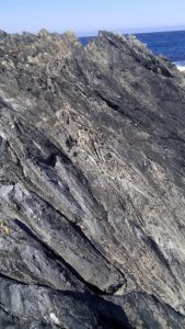
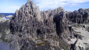
The Sky Coastal route west of Clifden. The Dalradian here is part of the Connemara Metamorphic Complex and is a continuation of that seen in Scotland. It contains quartzites, schists, marbles and amphibolites. The outcrops shown here are primarily strongly foliated schists with a later phase of tight, isoclinal folding.
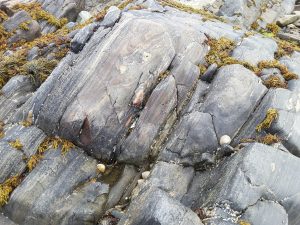
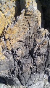
Four following images of Dalradian schist-amphibolite from the Connemara coast near Cleggan Harbour. Each shows strong foliation, recumbent isoclinal folds with axial planes approximately parallel to foliation, characteristic S and Z folds, stretching and boudinage of thicker quartz bands in the same plane.