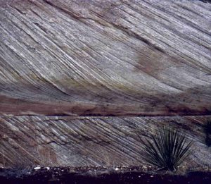
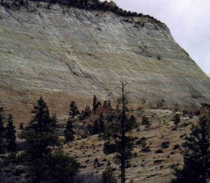
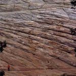
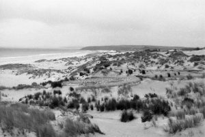
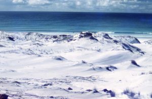
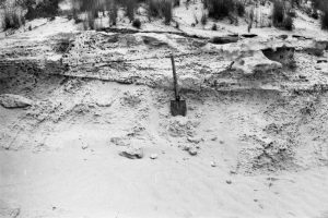
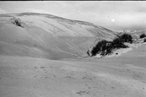
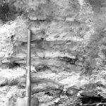
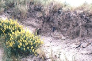
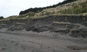
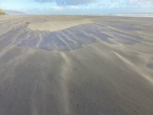
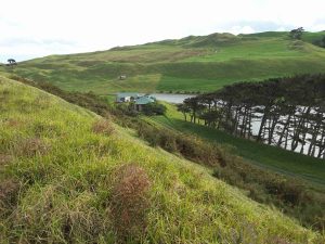
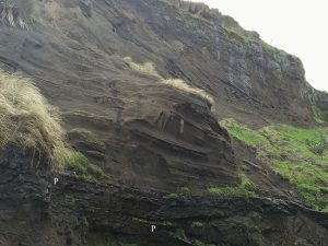
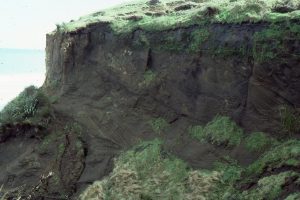
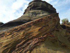
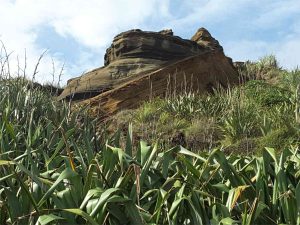
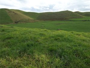
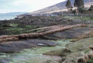
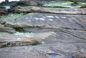
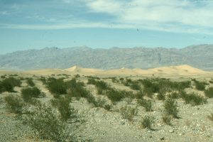
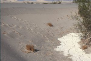
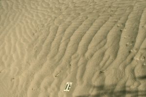
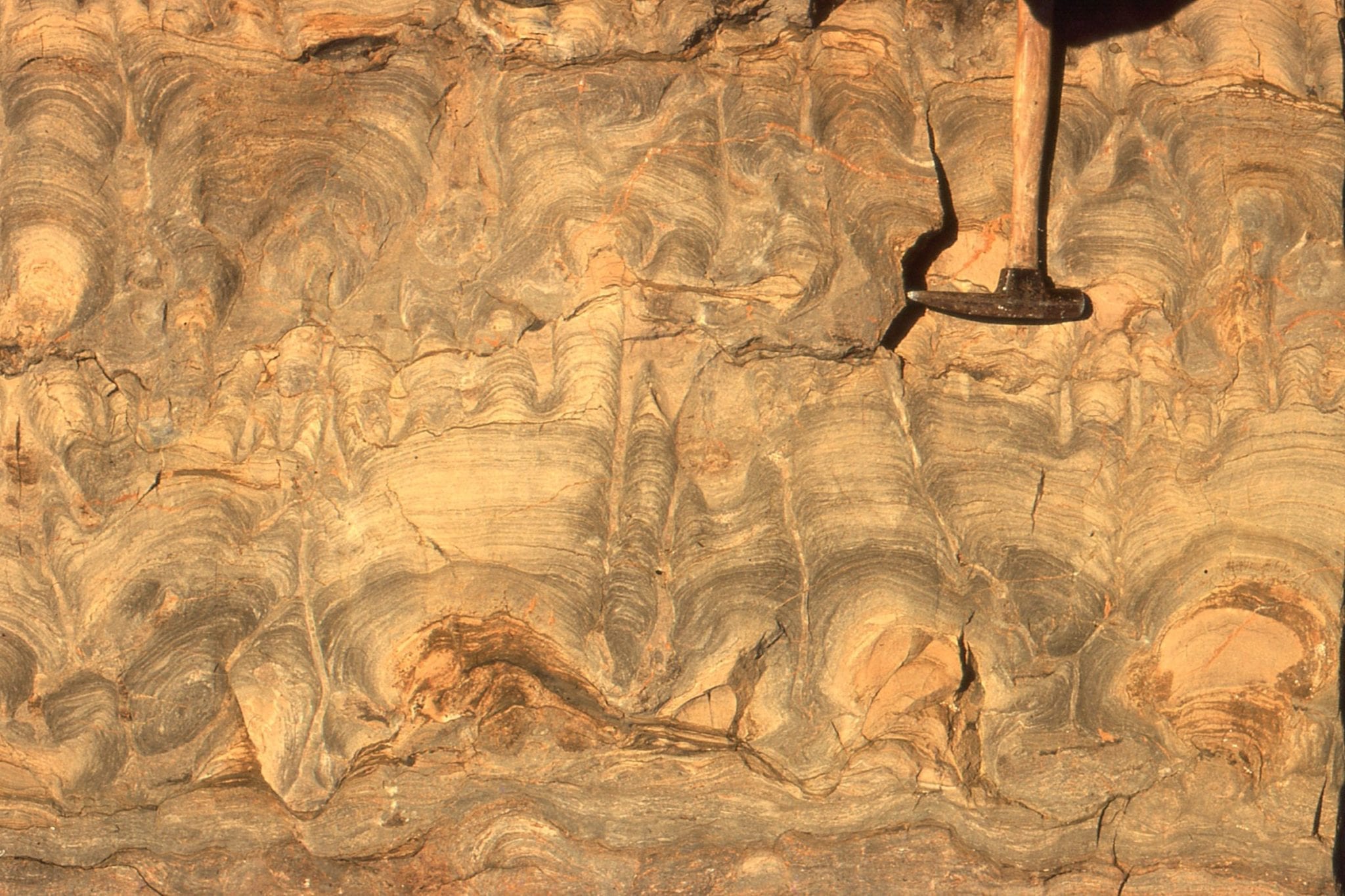
Here are some examples of modern and ancient sand dunes from continental and coastal settings. Click on the images for an expanded view.
The Atlas, as are all blogs, is a publication. If you use the images, please acknowledge their source (it is the polite, and professional thing to do).
This link will take you to an explanation of the Atlas series, the ownership, use and acknowledgment of images.
![Close up of Jurassic Navajo Sandstone dune crossbeds with tangential toe-sets, Zion National Park, Utah. Image height is about 2m. Large sand dune complexes in a continental desert, about 180 million years ago.](https://www.geological-digressions.com/wp-content/uploads/2018/04/Navajo-Sst-3-300x261.jpg)
![Large, stacked dune foresets (lee-face deposits) in the Jurassic Navajo Sandstone, Zion National Park, of southern Utah](https://www.geological-digressions.com/wp-content/uploads/2018/04/Navajo-Sst-2-300x261.jpg)
![Closer view of the exposure in above image, showing large foresets and individual dune truncation. The person (bottom left) is about 2m tall. Navajo Sandstone, Zion National Park, Utah](https://www.geological-digressions.com/wp-content/uploads/2018/04/Navajo-Sst-1-150x150.jpg)
![Coastal dunes bordering Great Exhibition Bay, northernmost New Zealand. The white sand contains 90-95% quartz. Much sand is sourced from older Pleistocene dune complexes exposed on the right side of the image.](https://www.geological-digressions.com/wp-content/uploads/2018/12/GEB-coastal-dunes-south-300x200.jpg)
![Coastal dunes bordering Great Exhibition Bay, northernmost New Zealand. The white sand contains 90-95% quartz. Much of the sand for the modern dunes comes from reactivation of late Pleistocene dune complexes, and sand stored on the adjacent shelf.](https://www.geological-digressions.com/wp-content/uploads/2018/04/GEB-coastal-dunes-300x197.jpg)
![Dune foresets in Late Pleistocene deposits, Great Exhibition Bay, northernmost New Zealand. Each set is bound by a truncation boundary. The mottled weathering pattern is due to incipient iron oxide precipitation on grain surfaces.](https://www.geological-digressions.com/wp-content/uploads/2018/04/GEB-dune-sets-300x200.jpg)
![Large, active barchan dunes traverse Kokota sandspit that forms a protextive barrier to Parengarenga Harbour, northernmost New Zealand. This view is of the main lee face. The dune is about 8m high.](https://www.geological-digressions.com/wp-content/uploads/2018/04/GEB-barchan-dune-300x200.jpg)
![Small lakes and ponds that are sometimes perched between sand dunes, accumulate mud, sand and peaty material from plants. Here are at least 6 interdune pond mud layers, some with fossil roots (also replaced by clays). See also the image below. Late Pleistocene, Great Exhibition Bay.](https://www.geological-digressions.com/wp-content/uploads/2018/04/GEB-interdune-pond-150x150.jpg)
![Salt-tolerant grasses and shrubs extend their roots deep into the dunes to capture as much moisture as possible, and in so doing help to stabilize the dune.](https://www.geological-digressions.com/wp-content/uploads/2018/04/dune-stabilizers-300x200.jpg)
![The beach at Raglan, west coast NZ, is lined by coastal dunes. There is a constant to and fro of the dune front where at times it progrades seawards, and other times is dissected by storm waves. Sand is continually being moved from the shallow shelf to the beach and dunes.](https://www.geological-digressions.com/wp-content/uploads/2025/02/dissected-coastal-dunes-Raglan-300x179.jpg)
![](https://www.geological-digressions.com/wp-content/uploads/2025/02/raglan-saltation-300x225.jpg)
![Interdune lake near the inland margin of a stabilized (vegetated), Pleistocene coastal sand dune complex, Kariotahi, south Auckland, NZ. The old dunes were part of a much more extensive barrier system along the west coast of North Island.](https://www.geological-digressions.com/wp-content/uploads/2018/04/kariotahi-interdune-pond-300x225.jpg)
![Multiple dune sets in a Pleistocene sand barrier, Kariotahi, south Auckland. Formation of the old sand barrier and dune field eventually created the straightened coastline that typifies the west coast of North Island. The barrier formed during repeated rises and falls in sea level over about 2 million years.](https://www.geological-digressions.com/wp-content/uploads/2018/12/Kariotahi-interdune-pond-lake-peaty-sand-300x225.jpg)
![Multiple dune sets in Pleistocene sands (Same cliff face as image above), indicating a fairly consistent orientation of the preserved lee faces, and the direction of dune migration (to the left - east). Kariotahi, Southwest Auckland, New Zealand.](https://www.geological-digressions.com/wp-content/uploads/2018/04/kariotahi-dunes-2-1-300x200.jpg)
![Barrier and dune sands, Kariotahi, south Auckland. Here an older set of dunes (orange weathering) are capped by an thin soil and bands of iron oxide (along the surface that slopes steeply to the left). The soil would have stabilized the older dune sands. A younger set of dunes formed over the top of the old soil.](https://www.geological-digressions.com/wp-content/uploads/2018/04/kariotahi-dune-surface-2-300x225.jpg)
![A more panoramic view of the old soil and dunes in the image above.](https://www.geological-digressions.com/wp-content/uploads/2018/04/kariotahi-dune-surface-300x225.jpg)
![The landward margin of Pleistocene sand dunes, now stabilized. The steep slopes are the old lee slopes (the steep surface of the dune that faces down-wind). When active, the dunes would have migrated towards the viewer. Kariotahi, south Auckland.](https://www.geological-digressions.com/wp-content/uploads/2018/04/kariotahi-back-dune-300x225.jpg)
![Reddened sandstone with large dune crossbedding, in the New Red Sandstone on Arran, west Scotland. The red colours are formed by iron oxides, after the sand was deposited during the Permian through Triassic - 280 to 200 million years ago.](https://www.geological-digressions.com/wp-content/uploads/2018/04/NRS-Arran-2-300x203.jpg)
![Multiple dune crossbed sets in New Red Sandstone, Arran, west Scotland, 280 to 200 million years old.](https://www.geological-digressions.com/wp-content/uploads/2018/04/NRS-Arran-1-300x203.jpg)
![Mesquite Flat dunes, Death Valley, near Stovepipe Wells. An inland 'sea' of sand, usually organized as dunes, is called an erg.](https://www.geological-digressions.com/wp-content/uploads/2018/04/DV-Stovepipe-Wells-erg-300x200.jpg)
![Dune sand at Mesquite Flat, migrating over desiccated pond silts. Death Valley](https://www.geological-digressions.com/wp-content/uploads/2018/04/DV-stovepipe-dune-over-pond-300x200.jpg)
![At least two generations of wind ripples in Mesquite Flat dunes. All those trails attest to numerous insects and the larger critters that hunt them.](https://www.geological-digressions.com/wp-content/uploads/2018/04/DV-ripples-sets-trails-300x200.jpg)