Source: Newfoundland and Labrador Heritage Website. You can watch this short video on Youtube
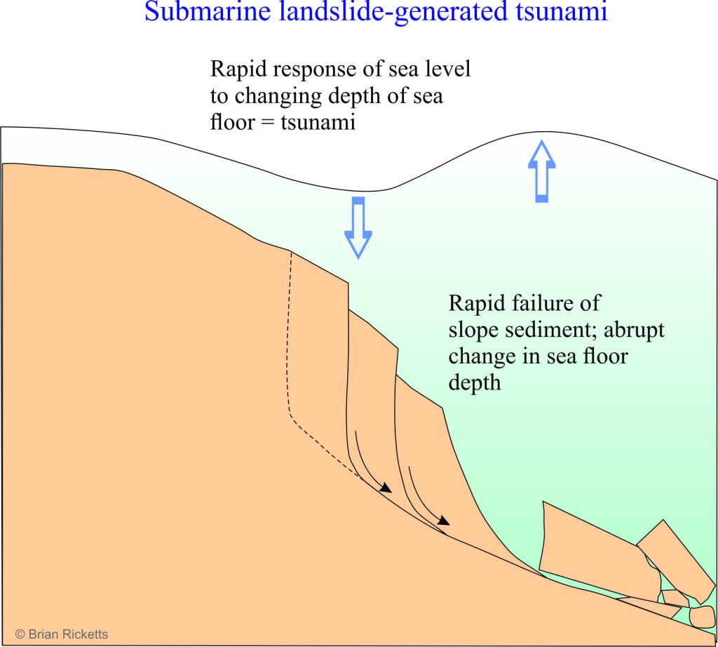
Five pm, November 18 1929 in the sleepy fishing village on Burin Peninsula, Newfoundland (at that time Newfoundland and Labrador were a Dominion of Britain. They did not become part of the Canadian Federation until 1949). Most people felt the tremors from the Grand Banks 7.2M earthquake, centered about 260km south of Burin but apparently went about their business as usual. About 7.30 the same evening, there was a sudden drop in sea level, exposing the local shore and stranding boats. The follow-up was totally unexpected – three massive waves inundated coastal dwellings, killing 28 people and leaving hundreds homeless. The waves were 3-7m high in most places, but along some narrow inlets the tsunami energy had focussed into 27m-high monsters. The tsunami was caused not by the earthquake itself, but by a massive submarine landslide. (Check out some images here).
The Grand Banks event is iconic because it provided some of the first empirical evidence that submarine slope failures occurred. The landslide and subsequent submarine mud flows severed trans-Atlantic telegraph cables in several places, enabling the calculation not only of the timing but also the speed of the submarine flows across the sea floor. The discovery re-kindled interest in the various processes by which sediment is deposited on the deep-sea floor (particularly turbidity currents).
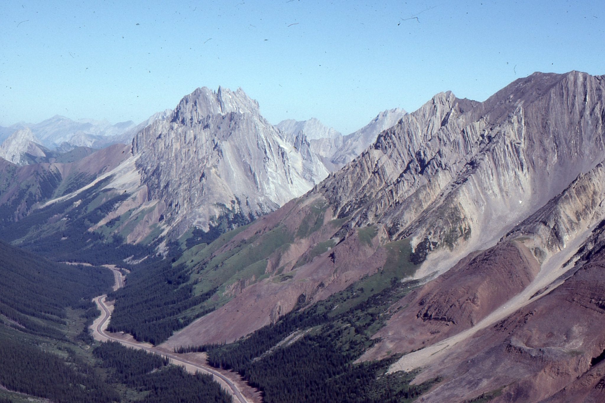
Most terrestrial landslides, the ones we are familiar with, occur on steep hillsides or mountainous terrain; slopes are commonly greater than 10o. We now know that submarine slope failures, or submarine landslides, can develop almost anywhere on the sea floor where sufficient sediment has been deposited. They can occur on slopes as low as 1o and at depths ranging from a few 10s of metres to 1000s of metres. We also have become acutely aware of the danger they pose to marine structures such as cables, pipelines and offshore oil rigs. A bitter lesson was learned during Hurricane Camille in 1969 when part of the Mississippi delta front failed, the ensuing slide destroying one rig and damaging others. In a very different geological setting, the 1964 Alaskan (subduction) 9.2M earthquake also resulted in several, destructive, submarine landslide-generated tsunamis.
Slide blocks and debris avalanches
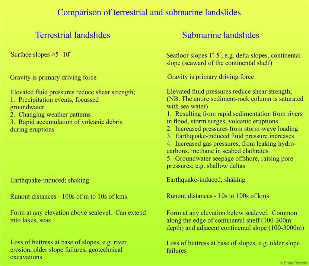
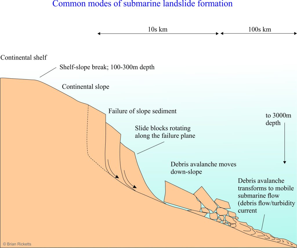 Like their terrestrial counterparts, submarine landslides can evolve in several different ways, but two common types are large slides where relatively coherent blocks move down slope, and debris avalanches that perhaps have more in common with many land-based landslides. However, one aspect with which they differ significantly to their terrestrial counterparts is their lateral extent; submarine landslides and associated submarine flows can run-out for 10s, even 100s of kilometres. They also tend to travel faster! Landslides commonly transform down slope to more mobile submarine flows such as debris flows and muddy flows, analogous to terrestrial debris flows, muddy flows and lahars (volcanic debris flows). A comparison between some aspects of terrestrial and submarine landslides is shown in the Table below.
Shallow events, like the 1969 Mississippi delta landslide, occur in water shallow enough to be influenced by storm waves and sudden influxes of sediment transported seaward by rivers and delta channels; these instabilities can develop rapidly, year on year. In contrast, landslides at the shelf edge or along the continental slope are usually too deep to be influenced by storm waves, but over long periods of time (perhaps 1000s to 10,000s of years) these parts of the sea floor may become gravitationally unstable because of sediment build-up; the sediment directly increases the load (weight) and tends to increase the slope of the sea floor. Slopes that have become unstable in this way will fail because of relatively benign gravitational instability, or from some external trigger such as a seismic event. Earthquake triggering is hypothesized for the massive prehistoric Ruatoria submarine landslide off the east coast of New Zealand. The landslide is located above the earthquake-prone Hikurangi subduction zone where Pacific
Ocean crust is being thrust beneath the Australian Plate. This event, about 170,000 years ago produced a blocky debris avalanche deposit, almost 3200 km3 in volume and in places 2km thick, that carried blocks up to 18km across (the map details of the slide were obtained from multibeam Swath – Sonar arrays). There is little doubt the sudden change in sea floor depth caused a significant tsunami, and perhaps fortunate there was no one around to witness it (source: Collot et al., Journal of Geophysical Research, 2001, v.106).
An additional mechanism of submarine slope failure, currently the focus of research, LINK involves subsea methane hydrates, or clathrates; methane evolved from clathrates could raise sediment pore pressures, or the weak ice layers themselves may provide a surface on which the sediment pile could slide.
A stab in the dark
Predicting submarine landslides is a bit like predicting earthquakes; earth scientists tend to think in terms of ‘return periods’ for active faults and it is possible to monitor some changes in stress across known fault zones. However, return periods are commonly estimated in 100s or 1000s of years, which leaves a lot of scope for error. In shallow marine settings, such as deltas we may see gradual changes in slope movements, or changes in fluid pressures that might be a harbinger of slope failure, but this usually requires installation of (long-term) monitoring equipment on the sea bed. In deeper continental slope settings continuous monitoring of slope behaviour is fraught with technical difficulties and high costs. It is possible to analyse the overall potential for landslides on segments of continental slopes, but the analytical approach is still broad-brush. And if the return period is on the order of 170,000 years…
The problem is that one never knows when the 170,000-year hiatus is about to end.
